Antenna simulation for Radio Holland
31 July 2007
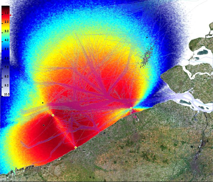
Radio Holland has an application that can determine a ship's location using only a few seconds of radio communication. In the past they used two antennas, but that turned out to be not accurate enough for the heavily used shipping routes. The problem was to find the best location for a possible third antenna. The Centre for High Performance Computing and Visualisation created an interactive application that produced a map with the expected accuracy using the position of two or more antennas.
| Last modified: | 24 January 2025 09.51 a.m. |
More news
-
24 March 2025
UG 28th in World's Most International Universities 2025 rankings
The University of Groningen has been ranked 28th in the World's Most International Universities 2025 by Times Higher Education. With this, the UG leaves behind institutions such as MIT and Harvard. The 28th place marks an increase of five places: in...
-
05 March 2025
Women in Science
The UG celebrates International Women’s Day with a special photo series: Women in Science.
-
16 December 2024
Jouke de Vries: ‘The University will have to be flexible’
2024 was a festive year for the University of Groningen. In this podcast, Jouke de Vries, the chair of the Executive Board, looks back.