100 years of GIA, a photo history
The GIA is 100 years old. In those 100 years enough has been done and done to write a thick book. Because Archeology is a discipline where a lot of information is told and processed in images, we opted for a different method: we show 100 photos that together reflect 100 years of excavation, top finds, the developments in excavation technology, but also in processing data, research and education and internationalization. With each photo we place a short explanatory text, both in English and in Dutch. The photos will also be posted on Facebook.
Photo 100. 1922 Foundation of the BAI, the predecessor of the GIA
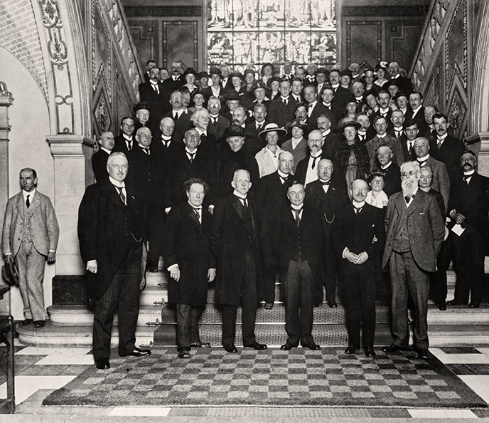
This last photo shows a group of invitees posing on the stairs in the Academy Building of the University of Groningen, shortly after A.E. van Giffen had given his opening speech on 17 June 1922. The intention was to combine this photo with a photo of the current staff of the GIA. Unfortunately, the Corona pandemic makes this impossible.
The attentive reader will wonder why the GIA chose the year 2020 as the anniversary year while the official opening took place in 1922. In fact, this choice was already made in 1970. After all, then the BAI celebrated its 50th anniversary. The first sentence of H.T. Waterbolk, Van Giffen's successor, answers: "In 1920 the Biological-Achaeological Institute of the University of Groningen was founded, at least in that year there was an Institute with that name for the first time and the Board of Trustees made funds available to the archaeologist Dr. A.E. van Giffen, who was then still curator at the Zoological Laboratory."
The photo was part of an exhibition that was expanded and adapted in 1970 for the 50th anniversary - in the building at the Poststraat. The arrival of the Mediterranean colleagues in 1996 (see photo 84), together with the extension of the library, made there was no longer room for the display cases and wall plates. A nice memento is the founding photo sawn from a larger wall plate. This hangs, thanks to Robert Kosters, in the canteen of the GIA (see the background of the photo on the right of no. 75).
Literature
- Rede uitgesproken den 17den Juni 1922 bij de officiële opening van het Biologisch Archeologisch Instituut aan de Rijksuniversiteit te Groningen. Groningen-Den Haag/A.E. van Giffen. 1922, pp. 26.
- Het Biologisch-Archaeologisch Instituut na vijftig jaar/H.T Waterbolk. In: Jaarboek der Rijksuniversiteit. Groningen, 1970, p. 29-39.
© University of Groningen, Groningen Institute of Archaeology.
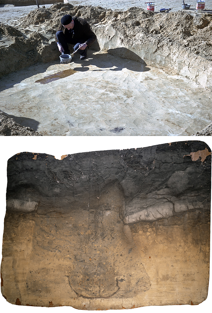
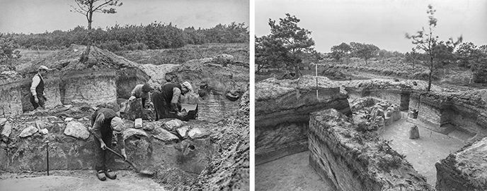
Photo 99. 1916–2021 The collection of glass plates of the GIA
A.E. van Giffen was a pioneer in archeology, his strength lay in, among other things, embracing new techniques. For example, he used photography to capture the environment and what could be seen during excavations in the field. Glass plates were used, provided with a sensitive layer. On return, prints were made, which were pasted chronologically into large photo albums with a description for each image.
A unique collection was thus put together between 1916 and 1960, because many images have now lost landscape in sharp detail. The condition of the collection of glass plates deteriorated over the years: there was breakage, surface dirt, but also silvering. The latter is a silver colored deposit in the center and on the edges of the glass plates. This resulted in white spots when printing. The information recorded on the glass plates slowly threatened to disappear. At the end of the nineties of the last century, the glass plates were therefore cleaned, repackaged and (1:1) duplicated on a film that was easy to handle.
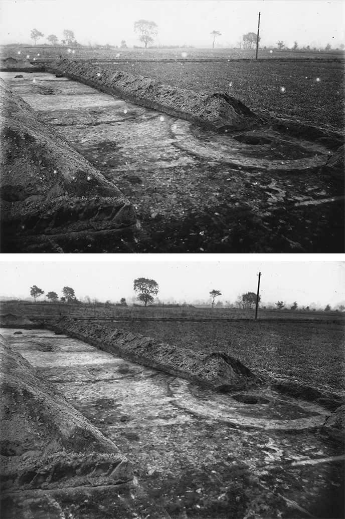
The photos show a picture taken in Wollinghuizen (Vlagtwedde) during the excavation of an urn field in 1920. Above the photo before and below the photo after the cleaning action.
The collection of (duplicates of) glass plates is currently being digitized as part of the Spotlight project of the RUG and placed in the UB-image bank. It is expected that the images will be visible to the public by the end of 2021/early 2022.
For a detailed description of the glass panes conservation project:
- Kooi, P.B. & K. van der Ploeg, 2003: Groningen op Glas : Beelden van vijftig jaar archeologisch onderzoek 1910-1960. Egbert Forsten & Profiel, Bedum.
© University of Groningen, Groningen Institute of Archaeology.
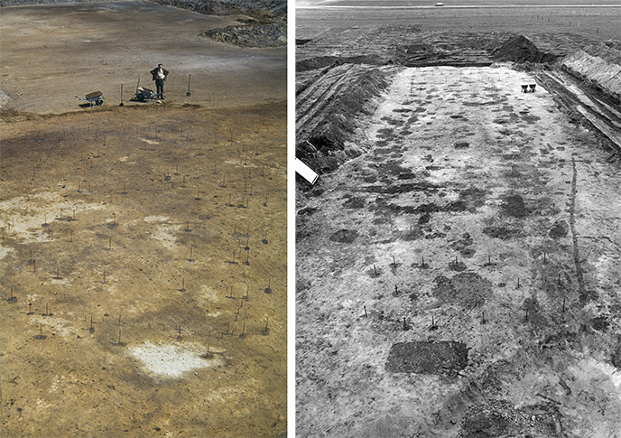
Photo 98. Photography in the field
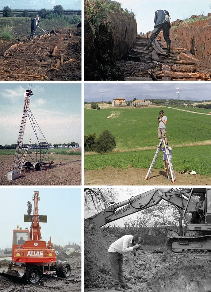
An excavation increases knowledge, but at the same time it is also a destruction of the archaeological archive: untouched information can only be excavated once. Therefore, documentation in archaeology is of utmost importance. One of the most striking forms of archaeological documentation is photography. Unlike drawing and describing, taking a photo is not an interpretation but a representation of reality. When properly stored, photographs can still be used to tell a story decades and even centuries after the shutter is released, as evidenced by this photo history.
During the first excavations of the B.A.I., taking a photo must have been quite an undertaking: the cameras were usually large and heavy and very sensitive. Over time, photography on archaeological sites became easier and more applicable on an ad hoc basis. The addition of scalebars and picture boards for contextual information contributed to the scientification of the research field. In the last ten years, archaeological photography, also at the GIA, has taken off: applications of photogrammetry and drone photography make it possible to visualize archaeological excavations in a very clear manner, and to document remains true-to-life, three-dimensionally.
© University of Groningen, Groningen Institute of Archaeology.
Photo 97. 1929–1949 Excavations at the Domplein, Utrecht
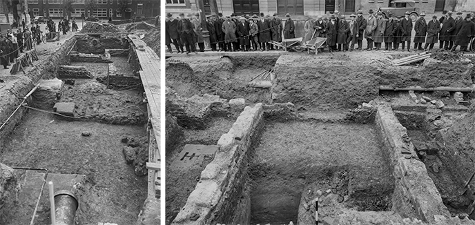
During renovations to the Domkerk and Domtoren in 1927, several Roman remains were discovered. This led to several excavations on the Domplein between 1929 and 1949, carried out by the B.A.I. under the direction of A.E. van Giffen. During these excavations parts of a Roman Castellum were found, together with Roman artefacts dating from the 1st to 3rd century AD. Later excavations and revisions of the data showed that Van Giffen, in his search for Roman traces, had overlooked important indications of the presence of an Early Medieval church. In the meantime, it has become clear that the Domplein area has been an important centre from Roman times onwards, especially for ecclesiastical seats of power from the Carolingian period onwards.
In 2014, the underground visitor centre 'DOMunder' was opened. One can walk among the in situ archaeological remains under the pavement of the Domplein. During the re-excavation for the construction of the attraction, objects such as a pencil sharpener and a bicycle handlebar were found. These must have ended up in the trench during the excavations in the period 1929-1949.
© University of Groningen, Groningen Institute of Archaeology.
Photo 96. 1960+1965 Soil lacquer peels Elp & Angelsloo
In addition to field drawing and photo, the soil lacquer peel is a welcome addition to the excavation documentation. As a true-to-life representation of a ground feature, it also proves useful in education. The technique is borrowed from soil science in examining soil faces and is based on the principle that a phenomenon is impregnated with synthetic resin, reinforced with a carrier and after curing can be peeled off and taken along as a full-size image. This technique works best in sandy soil.
One of the most informative soil peels from the GIA collection is the cross-section of a grave pit from the settlement excavation of Elp (1960) in which not only the pit contour becomes visible, but also the cross section of the coffin. The other photo shows field technician Albert Meijer working with synthetic resin, applied on a horizontal surface in Angelsloo in 1965, an application that is in line with archaeological observations in surfaces and profiles.
© University of Groningen, Groningen Institute of Archaeology.
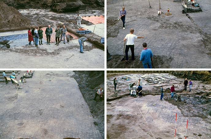
Photo 95. The added value of visits and consultation in the field
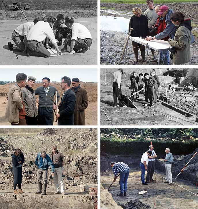
No matter how well prepared an excavation is, unexpected things can always literally surface. Even if no unexpected phenomena can be observed, an archaeologist can doubt what is revealed. Since an excavation cannot continue indefinitely, it is important, while the work pit is open, to draw conclusions and take further steps based on those conclusions.
What can help with any uncertainty is receiving visitors, especially from experienced fellow archaeologists. The knowledge and experience of those colleagues, the exchange of points of view, the assessment of tracks, finds or profiles - it means that observations in the field can be better interpreted on the spot. And sometimes it leads to confirmation of an assumption. During the past 100 years, 'visit' has been a regular part of the daily reports made during excavations of the BAI and the GIA. Colleagues visited each other's excavations, asked questions and suggested additional literature or experiences gained during similar excavations.
Archeology differs from other scientific disciplines because the scientific discourse literally takes place in the open air - not afterwards or during a written presentation of the research, but literally at the time of collecting the data. But whatever the proceeds of the visit, one aspect of the visit will always be added, namely the obligation to always bring a tasty treat when you visit an excavation!
The photos show various moments of consultation during 6 different excavations.
© University of Groningen, Groningen Institute of Archaeology.
Photo 94. 1916–present Cleaning surfaces in preparation of feature reading
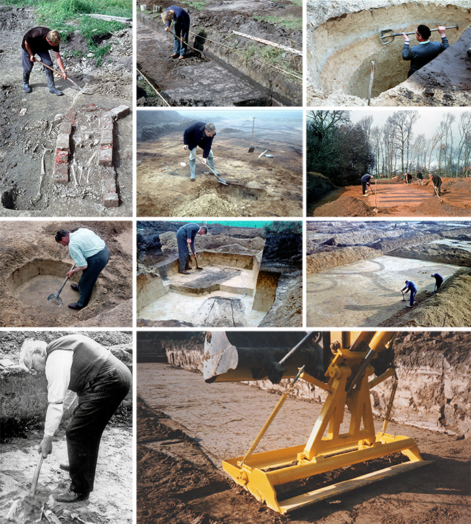
Nothing as important as a clean excavation surface and a cleaned up profile. Thus creating a readable surface is a condition for a correct interpretation of ground features.
This ‘shaving of’ in jargon is a skill to be learnt by every student of archaeology. In the plane this occurs in strips of two shovels wide and in a way that avoids treading the cleaned surface before the field drawing is made. Even for profiles handling the shovel sometimes works better than the trowel, as bigger strokes evoke a smoother profile - provided the shovel is razor sharp and spotlessly clean. Planing in clayey soils has been mechanised by equipping the excavator with a special shaving device.
© University of Groningen, Groningen Institute of Archaeology.
© R. Lutter (RCE; photo bottom right).
Photo 93. 1974–1977 Wim van Zeist – floation near Hadidi
This photo shows Wim (Willem) van Zeist processing soil samples by means of a method known as ‘flotation’ near Hadidi (Jordan). Although more sophisticated forms of flotations are applied in labs, the basic field method as carried out here is rather straightforward. A sediment sample is placed in a bucket of water, after which the water and the sediment is stirred (manually), which separates the lighter elements, in particular (charred) plant remains, from the heavier sediment particles. Directly after stirring, the water is poured over the lip of a bucket on a sieve.
Van Zeist, and his colleagues and assistants, processed hundreds of samples in this way. The analyses of these samples resulted in a substantial number of important publications (see for an overview Cappers et al. 2016). Van Zeists’ efforts to leave virtually no projects unpublished is, in addition to the quality of his work, an accomplishment that deserves to be emphasized here. Years after retirement, he published a series of papers called ‘Reports on Archaeobotanical Studies in the Old World’, simply because he felt that these data should be available to the academic community in his field.
Indeed, the works produced by Van Zeist were, and still are, most valuable. Van Zeist and colleagues significantly increased our knowledge regarding the origin and spread of arable farming in the Near East and Southeastern Europe. Internationally, Van Zeist can safely be said to be one of the big names in the field of archaeobotany. By no means, this implies that he has not been actively involved in the Dutch work of the BAI. He published major papers dealing with the northern clay region, The Swifterbant culture in the present-day Flevopolder, as well as research carried out on the sandy soils of Drenthe. As of today, his publications remain well-read and cited in the field.
© University of Groningen, Groningen Institute of Archaeology.
Photo 92. 1987–present Conservation lab GIA
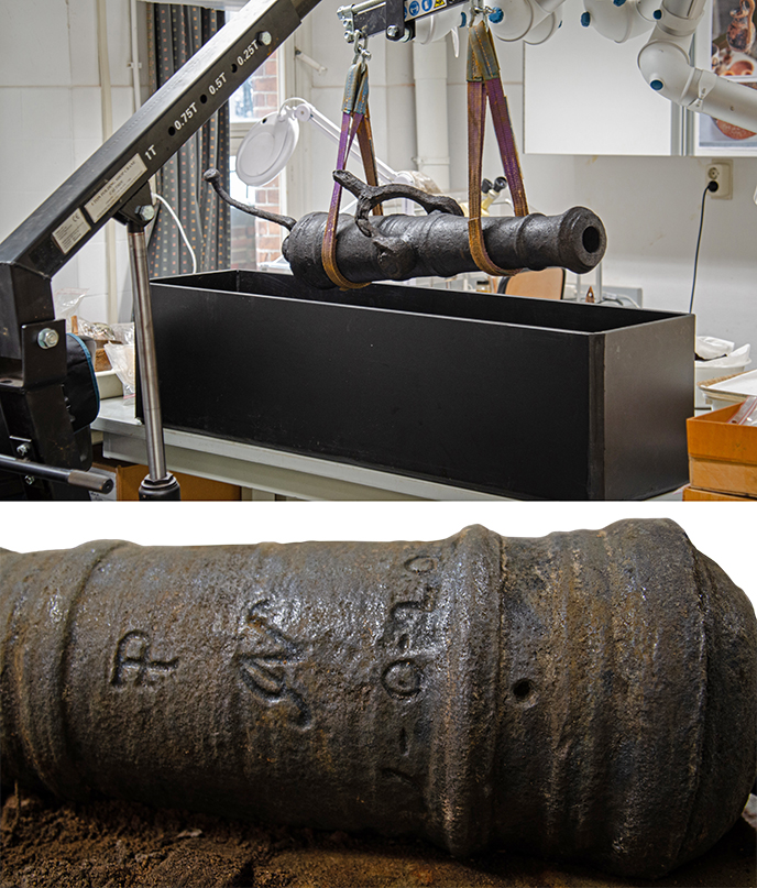
By excavating, you create a problem. Objects and materials that have been in balance with their soil environment for centuries are suddenly exposed to light, oxygen and varying relative humidity. In the case of the ship's gun, this means mechanically removing the corrosion. The object then becomes legible and datable. The "P" refers to 'proof', meaning that the gun was tested with an extra heavy load of gunpowder, and that it passed that test. The presence of the letter gives an indication of both the ship's origin and function: an English merchant ship. "AN" or "JN" is the monogram of the gunsmith. And finally "1-0-10": these indicate the weight. It gives the cannoneer an indication of the quantity of gunpowder to be used. The first number refers to the number of 'hundredweight' (112 pounds), the second number refers to the number of quarter 'hundredweight' (28 pounds) and the third number indicates the number of loose pounds. This swivel gun with the notation 1-0-10 originally weighed 122 English pounds (about 55 kg). Based on the type of bullet fired, it is also called a 'half-pounder'. On the 'Queen Anne' 2, 3 and 4-pound bullets were also found. It is suspected that there must have been heavier artillery on board.
The next step is the actual conservation, because iron rusts easily. Due to the influence of chlorides (a component of kitchen salt), the corrosion proceeds even faster until nothing remains. Because the ship sank in the Zuiderzee, all chlorides have to be removed. The cannon is immersed for more than half a year in a heated mixture of permanently stirred chemicals in distilled water. After that, the metal is impregnated and covered with a layer that protects it from airborne corrosion. Only then is it suitable for museal display.
© University of Groningen, Groningen Institute of Archaeology.
Photo 91. Learning to measure in the field
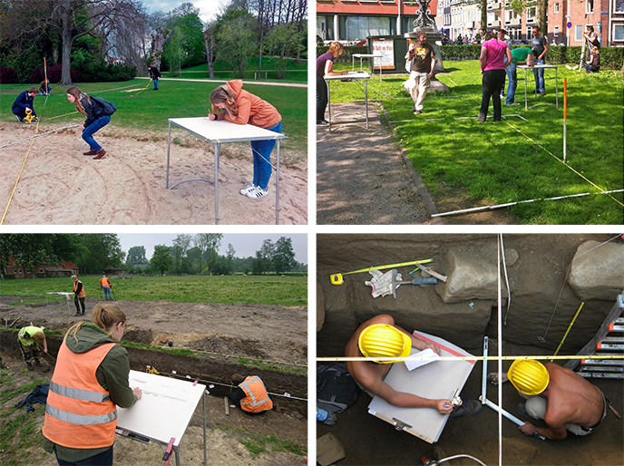
Since an excavation is destructive, it is important to properly record everything within one measurement system. This allows the precise position of finds and ground tracks to be documented. Nowadays it is quite easy to use the GPS to plot measurement lines that have been devised in advance (at the office) in the field. Sometimes, however, the high-tech equipment is not available, or there are problems such as trees that disrupt the connection to satellites and low-tech methods have to be resorted to, to stay within the measurement line context.
Students are thus trained to record the exact measurement data during fieldwork with both digital means and analog tools (such as tape measures and rulers). Obstacles such as shrubs and measuring with height differences must also be resolved. That is why during the first year of the study a fieldwork practical is given in the center of Groningen, during which the students learn different land surveying techniques. Jalons (the red-white poles), measuring tapes and corner mirrors teach how (new) measuring lines can be created within the measuring system. Then it is time to practice this by learning to draw a piece, with a ruler on the measuring tape, to scale on a drawing board with an empty drawing sheet that is divided into mm squares. Shortly after the fieldwork practical, there is already a student excavation in which they have to apply the learned techniques.
© University of Groningen, Groningen Institute of Archaeology.
© Tim Kauling (photo bottom right).
Photo 90. 1979 The first professor of Classical Archaeology in Groningen
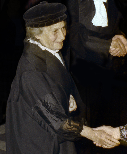
Annie Zadoks-Josephus Jitta (1904-2000) was the first full professor of Classical Archaeology at the University of Groningen. She was an expert in Roman art and is best known for her inventory of Roman bronzes in the Netherlands. In an interview with NRC she described herself as ‘not the field archaeologist, but the person studying the material after the excavation’.
Born to a wealthy Jewish family, Zadoks obtained her PhD at the University of Amsterdam in 1932. She survived WW2 in hiding, and under the false name of Annie van Buren even obtained a regular job studying the archives of the Dutch East India Company in Amsterdam. After the war, Zadoks was involved in a bitter conflict with the Allard Pierson Museum to retrieve a collection of bronzes she had given in custody to her PhD supervisor, museum director, and staunch national-socialist Geerto Sneijder. After a legal battle, the bronzes were given back in 1946.
After the war Zadoks resumed her academic career, first as a researcher with the Royal Coins and Medals Cabinet in The Hague and from 1956 as a part-time lecturer at the University of Groningen. In 1961 she became professor by special appointment in Classical Archaeology, and full professor in 1969 until her retirement in 1975. She lived with her dogs in the canal house on the Prinsengracht in Amsterdam where she had been hiding during the war, and had a pied-a-terre at the Westerhaven in Groningen.
In the photo, Professor Zadoks congratulates the doctoral candidate after a doctoral ceremony.
© University of Groningen, Groningen Institute of Archaeology.
Literature
- Zadoks-Josephus Jitta, A., Peters, W. J. T., van Es, W. A. (1967). Roman bronze statuettes from the Netherlands. Scripta archaeologica Groningana 1.2. Groningen: J. B. Wolters.
- Steinz, P., Een huis vol kikkers; Gesprek met de archeologe A. N. Zadoks-Josephus Jitta over dieren en klassieke kunst. In: NRC Handelsblad 30 november 1990.
- De Neef, W. 2019. Annie Zadoks-Josephus Jitta (1904-2000). In: Tijdschrift voor Mediterrane Archeologie 60, pp. 35-36.
Photo 89. PhD defense (1979) and inaugural lecture (2002): professors in gowns
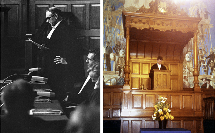
A PhD student defends the content of a dissertation during a special ceremony in the auditorium of the university. There the doctoral candidate is questioned by a committee of gown-clad professors and doctors in suits. The doctoral candidate defends the thesis by answering the questions as accurately as possible. After the meeting, the committee will withdraw to pass judgment, followed by the result: the doctoral candidate is appointed doctor by the chair of the meeting on behalf of the Doctorate Board. Then it is the turn of the supervisor (that is the professor who supervised the PhD candidate). The latter congratulates the PhD candidate and gives a laudation, this is a speech with more personal aspects. In the left photo you can see professor H.T. Waterbolk while he, in a toga, pronounces such a laudation in 1979.
Another occasion where professors wear a gown is the inaugural lecture of a recently appointed professor. At such a meeting, the auditorium is filled with a group of professors at the front of the hall, the Corona. These are often the direct colleagues and professors from the Netherlands and abroad who specialize in the same discipline as the one who delivers the inaugural lecture. A professor gives his inaugural lecture from the pulpit at the front of the auditorium. The inaugural lecture itself should not be too long (about 40 minutes) and it is intended that everyone present can follow the story, so the speech should not be too complicated. Afterwards, the professors leave, followed by the rest of the group. Usually this is followed by a reception where the professor is congratulated. The photo on the right shows Prof. P.A.J. Attema giving his inaugural lecture from the pulpit.
See also photo 90 for a professor in a gown during a reception after a PhD.
© P.B. Kooi (photo left).
© P.A.J. Attema (photo right).
Photo 88. 1923 Prehistoric flint mines in Rijkcholt, Limburg

From 1923 onwards, A.E. Van Giffen carried out excavations in the Savelsbos near Rijckholt, South Limburg. Fifty years earlier, the Belgian archaeologists De Puydt and Hamal-Nandrin had already proven that flint had been mined and worked on a large scale in prehistoric times. In 1925, during an excavation, Van Giffen came across a system of galleries. The mine shafts had been dug vertically to a depth where there was a rich flint layer. In 1964, under supervision of H.T. Waterbolk, a new investigation was started in which again mineshafts were found.
In the years that followed, the research into the flint mines was continued by a group of volunteers, mainly former miners from the Dutch coal mines. Under the archaeological supervision of Waterbolk, they built a gallery of 120 metres. This gallery was constructed horizontally in the hillside and is thus a cross-section of the prehistoric vertical mine shafts. The gallery can be visited by appointment.
© University of Groningen, Groningen Institute of Archaeology.
Photo 87. The eighties – Sticking together potsherds
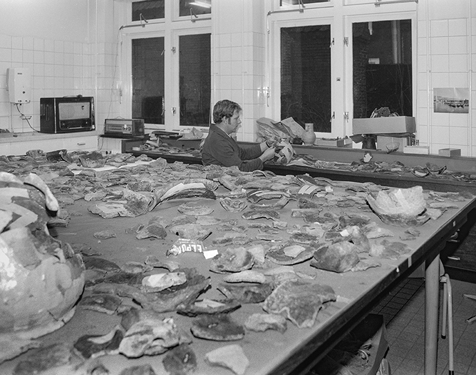
This photo shows Klaas Klaassens, somewhere in the eighties of the last century, in his office at the Institute (Poststraat 6). It is winter, because during summer he was mainly active in the field.
Because excavations during wintertime were rare, this was the time to glue pottery find material. As can be seen in the photo, the loose potsherds had already been washed and sorted, sometimes even provisionally attached to each other with tape. Klaas agglutinated the potsherds together and made urns as complete as possible.
© P.B. Kooi.
Photo 86. 1997–present Towards an archaeological depot
For many years the personal bond between the GIA and the three northern provincial museums ensured a good storage of excavated archaeological material. However, in 1994 the museum boards together decided to change their storage strategy, as their depots were getting overcrowded. A search for one single archaeological depot began, resulting in a centrally located, former state-owned building complex with a floor area of 2.500 m2. In 1997 purchased jointly by the provinces of Friesland, Groningen and Drenthe with financial state aid, this complex became the first interprovincial depot for archaeological finds altogether. In addition to the basic conservation and management facilities much energy was put into public outreach and study amenities.
As the national elaboration of European legislation for an adequate management of archaeological heritage, sharply increased in volume since Malta was implemented in the Netherlands in 2007, the Northern Archaeological Depot has proven its place in the northern heritage community. Also GIA students know how to find their way there.
© University of Groningen, Groningen Institute of Archaeology.
Photo 85. 2005–2008 A pine forest from the distant past
In the years 2005 to 2008, when a shallow peat layer (max. Depth 1 m) in a depression north of Roderwolde was converted, a large amount of stumps and trunks of Scots pine emerged. In addition, a number of large trunks of oak were found in the southeastern part, as well as remains of birch scattered throughout the site. Pollen studies by GIA's archaeobotany department, along with carbon dating and dendrochronological studies, placed forest distribution predominantly in the late Boreal and early Atlantic (Woldring et al., 2017). A 14C-dated trunk is the oldest fossilized oak in our country to date. The pine forest was able to establish itself during a dry phase in the second half of the Boreal and was drowned due to a rapid groundwater rise shortly after the start of the Atlanticum (Woldring & Zomer, 2009). The expansion and decline of a forest of mostly oak and birch around the beginning of the mid-Atlantic (5900 BC) followed the same pattern. According to annual ring counts, the pines lived to be 20 to 226 years old, the oaks (at least) 90 to 268 years. A number of pines died simultaneously, a clear indication that the trees died because of an external cause and not because of old age (fig. 2; Jansma, E., 2014).
© University of Groningen, Groningen Institute of Archaeology.
Literature
- Jansma, E. 2014. Dendrochronologisch onderzoek van boomresten uit Roderwolde-Het Stobbenven, Drenthe: samenvatting en bevindingen. RING rapport nr. 2013052.
- Woldring, H., P. Cleveringa & E. Jansma, 2017. Onvoltooid verleden tijd? Fossiel hout uit het vroeg-Atlanticum. Paleo-Palfenier,159-168.
Photo 84. 1920–2014 The Archeology Library
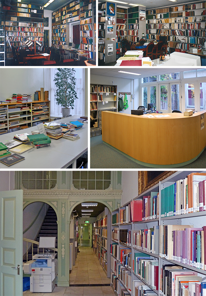
Archaeologists often rely on the knowledge and experience of their predecessors. For example, they encounter situations in the field that they cannot immediately be interpreted properly, but in order to arrive at a useful explanation they resort to publications. Or they look at similar situations in the preparation or elaboration of an excavation.
Immediately after the start of the BAI in 1920, A.E. van Giffen's started creating a reference collection. By including numbers from the PaleoHistoria in the exchange (exchanging journal numbers between scientific libraries with a closed purse) the collection grew. With the arrival of the Classical and Mediterranean archaeologists in 1996 in the building at the Poststraat, the library was expanded with the Mediterranean collection, which was largely placed in the spacious corridor next to the library (bottom photo). A professional desk was placed and the collection was catalogued as a whole. At the front, overlooking the Oude Boteringestraat, there were bright study areas for students.
In 2014 the Archeology library was closed. Like the other decentralized faculty libraries, the library became part of the central University Library of the RUG. The Archaeological collection is now partly located in one of the halls open to the public - the rest is stored in the warehouse. Books can be requested via the computer. Fortunately, the entrance to the University Library is located 150 meters from the Poststraat….
© University of Groningen, Groningen Institute of Archaeology.
Photo 83. May 1990 From farmyard to squatters' fortress and library on the doorstep
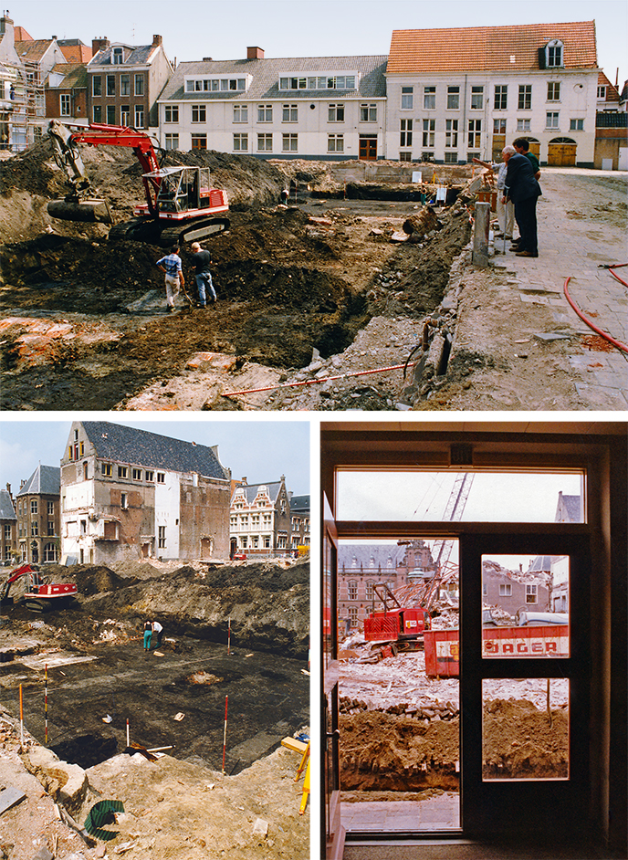
1990 was the historic anniversary year for Groningen: 950 years earlier, in 1040, Roman King Hendrik III donated possessions and rights in the village of Gruoninga to the church of Utrecht. The only event in April of the Jubilee that did reach the international press was the battle that arose during the siege of the labyrinth of the former Wolters-Noordhoff publishing and printing company, which was fortified into a squatters' fortress. During the eviction, the demolition of mainly 19th-century but also medieval buildings started. Building historians and archaeologists from the municipality and the Foundation Monument & Materiaal (Groningen) also had to set to work quickly, with the help of volunteers and BAI archeology students. Although there was no time to completely excavate the construction site, the research did provide a good picture of the development of the 'village' subdivision and development from early medieval Cruoninga through the early wooden city from the 11th century to the brick stone jungle of 1990. The design for the new Public Library at this location - after a design by Giorgio Grassi - in a sense continued in that development. “This is how the city was created and it also changes again, again and again”, alderman Ypke Gietema skews in the foreword to: Van boerenerf tot bibliotheek. Historisch, bouwhistorisch en archeologisch onderzoek van het voormalig Wolters-Noordhoff-Complex te Groningen. (translated: From farmyard to library. Historical, building historical and archaeological research of the former Wolters-Noordhoff Complex in Groningen) (P.H. Broekhuizen et al. (Ed.), Groningen, 1992). In less than 600 pages, this is the story of the site told by involved archaeologists, architects, historians and evicted "residents and users."
© P.B. Kooi.
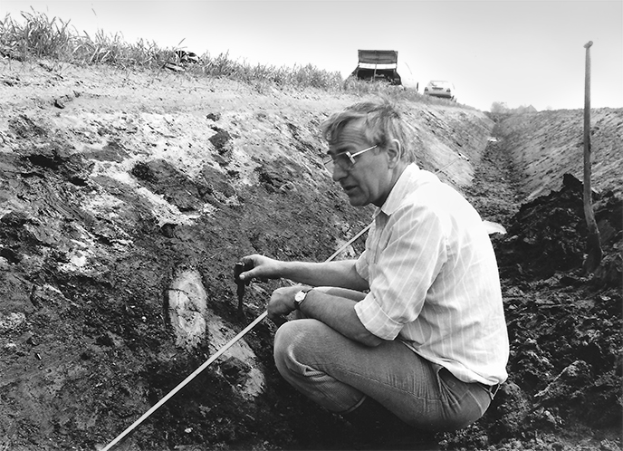
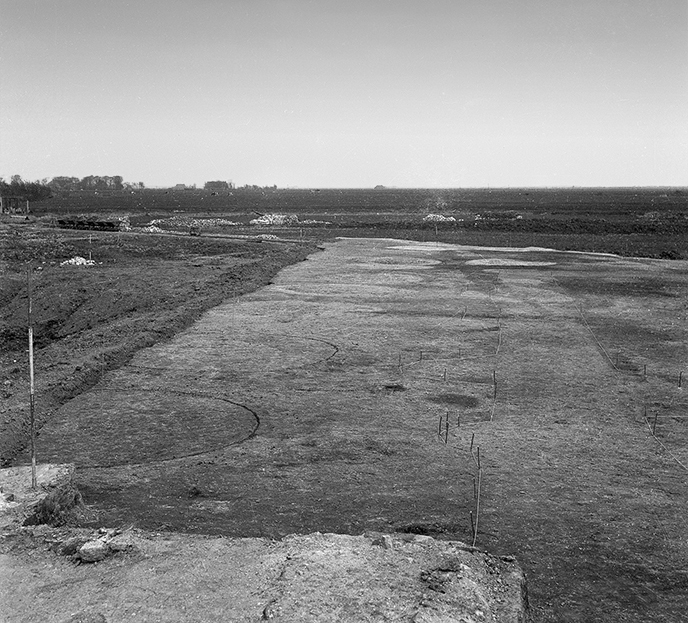
Photo 82. June 1985 Plow marks in the depth
During the construction of a parking garage on the bank of the Winschoterdiep in the Groningen urban district Oosterpoort, a "strange round pit" was found in June 1985, according to J. Smits, demolition coordinator of the municipality. He tipped me off and so I cycled thru the drizzly evening of Tuesday 11 June, equipped with my shovel, trowel and camera, to take a closer look. Fortunately it was light for a long time. The pit turned out to be the brick foundation of the steam oil mill Vredelust, which had been demolished in 1872. While excavating the construction pit, the excavator had saved the foundation and excavated 3 meters of fill layers and natural clay deposits up to the eastern flank of the Hondsrug. In the depth, a fabric of perpendicular, long, narrow dark stripes stripes were visible in the light gray cover sand. In that almost abstract image, I was completely surprised to recognize the plow marks, depicted in the book "Verleden Land" (page 19), which was in my bookcase. The age of this rare phenomenon was still unclear: somewhere between Iron Age and Stone Age. When it became clear that the plow marks were situated at a depth of 1.9 to 1.5 m. below N.A.P., the sea level curve showed that the area was already too wet to use at the beginning of the Bronze Age. The plow scratches therefore date from the late Stone Age.
The benevolent cooperation of the contractor and housing association, and financial support from the municipality were quickly arranged. Between 12 and 25 June - the weekends through - many hands of employees and students of the B.A.I. and volunteers from the Stichting Monument & Materiaal and the northern department of the Archeologische Werkgemeenschap voor Nederland did the job. Almost 2000 m2 could be excavated and documented.
With a non-turning plow, an ard or scratch-plough, the scratches had been made in the soil, probably to make the site suitable for agriculture. That has happened at least three times. In between two "cultivation phases" a low wall has developed between two fields, perhaps due to accumulation with plowed roots. The few discovered pottery sherds, a piece of polished stone ax and a transverse arrowhead probably belong to some older pits, dating from the time of the ‘Hunebed’ builders, the Funnel Beaker culture, roughly 3400 BC. Just before peat started to grow on the sand, somewhere between the 22nd and 25th century BC., fences were made with four rows at a right angle, by driving stakes into the ground. Perhaps a stockyard in the already somewhat swampy madel countries and perhaps made by the farmer of the Enkelgrafcultuur, who was buried with a small cup as an additional gift on the other, western flank of the Hondsrug, in the urban district Helpermaar.
© Peter Broekhuizen, Stichting Monument en Materiaal, Groningen, collectie Gemeente Groningen and University of Groningen, Groningen Institute of Archaeology.
Literature
- Bloemers, J.H.F., L.P. Louwe Kooijmans & H. Sarfatij, Verleden land. Archeologische opgravingen in Nederland (Amsterdam 1981).
- Fens, R.L., J.P. Mendelts & W. Prummel, De trechterbekernederzetting Helpermaar - De systematische opgraving van een neolithische scattervindplaats aan de westzijde van de Hondsrug in Groningen-Zuid. Stadse Fratsen 33, Groningen 2013.
- Kortekaas, G.L.G.A., “Een laat-neolithisch akkercomplex in de Oosterpoortwijk te Groningen”, in: Groningse Volksalmanak, 1987, 108-124.
Photo 81. (+/- 1970’s)–2017 Vopel, the BAI / GIA’s space for artefact studies
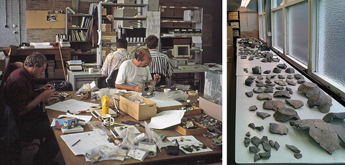
Many square meters of table surface are needed to study archaeological finds, especially if it involves the comparative study of specific find types. Until 2017, the GIA had a space specifically for studying artefacts, the Vopel building, where many PhD students and senior students could be found bent over artefacts for months at a time. The finds had to be unpacked, classified and compared to other finds before they could be interpreted correctly. The reason why Vopel was such a favourite location, was its close proximity to the Poststraat: only a 150 meters walk. Unfortunately, the university decided to sell the building in early 2017.
In the photo on the left, Ernst Taayke (in a white t-shirt) and Danny Gerrets (in a dark red shirt) are working on the finds from the 1996 excavation from Wijnaldum. On the table are, among other things, analogue and digital scales, plastic find bags and finds cards. The latter did not yet have barcodes, which would follow later.
The photo on the right, taken in late 2013, shows the pottery finds from Hijken-Hijkerveld (excavated between 1969 and 1974), that were studied by PhD student Karen de Vries, then still a master student. The pottery finds were placed on the tables at the Stalstraat side of Vopel, on the 1st floor. All the pottery on the photo originated from one “refuse pit”. By placing all the pottery on the tables at the same moment, it becomes clear how large the assemblagess were, but also that none of the vessels were complete. The material probably represented part of the household goods that were deliberately left behind after the adjacent house was abandoned and demolished.
© University of Groningen, Groningen Institute of Archaeology (photo left).
© K. de Vries (photo right).
Photo 80. 1997 Borger-Daalkampen – Freek Modderkolk, an experienced volunteer in archeology
During an excavation, an extra pair of hands is always welcome, for example, when there are many square meters of surface to be planed, ground tracks to be sectioned, waste pits to be prepared and the registration of material to be found. In the past 100 years, volunteers have played an important role in excavations. A list of names of volunteers is usually incomplete. The one on the right in the photo is just one of the large number of volunteers who have helped excavations from the BAI and later the GIA. The photo shows Freek Modderkolk standing up, photographed during the 1997 campaign of Daalkampen in Borger. This concerned settlement research by the GIA, in collaboration with the ARC (Archaeological Research Center).
The picture shows Freek Modderkolk busy, together with another volunteer and a former student, sectioning a (waste) pit. He oversees the state of affairs. From his job, he worked at Staatsbosbeheer and then at the Provincial Planning Service in Drenthe, he was involved in landscape management. After his retirement, he contributed to several excavations, also after the adjustment of the archaeological system around 2000 when commercial archeology made its appearance. Incidentally, volunteers sometimes also contribute in other subjects in archeology - see for example photos 60 and 65.
© P.B. Kooi.
Literature
- In memoriam Freek Modderkolk (1934-2006)/W.A.B. van der Sanden. In: Nieuwe Drentse Volksalmanak 2006, p. 92-95
- Een definitief Archeologisch Onderzoek langs de Rijksweg N34 te Borger, gemeente Borger-Odoorn (Dr.) / P.B. Kooi & M.J.M de Wit. Met bijdragen van H. Buitenhuis, C.G. Koopstra, M.J.L.Th Niekus en G.J de Roller. ARC Publicaties 71, Groningen, 2003. In the Introduction, p. 3, the contributions of all participants, including F.M. Modderkolk, are mentioned.
Photo 79. 1920–present Searching for traces of former residents
Settlement research in the Northern Netherlands is one of the pillars of the BAI and later GIA. Unlike pottery, querns or other domestic artefacts, archaeologists never excavate complete houses. However, the archaeological remains of these houses, so-called house plans, are frequently found during excavations, often only as discolorations (postholes) in the ground where the wooden construction used to be placed in the ground (see photos of Hijken-Hijkerveld and Gasselte above and see photo nr. 38 of the excavation at Peelo). Preferably, archaeologists try to understand which postholes are associated to the same structure when they are in the field, based on the regularity, size, color and depth of the postholes. When the density of postholes is high, because several houses have stood in one and the same place (see photo of Gasselte), it is sometimes necessary to complete the puzzle behind a desk inside, with the use detailed drawings made in the field.
The knowledge that has been built up over the past 100 years about the developments in prehistoric house building techniques can aid the researcher with these puzzles. Over time, different building techniques and building traditions have existed, sometimes successive and sometimes simultaneously. In an excavation these different construction techniques can be recognized by the relative positioning of the features or postholes. As traditions changed over time, the type of house plans can help make a statement about a settlement’s age.
In archeology, these building traditions are often described by means of house types, the overview is called a typology. The most recent example is Getimmerd Verleden by H.T. Waterbolk (2009). House plans, however, can provide much more information about the past than just age. For example, they can provide insight into ways of life and social differences in the past. In recent research (De Vries, in preparation), house-building traditions are studied in a different way, as a ways by which the prehistoric inhabitants of the Northern Netherlands could express whether or not they were part of larger communities - by conforming to widely shared traditions or by doing something else.
© University of Groningen, Groningen Institute of Archaeology.
Literature
- Waterbolk, H.T. 2009. Getimmerd Verleden. Sporen van voor- en vroeghistorische houtbouw op de zand- en kleigronden tussen Eems en IJssel. Eelde: Barkhuis
- Vries, K.M. de (in voorb.). Settling with the norm. Normativity and variation in the definition of social groups and their material manifestations in (Roman) Iron Age settlement sites of the northern Netherlands. PhD thesis, Rijkuniversiteit Groningen.
Photo 78. 2015–2017 Agricultural experiments in the moderately protected salt marsh: a continuation after almost 40 years
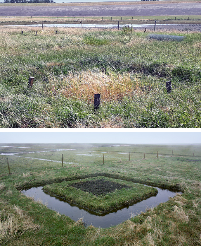
The agricultural experiments carried out between 1969 and 1978 have become classics in their field, and are widely cited by many archaeologists working in coastal areas in the Netherlands, as well as abroad. Whilst innovation and progress are abundantly cherished and stimulated within a modern research environment, the value of maintaining awareness of what was done before cannot be stressed enough. Indeed, as archaeologists know best, inspiration for innovation can often be found in the past.
In 2015, almost four decades after the BAI experiments, Mans Schepers was granted an NWO Veni grant to study arable farming in the terps area. This project included new cultivation experiments. These (2015-2017) did not simply repeat what was done previously. Archaeological features explicitly served as an inspiration this time. The frequent occurrence of ditches and small dikes in terp excavations, testify to a considerably culturized saltmarsh landscape. The simple question triggering the new experiments was thus the following: do minor landscape modifications have a noteworthy effect on arable farming in this environment indeed?
These new questions, as well as intensive cooperation with ecologists, resulted in a considerably different design of the experiments. A certain distance was held between the experimental plots, to avoid them affecting each other. Moreover, the number of crops was reduced to only two (barley and beans). For each crop, five plots were surrounded by a ditch, five by a minor dike, and five were left unprotected, resulting in a total of 30 plots (2 crops*three treatments*5 replications).
© M. Schepers.
Photo 77. 1981–2002/2003 Hunting for aurochsen in the valley of the Tjonger near Jardinga (Frl.), 5400 and 5250–5050 BC.
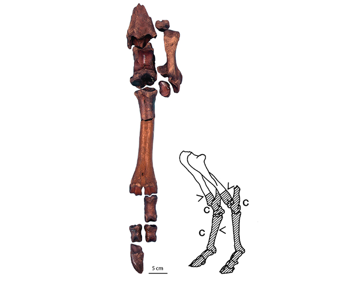
Middle Stone Age hunter-gatherers came to the Tjonger Valley near Jardinga at least twice to hunt aurochsen, red deer and beavers. In the river they may have caught European pond turtle, pike and bass too. Bones of these species have been found. The BAI and the Fries Museum conducted here excavations in 1981, the GIA in 2002 and 2003.
We don't know how the hunter-gatherers got hold of and killed the animals. It is clear that the meat of the animals was brought to higher parts in the area to eat it there. No fires were found at the site. Flint tools were recovered with which the skin and flesh would have been removed. Such hunting grounds are very rare.
The photo shows the lower part of the right hind leg of one of the aurochsen. The same part of the left hind leg has also been found, as well as corresponding parts of the front legs. These parts were left because there was no meat on them. From top to bottom you can see the lower part of the tibia, the tarsus bones, the metatarsal bone (the long, broken bone), a first phalanx, two second phalanges and a third phalanx (hoof).
The metatarsal bone had been broken by the hunters. This way they could drink the marrow from this bone on the spot. The diagram on the right shows the lower parts of the hind legs of an aurochs. The parts found are shaded. The <-signs indicate bones slashed (tibiae and metatarsal bones). The C-signs are next to bones with cutmarks (the largest tarsus and the metatarsal bones).
© University of Groningen, Groningen Institute of Archaeology (photo R. van Ewyck).
© University of Groningen, Groningen Institute of Archaeology (diagram).
Literature
- Prummel, W., M.J.L.Th. Niekus, A.L. van Gijn & R.T.J. Cappers, 2002: A Late Mesolithic Kill Site of Aurochs at Jardinga, the Netherlands. Antiquity 76, 413-424.
- Prummel, W. & M.J.L.Th. Niekus, 2005: De laatmesolithische vindplaats Jardinga: De opgravingen in 2002 en 2003. Paleo-Aktueel 14/15, 31-37.
Photo 76. 1950–present Carbon-14 dating
Around 1950, the Carbon-14 method was “discovered” by the American Libby. The method enabled the measurement of the age of organic materials. Soon thereafter, a 14C laboratory was founded in Groningen by the physicist Hessel de Vries, instigated by van Giffen. This was the start of the Center for Isotope Research (CIO), part of the Faculty of Sciences of the university. Since then it was possible to date archeological samples by means of a “measurement”; before, ages were determined indirectly by cultural associations. The method can be applied for wood, charcoal, peat and other botanical samples, bone, shells etc. Carbon-14 (14C) is radioactive and is present in nature, including living organisms via the foodchain. Upon death of an organism only radioactive decay remains; after 5730 years (the half-life) 50% of the original amount has disappeared. The method works back to 50.000 years ago.
De natural amount of 14C is very little, whish makes the measurement difficult. In the lab, samples undergo two kinds of procedures: pretreatment and dating. Pretreatment is mostly chemical: contamination (for example carbon from the soil) needs to be removed, and the datable fraction (for example collagen from bone) must be prepared. This is combusted into CO2, in which the amount of 14C is measured, a physical proces.
Originally this was done by measuring the 14C radioactivity, the method refined by de Vries. That required large samples, typically grams. During the 1980’s a new method was developed: a direct measurement of the 14C concentration, requiring only a milligram of carbon. The method applies a small particle accelerator (AMS, Accelerator Mass Spectrometry). The CIO employs such a machine, since 2017 the most modern version.
© Hans van der Plicht.
Literature
- M.W. Dee & J. van der Plicht, 2020. Isotopen in de archeologie – verleden, heden en toekomst. Paleoaktueel 31.
- J.N. Lanting & J. van der Plicht, de 14C-chronologie van de Nederlandse pre- en protohistorie. Serie artikelen in Palaeohistoria, 1996-2012.
- J. van der Plicht, C. Bronk Ramsey, T.J. Heaton, E.M. Scott & S. Talamo, 2020. Recent developments in calibration for archaeological and environmental samples. Radiocarbon 62, 1095-1117.
Photo 75. 2020 ADC Excavations Swifterbant
Archaeological firms carry out the largest part of the fieldwork in the Netherlands. ADC ArcheoProjects carried out excavations on a large number of locations in the Swifterbant area, as part of the realisation of a massive wind turbine project. GIA is involved in this project as scientific advisor of the consortium that builds the turbines. Project manager Elma Schrijer from ADC – and alumna of our institute – is responsible for dozens of test trench that are excavated. In some trenches ceramics were found. Great to study and interpret these sherds together. Preliminary conclusion is that it concerns ceramics from the Swifterbant culture, dated c. 4300-4000 cal. BC.
© University of Groningen, Groningen Institute of Archaeology.
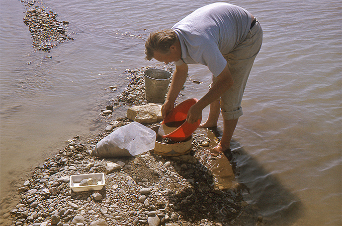
Photo 74. 1992 Wet sieving at Siddeburen (province of Groningen)
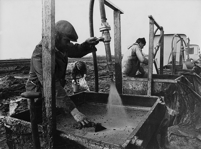
Hunter-gatherers who inhabited the Netherlands during the middle Stone Age, the Mesolithic, left all sorts of remains behind at many thousands of places in the landscape. Remains of organic materials, such as bone and wood, are normally not preserved. What we mostly find back are tools made out of flint, as well as waste originating from tool manufacture. Such material is highly informative and can tell archaeologists a lot about, for instance, landscape use, the functional organisation of settlement space, as well as technological developments. But to collect all this material, requires quite some work. The GIA, and its predecessor the BAI, has a long tradition in this field. In 1982, for instance, remains of a hunter-gatherer campsite were investigated during large-scale land consolidation works near Siddeburen, in eastern Groningen. Occupation remains of the Funnel Beaker Culture were also discovered at this occasion.
Finds were not uncovered by using brushes and teaspoons; this would have taken far too much time. The sieving of the sand, containing the flints, was much faster. By spooling the sand, collected in spits from squares, over a sieve using a fire hose, large quantities of material could be collected in a short amount of time. As this picture shows, a wet and muddy affair, and considering the season (it is March), no doubt a cold one too. Now, some 40 years later, and although improved and modernised in many respects, this is still the common method of archaeological research at Stone Age sites. Indiana Jones is far away.
© University of Groningen, Groningen Institute of Archaeology.
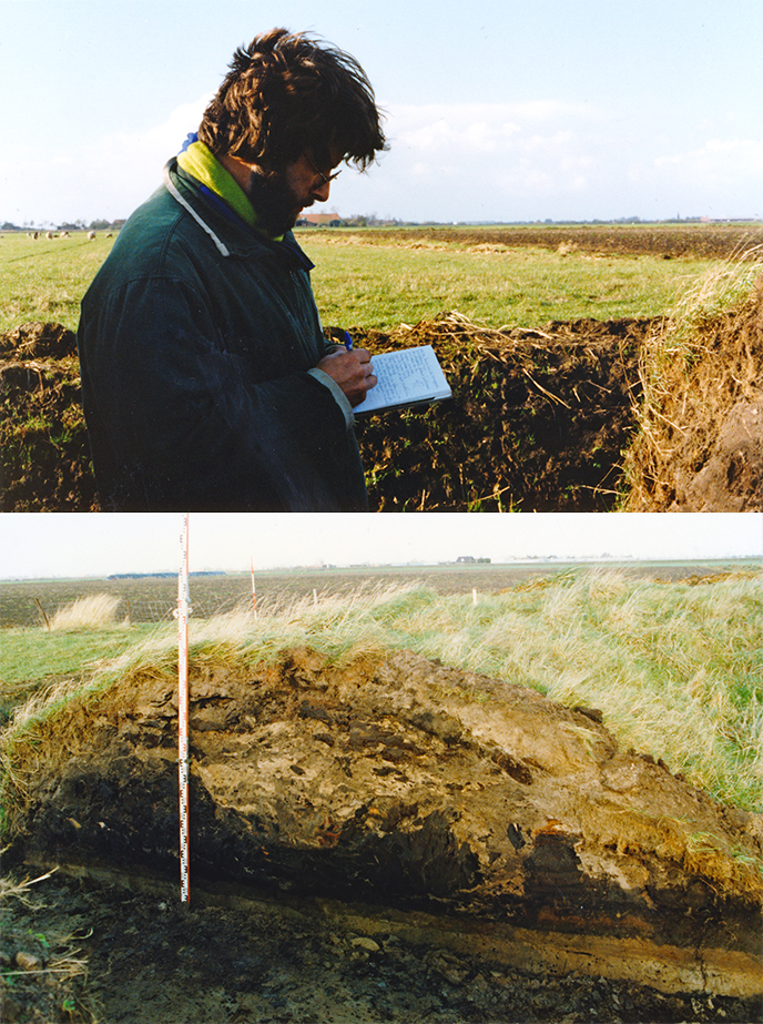
Photo 73. 1958–1988 Peat expertise
Together with the last peat diggers the raised bog disappeared from the Netherlands. In the 1960’s the only peat region of any size was to be found in the Bourtangermoor in southeast Drenthe, east of Emmen. There, since the mid-1950’s archaeological moor finds had drawn the attention of the BAI. The planning of an urban run-off area for Emmen’s new housing estate Angelslo was another reason to research the palaeobotanic aspects as well as the genesis of the last Dutch raised bog complex. From 1958 onwards the biologist W.A. Casparie devoted his doctoral thesis to this. His know-how evolved to an internationally esteemed peat expertise and contributed greatly to the realization of the peat reserve Meerstalblok-Bargerveen that nowadays, together with the adjacent German Bourtangermoor, forms a living raised bog again. We see Wil Casparie in 1988 inspecting a peat filled stream gully in the Loosterveen, Reconstruction area East-Groningen.
© H.A. Groenendijk.
Literatuur
- W.A. Casparie, 1972. Bog development in Southeastern Drenthe (the Netherlands). Diss. Rijksuniversiteit Groningen. Den Haag, W. Junk.
- W.A. Casparie & J.G. Streefkerk, 1992. Climatological, Stratigraphic and Palaeoecological Aspects of Mire Development. In: J.T.A. Verhoeven (red), Fens and Bogs in the Netherlands: Vegetation, History, Nutrient Dynamics and Conservation. Kluwer Academic Publishers, 85-133.
Photo 72. 2020 The drawing room: archaeological draughtsmanship at the GIA
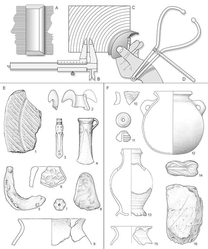
The GIA drawing room produces archaeological images. The surveyors make maps (like photo 66) and the archaeological draughtsmen make object drawings. In addition to photographing, objects on the GIA are drawn by hand. Part of an object can be reconstructed in a drawing. Moreover, fault lines and other coincidences can be omitted and decorations can be made (more) clear. Because the draftsmen carefully study the material during their work, they sometimes discover new details that, reported to the scientists, can lead to new insights.
With the aid of a profile comb (A), calliper (B), diameter paper (C), craniometer (D), rulers, pencil and eraser, we first make a pencil sketch that is checked by the client. We mainly draw on a 1:1 scale. After processing any changes, we work out the drawings. In the past dip pens were used for this and the ink came from glass jars. From the mid-twentieth century, Rotring pens with loose fillings have been used in the drawing room. These pens mess a lot less.
The pencil drawing is outlined on tracing paper using the pens and the shadows are indicated by dots. The more dots, the darker the shadow, see 'E'. These ink drawings are then scanned, archived and placed together on a smaller scale on so-called plates, examples of plates can be seen above. This way you can store multiple object drawings on one page. For a few years now we have also been scanning pencil drawings, we make the outline using Photoshop, see 'F'. With exclusive objects we can combine the scans of the ink and pencil drawing, such as with the diadem from Crustumerium, see photo 61.
© University of Groningen, Groningen Institute of Archaeology.
Literature
- Boersma, S.E. & M. Los-Weijns, 2020: A Guide to Archaeological Draughtsmanship. Groningen, Barkhuis Publishing.
Photo 71. 1940 The Bernardine abbey church to the cisterian monastery Klaarkamp at Rinsumageest (Friesland)
In the summer of 1939, two celebrities from northern Netherlands archeology walked together on the excavated part of the monastery mound Klaarkamp: Pieter C.J.A. Boeles and Albert Egges van Giffen. Boeles collected finds for the Fries Museum. Van Giffen had a different goal. Between 1939 and 1941 he ordered the foundation traces of the abbey, that came to light during the excavation of the monastery mound, to be drawn.
The age of those encountered foundation traces is the subject of scholarly discussion. Klaarkamp was the first Cistercian abbey in the Netherlands. In September 1165 it was officially admitted to the Order of Cîteaux. The monastery grew into one of the most important in northwestern Europe. Archaeologists Klaarkamp might be the first location in the Northern Netherlands where brick was used. To determine the age of the traces, researchers mainly looked at the shape of the floor plan of the abbey church, as relevant datable archaeological material was lacking. Some believe that the house of God must have been built around 1165, while others argue that it may not have been built until around 1275. For the time being, the most plausible dating comes from the professor Matthias Untermann. He argues that abbey churches such as Klaarkamp are variations on the so-called Bernardine-type: a cruciform ground plan with a rectangular sanctuary and rectangular transept chapels. This setup is characteristic of Cistercian god houses. The three-aisled transept, according to Untermann, is decisive for the dating. That would be a renewal of the traditional Bernardine concept that occurred in the period 1175 / 80-1240.
© University of Groningen, Groningen Institute of Archaeology.
Literature
- Doesburg, J. van & J. Stöver, 2012. ‘Tmeeste ende tgrootste van alle cloisteren, wel begraven mit wyden graften’. Waardestellend archeologisch onderzoek naar het cistersienserklooster Klaarkamp (gem. Dantumadeel) in september 2010.
- Mol, J.A., 2006. Klaarkamp bij Rinsumageest: de ruimtelijke ontwikkeling van terp en klooster, Fryslân. Nieuwsblad voor geschiedenis en cultuur 12/2, 5-12.
- Praamstra, H. & J.W. Boersma, 1978. Die archäologischen Untersuchungen der Zisterzienserabteien Clarus Campus (Klaarkamp) bei Rinsumageest (Fr.) und St. Bernardus in Aduard (Gr.), Palaeohistoria XIX, 173-259.
- Untermann, M, 2001. Forma Ordinis. Die mittelalterliche Baukunst der Zisterzienser. München/ Berlin, Deutscher Kunstverlag. 171-180, 466-472.
- Vermeer, G., 1999. Kloosters van baksteen. De architectuur van de hervormingsorden in Nederland tot omstreeks 1300 (self-published).
Photo 70. 2014 Boskin Iraq – Ethno-archeobotanical research
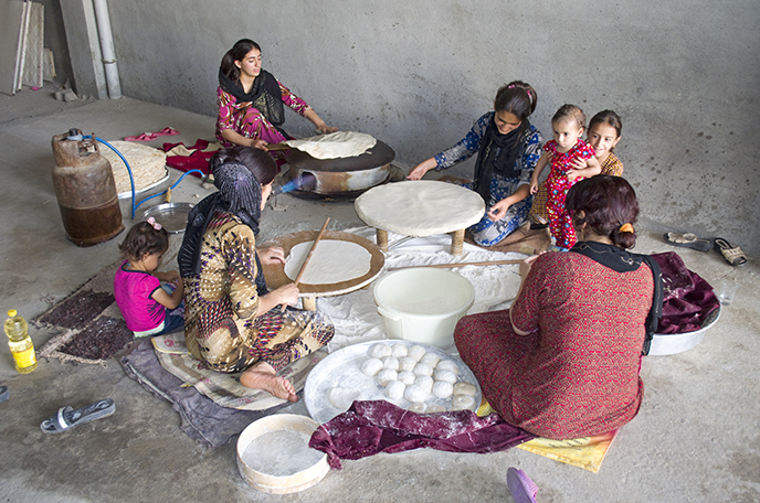
Since 1995, ethno-archaeobotanical research has been carried out in southwest Asia, India and North Africa. All kinds of processes and structures that relate to the collection of food, crop production and the processing of harvest into food have been documented. This documentation covers the collection of botanical samples for the reference collection and photographing and filming. The plant material concerns seeds and fruits of wild plants that are used for the species identification of subfossil seeds and fruits. This makes it possible to reconstruct the vegetation of the plant community and to deduce all kinds of environmental factors. All stages of processing have been collected from economic plants, including a wide range of traditional foods made from grain and milk. The photos document the relationship between humans, plants, animals and material culture. Among other things, attention is paid to the production, storage, use and disposal of objects. Films deal with specific processes as well as interviews with farmers.
Part of the ethno-botanical research has been published in two handbooks and five atlases and comprises c. 19,000 photos. An important contribution here is the standardization of both structural concepts and process concepts. This standardization relates, among other things, to the characteristic fragments of plants that arise from specific forms of fragmentation, to tools such as sickles and to installations such as ovens. Such standardization makes it possible to make comparisons between different forms of crop processing. The published photos are digitally searchable and can be seen in detail on the website of the Digital Plant Atlas Project (www.plantatlas.eu).
© University of Groningen, Groningen Institute of Archaeology.
Photo 69. 1989 Region-relevant research
at Muntendam
The 1970s to 1990s were dominated by land consolidation in the Northern Netherlands. Gradually, it became customary to conduct an archaeological inventory in advance and to supervise the earthwork archaeologically. The BAI put recent graduates forward in order to gain work experience in a difficult labor market. The Redevelopment of East Groningen and the Groningen-Drenthe Peat Colonies was more than a traditional land consolidation, namely a broad regional overhaul. This required a lex specialis (a law that takes precedence over general legislation)and the implementation took over 30 years. From 1982 onwards, the BAI took care of the archaeological inventory and supervision of the Groningen part, financed from what was then called the 'region-relevant research pool' at the University of Groningen.
In 1989, a remnant of the Oude Veendijk near Muntendam, constructed in early modern times to keep acidic water from the fields, was cut through for the construction of a culvert with a weir. The peat quay was originally wider and consisted of undigested raised peat, which in WWII still supplied the neighboring farmers with (illegal) fuel. After WWII, the Ned. Heidemij started the recovery, whereby the central trench was created and sand embankment followed to protect the peat remnants.
© University of Groningen, Groningen Institute of Archaeology.
Literature
- H. Groenendijk & R. Bärenfänger, 2008. Gelaagd landschap. Veenkolonisten en kleiboeren in het Dollardgebied. Archeologie in Groningen 5. Bedum, Profiel.
Photo 68. 1959–2021 Bronze Age Catalog - Butler and the Drawing Room
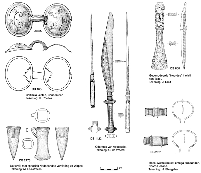
Since his appointment in 1957, as a Bronze Age expert, J.J. Butler focused on compiling the so-called Bronze Age catalog of the Netherlands. This catalog appeared/appears in parts in Palaeohistoria; each part deals with a group of bronze objects. Because images in such a catalog are indispensable, the draftsmen of the GIA drawing office have drawn many of "Butler's bronzes".
The object draughtsmen (often trained at drawing academies) were great from the start in their representation of those objects: the final product was often more beautiful than the object itself. All aspects that were relevant, according to Butler, were directly reproduced on paper using Indian ink. Adjusting such drawings “just” was quite a job and that is why they worked very carefully; when tracing paper was introduced, it was quickly embraced because it was easier to scratch out, because Butler was not easily satisfied ...
In the attached picture (original scale 1:2) you can see five examples of drawings made from 1959/1960. The artists often went into the country with Butler. Parttimer G. de Weerd became an independent artist after a few years, H. Roelink was affiliated with the BAI/GIA until his retirement and was succeeded by M. Los-Weijns who he worked in; J. Smit was Hannie Steegstra's art teacher until his retirement. The latter is currently publishing the final articles of the Bronze Age catalog together with Stijn Arnoldussen.
© University of Groningen, Groningen Institute of Archaeology.
The drawings on the accompanying illustration are from the following Palaeohistoria publications:
- DB 165: Butler, J.J., 1986. Drouwen: End of a ‘Nordic’ Rainbow? Palaeohistoria 28: p. 163, Fig. 30.
- DB 600: Butler J.J. & H. Steegstra, 1997/1998. Bronze Age metal and amber in the Netherlands (II:2): Catalogue of the palstaves. Palaeohistoria 39/40: p. 173, Fig. 45: No. 184.
- DB 1422: Butler, J.J., S. Arnoldussen & H. Steegstra 2011/2012. Single-edged socketed Urnfield knives in the Netherlands and Western Europe. Palaeohistoria 53/54: pp. 88-89 en Fig. 12.
- DB 2173: Butler J.J. & Hannie Steegstra. Bronze Age metal and amber in the Netherlands (III:2). Catalogue of the socketed axes, part B. Palaeohistoria 45/46, pp. 232-233 en Fig. 68B.
- DB 2921: S. Arnoldussen & H. Steegstra 2021. Fossilized fashion and social sparkle: Dutch Bronze Age bracelets in context. Palaeohistoria 61/62, Fig. 16. In druk.
Some of the drawings from the above articles have also appeared in:
- W.H. Metz, B.L. van Beek & H. Steegstra (eds.), Patina. Essays presented to Jay Jordan Butler on the occasion of his 80th birthday. Groningen/Amsterdam, private publishing.
Photo 67. 1991 Archaeozoological reference collection on fire
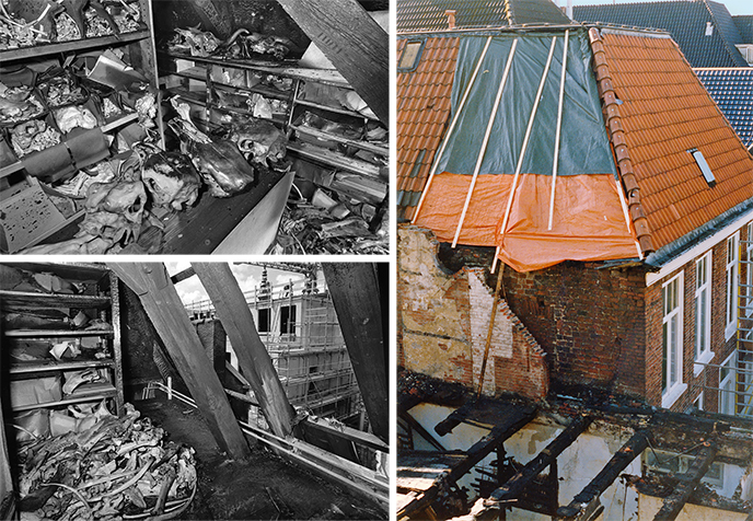
In the early morning of Tuesday June 4, 1991, a fire broke out in the attic of Oude Boteringestraat 8, the neighbouring building of the archaeology department (then BAI, now GIA). The entire top of this building burned out. The fire spread to the rear of the attics of Oude Boteringestraat 6, the part of GIA that borders the Oude Boteringestraat. The archaeological reference collection was set up in the top attic, with more than 3000 skeletons of about 620 species of mammals, birds, fish, reptiles and amphibians. The jets of water had blown the boxes with the skeletons out of the racks. Many skeletons had been burned and had to be disposed of. The collection of bovine skulls from Indonesia was irretrievably lost. Other skeletons were partly burned. Everything was covered with soot. Photographer Elmer Spaargaren took photos 1 and 2 on the day of the fire, They show the heavily damaged collection of cattle skulls. Giorgio Grassi's Public Library in the process of construction is visible on photo 2 through the open roof. The Wolters-Noordhoff complex was there before. This was vacated from squatters in May 1990. The Faculty of Law of the University of Groningen has been located here since 2020. The tower of the Academy Building rises in the background. Photo 3, taken by Piet Kooi in the summer of 1991, shows the burnt part of the roof of Oude Boteringestraat 6 (under the plastic). The four windows below belong to the rooms of now Lidewijde de Jong (the two windows on the left) and Canan Çakirlar (the two windows on the right).
It was a serious blow to the archaeozoology department. The rooms of now Lidewijde de Jong and Canan Çakirlar had a lot of flooding. Many books and other papers in these rooms were wet. The roof decking was burned, but the ancient rafters were only charred black. Larger skylights were installed in the new roof. Fire doors were installed throughout the building.
© Elmer Spaargaren (foto 1 en 2).
© P.B. Kooi (foto 3).
Photo 66. 2012 From field drawing to digitized drawing
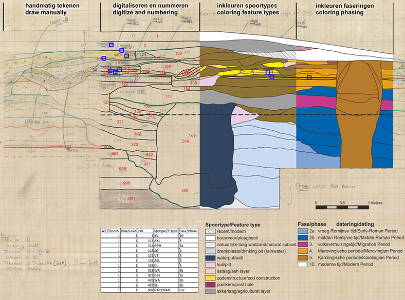
During each excavation archaeological traces are found in the plane or the profile. These traces are traditionally drawn by hand on A0 millimeter sheets. Despite the technological possibilities for digital drawing, the excavations of the GIA are still often drawn manually. In the field it becomes immediately clear what has been drawn and the students become proficient with drawing to scale. After the excavation, the field drawings are scanned for digital tracing. By numbering all tracks, it is possible to link to a database of the various specialists (material finds). The final modified drawings are used for clarification of the text in scientific publications.
Shown here is a drawing of a 3 m high cross-section through a mound near Dronrijp, made during a GIA excavation in September 2012. The drawing shows natural tidal and salt marsh layers at the bottom, covered by a thick package of mounds. Within the plagues are a watering place for cattle, two wells and some sod structures of a farm, dating from the Iron Age to the Middle Ages.
A part of the database, the information of which can be linked to the profile, shows that each numbered track has been assigned to both a track type and a phasing. With the help of different colors, as shown in simplified legends, it is clear what the different ground tracks are and from what period they date. The profile drawing shows that in addition to tracks, other relevant matters are also drawn. The blue squares are the locations where the soil sampling trays are placed.
© University of Groningen, Groningen Institute of Archaeology.
Literature about the mound excavation at Dronrijp:
Photo 65. 2018 GIA’s washing cellar
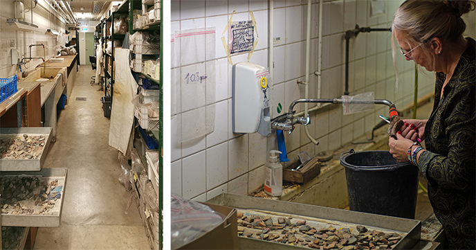
The washing cellar consists of a long space with shelves containing the archaeological material on one side and a sink, an extension tray and a drying cabinet on the other. A special container is attached under the sink for the collection of sand and clay, in particular, in order to prevent clogging of the sewer. This container is emptied with a certain regularity. After a field survey or an excavation, the material must be washed on return to the GIA. Sometimes this is done on the archaeological site, but usually this is not the case and the find material is cleaned in the so-called washing cellar of the institute. Armed with a dish brush and a toothbrush, every object here is cleaned of clay, sand and other irregularities. After washing, the material shows its original color and it is often easier to recognize what it represents. After cleaning, the material is placed in a heating cabinet to dry gently.
In the washing cellar, not only pottery is washed, but also bone material is cleaned here (think of the head of a cow or a horse's head) for example. In this case, the temperature of the drying cabinet must be lowered to prevent tearing of the bone material. After washing, the final responsible archaeologist looks at the material and the material is divided per find category. The finds are then stored in boxes, provided with find tags with barcodes. Metal finds sometimes need to be preserved in the conservation lab of the GIA. Objects are also selected to be drawn in the drawing office of the GIA. It is special to find, whilst washing the material, that one piece among a lot of material that matters, for example to be able to date a context more specifically. The rinsing cellar is an important part of the institute, where many future archaeologists are gaining material knowledge.
© University of Groningen, Groningen Institute of Archaeology.
Photo 64. 2002 Horse meat consumption in Kesteren (province of Gelderland, Netherlands)
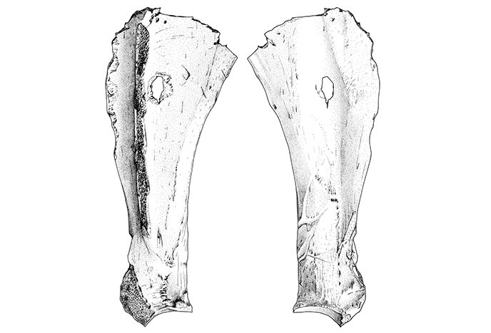
These drawings, made by Rita Aalders, around 2004/2005 at GIA, show the left scapula of an adult horse from Kesteren, a vicus of a Roman castellum. To the left is the outer surface of the scapula, to the right the inner surface. The length of the bone is 33,5 cm.
The scapula was perforated in its proximal end. The spine on the lateral surface was removed. Other cutmarks are at the cranial side of the scapula (left on the left drawing, right on the right drawing). Dog gnawing pits are visible at the uppermost part of the bone. The bone was 14C-dated at 1945±40 BP (GrA-23299), i.e. between 14 BC and AD 205, Early or Middle Roman Period.
The perforation suggests that the left front leg of the horse had been hanged for smoking. After the smoking, the meat was taken from the scapula to be consumed. Thereafter the scapula was given to a dog. Eating horse meat was not a Roman habit. This was different in the terp region in the North of the Netherlands, where horse meat was regularly consumed, also in the Roman period.
© ARC.
- Zeiler, J.T., 2005: Paardenrookvlees uit Kesteren (Gld.). Paleo-Aktueel 14/15, 143-145.
- Prummel, W., 2008: Dieren op de wierde Englum. In: A. Nieuwhof (red.), De leege Wier van Englum. Archeologisch onderzoek in het Reitdiepgebied (= Jaarverslagen van de Vereniging voor Terpenonderzoek 91). Groningen, 116-159.
Photo 63. 2014 The wall of the Kaibon kraton in Banten - West Java
In 2019 Martijn Eickhoff has been appointed Professor by Special Appointment in Archaeology and Heritage of War and Mass Violence at the Groningen Institute of Archaeology. This chair is established in collaboration with the NIOD Institute for War, Holocaust and Genocide Studies and the Royal Netherlands Academy of Arts and Sciences (KNAW). The research field ‘Archaeology and Heritage of War and Mass Violence’ is relatively new. It studies both the vulnerability of archaeological sites and objects during violent conflicts, as well as the impulse that is simultaneously given to archaeological practices and processes of heritage formation. An important characteristic of the research field is that it links archaeological approaches to landscapes and objects with historical questions, and debates on heritage (and identity). The first project starting in this context, is done in collaboration with the Archaeology Department of Universitas Gadyah Mada in Yogyakarta and focusses on traces remaining from the early nineteenth century destruction of the harbor city of Banten in West Java. With this act of extreme violence, the colonial state intended to permanently eradicate an economic and political rival. In 2021, an Indonesian PhD student will start research into the diverse, but also interrelated ways in which communities in Indonesia and the Netherlands feel connected to the material traces of this historic event.
© M. Eickhoff.
Photo 62. 1929 Excavation stone cist Diever
In the period that the Dutch megalithic tombs were built (c. 3400-3000 BC) we not only have megalith tombs (!) but also smaller stone tombs (stone cists) and individual graves with some or without stones. We would love to know how it was decided who was to be buried in which type of grave.
Van Giffen excavated the famous Diever stone cist in 1929. As a matter of fact: it concerns a burial mound with two phases. The primary burial consists of the stone cist, covered with a burial mound. During the Bell Beaker period (c. 2400-2000 BC) a second burial with a second burial mound was located on top of it.
The photo shows that making a photo was taken very seriously. The surfaces and sections were cleaned with great care. The photo is a rare example of that work in progress by the excavation labourers; as a rule only the end result of their efforts was photographed. The man on the right was so busy that the camera’s long shutter speed resulted in a vague area where his hand is moving back and forth.
© University of Groningen, Groningen Institute of Archaeology.
Photo 61. 2007 Excavated in Crustumerium:
a diadem
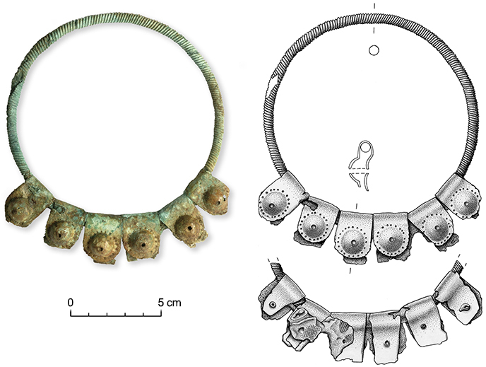
This object is a so-called diadem, part of a headdress that was found in a female tomb dating to the first half of the 7th c. BC, in one of the cemeteries at Crustumerium. Upon discovery, it was carefully excavated and afterwards restored in GIA’s laboratory by Gert van Oortmerssen. In further research in laboratories in Rome, small pieces of textile were found still attached to it, corroborating its function as a headdress. The diadem consists of a ring made of a solid twisted bar, is circular in section. Six folded plates made of copper alloy once holding precious stones adorn its frontal side.
While the photo shows the general appearance of the object and provides us with information on its colour and texture, the drawing interprets the object, showing details as to how the folded plates are attached to the ring of twisted bar. It reveals irregularities and damaged spots and presents through the addition of cross-sections of the object threedimensional aspects of the object.
© University of Groningen, Groningen Institute of Archaeology.
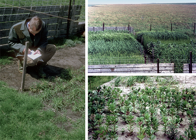
Photo 60. 2019 Field surveys in the Friesland/Groningen Terp- and Wierde area
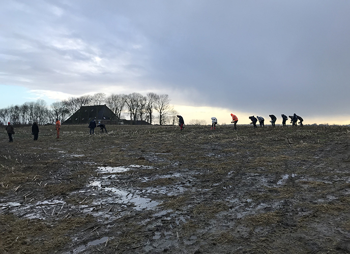
This photo was taken during the field survey performed on the mound Ee - Ald terp, Friesland (February 2019). It was the first field surveying of the second fieldwork season that is part of Angelique Kaspers' PhD research. The research focuses on early and high medieval trade in imported pottery. The field maps are used to enlarge the corpus with information about the distribution of this pottery.
During a field survey, a plot under which a terp is situated, is divided into sections of 20 x 20 m. Within each section there are 10 volunteers who pick up all the pottery that lies on the surface. That's what you see in the picture! The group of volunteers who participate in the fieldwork are students and colleagues from the GIA, but an enthusiastic group of volunteers from the Terpenvereniging, the DPV and the AWN, and sometimes even local residents, also join in. The fieldwork therefore consists of a mixed group of 'professionals', amateur archaeologists and others interested.
The elaboration of the field mapping is still in full swing. A large amount of pottery has been collected, but also an amber bead and a fragment of a grinding stone.
© University of Groningen, Groningen Institute of Archaeology.
Literature
- Kaspers, A., & T. Sibma, 2017: Veldkarteringen in het terpengebied: een pilot in noordelijk westergo. Paleo-aktueel 28, Rijksuniversiteit Groningen/ Groninger Instituut voor Archeologie & Barkhuis Publishing, p. 49-58.
- Kaspers, A., 2018: Degratierapport Terpen en Wierden I. Onderzoek uitgeveord in Dongjum, Berlikum (gemeente Waadhoeke) en Wijnaldum (gemeente Harlingen). GIA 157, 159-162. (= Grondsporen 42).
- Kaspers, A., 2020: Wijnaldum-Tjitsma revisited. Testing the potential value of field-surveying terp sites. In: A. Nieuwhof: The Excavations at Wijnaldum. Volume 2: Handmade and Wheel-thrown pottery of the first millennium AD. University of Groningen/ Groningen Institute of Archaeology & Barkhuis Publishing. Groningen (= Groningen Archaeological Studies vol. 38).
Photo 59. 1988–1989 An early-mediaeval cemetery in Oosterbeintum, Friesland
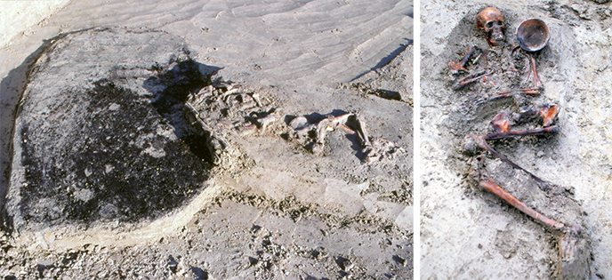
In the southeast corner of the Oosterbeintum terp, a part of an early medieval burial field was excavated. The burial ground had been in use between about 400 and 725 AD. The cemetery contained at least 47 skeletal graves and 21 urns, six other Brand gruben. In addition, six males and a stallion were buried and a pyre grave with the cremated remains of a lamb and a teal were found.
The excavation revealed that the burning of the dead also leaves ground marks other than the urn burial. The photo on the left shows a special Brand grube in the form of a pit under a funeral pyre in which a lot of charcoal was deposited. The pit - bustum is the technical term - was meant for better oxygen supply during the cremation, but the funeral pyre also fell partly in the pit. In the corner one level lower there turned out to be an earthenware pot from the 5th century. No less special is the skeletal tomb on the right side of the left photo. This tomb is younger than the bustum. The skeleton was found to belong to a 25-year-old achondroplastic dwarf.
There were several children's graves. The photo on the right shows a special man who was provided with feminine grave goods with jewelry and a bowl next to the head. Sexing graves on the basis of grave goods alone is not always correct! Rivets found indicate that clinker-riveted ship's timber was reused. A grave contained weapons. In other tombs jewelry, beads or small tools were left. A silver wire ring was the most precious burial gift.
Later isotope analysis of the skeletal material suggested that some of the interred persons may have come from southern Scandinavia.
© University of Groningen, Groningen Institute of Archaeology.
Literature
- Lanting, J.N. & J. van der Plicht, 2011-12: De 14C-chronologie van de Nederlandse Pre- en Protohistorie VI: Romeinse tijd en Merovingische periode, deel B: Aanvullingen, toelichtingen en 14C-dateringen. Palaeohistoria 53-54, 283-391.
- McManus, E.T., 2010: An isotopic investigation of the Early Medieval cemetery of Oosterbeintum, Friesland, the Netherlands. Master dissertation University of Bradford.
- Knol, E., W. Prummel, H.T. Uytterschaut, M.L.P. Hoogland, W.A. Casparie, G.J. de Langen, E. Kramer & J. Schelvis, 1996: The early Medieval Cemetery of Oosterbeintum (Friesland). Palaeohistoria 37/38 (1995-1996), 245-416.
Photo 58. 1979–1991 Excavation of Satricum in Latium (Italy)
Between 1979 and 1991, the Groningen Institute for Archeology carried out excavations in the Italian town of “Le Ferriere”, located about 50 kilometers south of Rome. Although the village only counts a handful of inhabitants today, this place was once one of the most important centers in pre-Roman Latium, also known as “Satricum”. The excavations of the Groningen institute mainly focused on the most important hill of the settlement, the Acropolis, and uncovered a large number of settlement remains dating from the 9th to the 6th century BC. In addition, a votive depot and burial ground were also discovered from a later period (5th - 4th century BC), probably belonging to a pastoral tribe known as “the Volscians”. The results of these excavations have made an important contribution to the current knowledge of the proto-historical civilization in Latium Vetus and are especially relevant because of its unique amount of settlement structures.
Although the Italian summers are not particularly inviting for outdoor physical labour, the excavation campaigns with students often took place in the months of July to September. The fixed curriculum that demanded the students' attention for the rest of the year caused that there was no other option than to go out in the hottest months. This meant getting up early, putting on a lot of sunscreen and wearing light (or little) clothing. The hot Mediterranean climate and the dry tuff soil also ensured that excavating was not performed with a shovel, as is common practice in the Netherlands, but mainly with a pickaxe and broom. After several hours of work, the trench surface would be covered with fine tuff sand, for which there was no other solution than straightforward brooming!
© University of Groningen, Groningen Institute of Archaeology.
Literature
- Maaskant-Kleibrink, M., & Attema, P. (1992). Settlement excavations at borgo le ferriere <satricum> (Vol. II, the campaigns 1983, 1985 and 1987). Groningen: Egbert Forsten.
- Maaskant-Kleibrink, M., & Attema, P. A. J. (1987). Settlement excavations at Borgo Le Ferriere <Satricum> (Vol. I, the campaigns 1979, 1980, 1981). Groningen: Egbert Forsten.
- van 't Lindenhout, E., de Vos, M. & Attema, P.A.J. (forthcoming). Settlement Excavations at Borgo Le Ferriere <Satricum> (Vol. III, the campaigns of 1989, 1990 and 1991).
- van ’t Lindenhout, E. (2013). Satricum: oud en nieuw onderzoek. Paleo-aktueel, pp. 24; 67-75.
Photo 57. 1969–1978 An agricultural experiment in the unprotected salt marsh
The terp mounds along the Dutch and German Wadden Sea coast attracted attention from Groningen researchers from the very beginning of the institute. It was well understood that these mounds were originally constructed in a flat open salt marsh landscape, that would flood during extreme tides and storm events. Needless to say, living in such a landscape makes various activities more challenging than elsewhere. Crop cultivation is one of them.
Nonetheless, there were ample indications that people were growing crops on the marsh proper (so not ón the terps). Intrigued by this, a group of enthusiasts set out to test the success of various crops when grown on an ‘unprotected salt marsh’. These experiments were carried out between 1969 and 1978. The team included the Groningen botanists Wim van Zeist, Sytze Bottema, Henk Woldring, and Wim Gremmen, but took place in close cooperation with local farmer Tammo van Hoorn.
A wide variety of crops was grown in the experimental plots, including wheat, barley, oat, fava bean and gold of pleasure. Besides the comparison of various crop plants, the research focused on the (potential) effect of manuring, the development of arable weed vegetation, and the relation between flooding events and crop performance.
© University of Groningen, Groningen Institute of Archaeology.
Literature
- Bottema S, Van Hoorn TC, Woldring H, Gremmen WHE (1980) An agricultural experiment in the unprotected salt marsh. Part II. Palaeohistoria 22: 127-140.
- Van Zeist W, Van Hoorn TC, Bottema S, Woldring H (1976) An agricultural experiment in the unprotected salt marsh. Palaeohistoria 18: 111-153.
Photo 56. 1970 The Mask of Middelstum (Groningen) c. 500 BC.
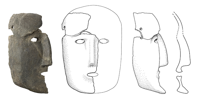
During the excavation of an agricultural settlement from the Iron Age near Middelstum, known locally as Boerdam, a large fragment of a locally made, earthenware human mask was found. An upper part of the forehead was discovered much later, during analysis of the pottery finds. The whole right half of the face has been preserved, 23.5 cm high. It is assumed that the mask was symmetrical. On the side there are two little holes for a string by which the mask can be attached to the head. The face is austere, with a straight nose. An exact parallel for the mask is unknown from Northwest Europe, which makes the mask difficult to interprete. Perhaps the mask was worn by a shaman-like person.
In addition to a photo, a technical drawing has also been made of the mask. A good photo can convey more than a long text, but archaeologists often want even more information. If decoration on a handmade pot is difficult to distinguish from accidental scratches or pits, it is useful to make a drawing and filter these out. But also: what does the inside of an ceramic pot, or in this case a mask, look like, what is the thickness of the wall? For that purpose, not only the surface but also the cross-section is drawn. Some archaeological publications consist purely of drawings. Maybe boring, but clear. Therefore both a photo and a drawing of the mask are shown.
© Groninger Museum inv.nr. 1970-IX-112 (photo Marten de Leeuw).
© University of Groningen, Groningen Institute of Archaeology (drawing).
Literature
- Boersma, J.W., 1983: De opgraving Middelstum-Boerdamsterweg in een notedop. Aanhangsel bij P.B. Kooi, Leven langs de Fivel, van Helwerd tot Zwart Lap. In: Middelstum-Kantens. Bijdragen tot de plattelandsgeschiedenis met een beschrijving van de boerderijen en hun bewoners. Kantens, 31-35.
- Perton, H., 2011: De Vondst III (Jaap Boersma). Stad & Lande 20(3), 21.
- Taayke, E., 1996: Die einheimische Keramik der nördlichen Niederlande, 600 v.Chr. bis 300 n.Chr, Teil III: Mittel-Groningen. Berichten van de Rijksdienst voor het Oudheidkundig Bodemonderzoek 42 (1996). S. 9-85 (Abb. 40!).
Photo 55. 1917 Van Giffen digs for the first time on the Noordse Veld in Zeijen (Drenthe)
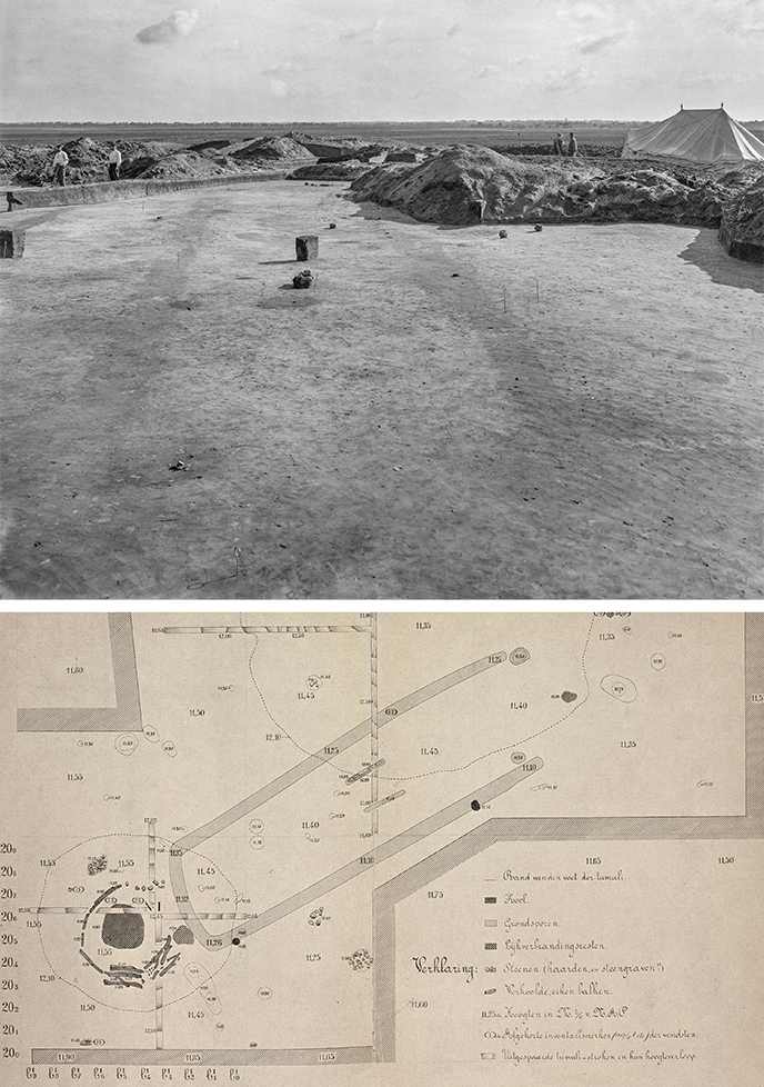
In 1917, the opportunity arose for A.E. van Giffen – as member of the Museum Committee of the Museum at Assen - to excavate on the Noordse Veld heathlands near Zeijen. A crucial factor was that mr. F. Lietinck (whose made his fortune in the tobacco trade) not only granted access to his lands, but also provided (…funds in the most generous of matters….; Van Giffen 1918, 137) to excavate there. Moreover, due to Van Giffen’s well-placed network, he managed to borrow a Chief Officer’s army tent from Officer Hinrichs from Delfzijl, so that the excavation materials could be well-sheltered.
At the time, Van Giffen assumed that he was excavating a ‘so-called Roman army camp’ and urnfield, but as he could find no evidence for use of the site as settlement, gardens or sheep-pens, he postulated a relation between the local banks and the barrows. It would only be later that he would discover that the banks were not related to funerary rites, but once demarcated field plots as part of a Later Prehistoric (Celtic field) field system (Van Giffen 1949, 139).
Similarly, the true nature of the enclosed sub-rectangular areas was not yet known to him at the time. Adjacent to Tumulus I of the barrow complex known as the ‘Negen Bargen’ – which was characterized by a cluster of burnt beams in its center – such traces were uncovered. Van Giffen (1918, 169) initially identifies these as foundation trenches for buildings, but later revised this to ‘raised agricultural beds’ (Van Giffen 1949, 79; 99). Here too, only later research would show that these ditches were part of funerary monuments as well (Kooi 1979, 130-131): the ditches delimited the foot of elongated low barrow mounds known now as longbed-type barrows of the Type Noordbarge, and are datable to the Early Iron Age (ibid.).
© University of Groningen, Groningen Institute of Archaeology.
Literature
- Giffen, A.E. v. (1918). "Begin van een onderzoek van 'de zogenaamde voormalige Romeinsche legerplaats en aangelegen grafheuvelveld te Zeijen." Nieuwe Drentse Volksalmanak 36: 135-175.
- Giffen, A.E. v. (1949). "Het Noordse Veld bij Zeijen, Gemeente Vries. Opgravingen in 1944." Nieuwe Drentse Volksalmanak 67: 93-148.
- Kooi, P.B. (1979). Pre-Roman urnfields in the north of the Netherlands. Groningen (PhD thesis), Wolters-Noordhof.
Photo 54. 2016 Bonify: remote determination of bone material
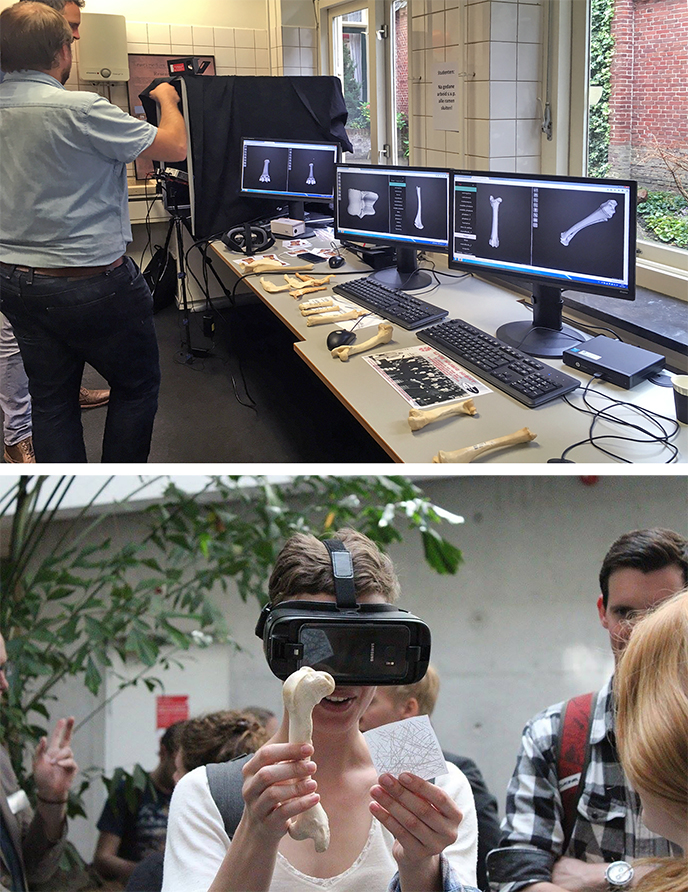
Accessibility to zooarchaeological reference materials is a key hurdle when determining species classification, particularly in cases where the differences between two species (e.g. sheep and goat) are nuanced. Bonify is a pilot platform allowing the virtual comparison between 3D virtual animal bone models and zooarchaeological specimens. Two technologies were case studied, online web presentation and augmented reality. The two methodologies were tested by a selection of students and domain professionals. Both versions allow to examine sheep and goat bones from all angles without the need for a physical reference collection.
© University of Groningen, Groningen Institute of Archaeology.
Photo 53. 2004 Thin sections

Soil micromorphology is applied more and more in archaeological research, including GIA projects. This technique is the study of soils and sediments, using very thin slides of impregnated samples (the “thin sections”) and a polarization microscope. Although the first application of micromorphology was mostly in soil and landscape research, its application in archaeology seems to have increased manyfold in the last decades.
Micromorphological research at GIA started at the Swifterbant S2 and S4 fieldwork (2004-2007), where it played a role in the discovery of the oldest known tilled fields worldwide (Huisman & Raemaekers 2014). Between 2008 and 2013, a focus was on Celtic Field research, including at Someren-Hoenderboom. Here, thin sections were used to study the formation processes of the Celtic field banks, and to identify evidence for ancient tillage (Arnoldussen & Scheele 2018). Another major focus was the characterization of terp and wierde deposits (2009 to 2020). Here, micromorphology provided detailed information on formation processes, human activities and taphonomy of these anthropogenic deposits (e.g. Nicolay et al. 2019). In 2016, micromorphological research with a completely different focus was initiated, focussing on Mesolithic hearth pits (or pit hearths). The goal(s) and purpose(s) of these relatively common features are still unknown, but a micromorphological study provided new insights in the properties of the fire that produced them and on the way the pits were formed (Huisman et al. 2019).
© University of Groningen, Groningen Institute of Archaeology.
Literature
- Huisman, D.J., & Raemaekers, D.C.M. 2014: Systematic cultivation of the Swifterbant wetlands (The Netherlands). Evidence from Neolithic tillage marks (c. 4300–4000 cal. BC). Journal of Archaeological Science. 49, p. 572–584.
- Huisman, D.J., Niekus, M.J.L.Th., Peeters, J.H.M., Geerts, R.C.A . & Müller, A. 2020: Deciphering the complexity of a ‘simple’ Mesolithic phenomenon: Indicators for construction, use and taphonomy of pit hearths in Kampen (the Netherlands). Journal of Archaeological Science. 109, 104987.
- Nicolay, J.A.W., de Langen, G.J., Stöver, J., Aalbersberg, G., Bahlen, G., Bakker, M., Huisman, D.J., Mantel, S., Nieuwhof, A., Ngan-Tillard, D., Prummel, W. de Rijk, P., Schepers, P., Varwijk, T. & Vos, P. 2019: De terp van Hogebeintum in boorkernen. In: A. Nieuwhof, E. Knol & J. Nicolay (ed.), Jaarverslagen van de Vereniging voor Terponderzoek 101, p. 33 - 130.
- Arnoldussen, S., & Scheele, E. E. (ed.) 2018: Someren - De Hoenderboom: Archeologisch onderzoek aan een Brabantse raatakker. Grondsporen 40. Groningen, Groninger Instituut voor Archeologie, Rijksuniversiteit Groningen.
Photo 52. 2001 The reconstruction of the oldest boat in the world
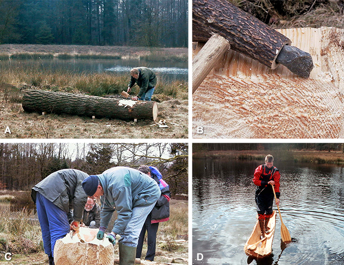
In mid-August 1955, an exceptional discovery was made during the realization of the A28, south of the village of Pesse. Digging revealed the hollowed-out trunk of Scots pine which would later become known as the oldest boat in the world. The find was reported to the Biological Archaeological Institute (BAI) and transported to Groningen. After conservation, the unique 10,000-year-old vessel has been exhibited in the Drents Museum in Assen to this day.
Over the years, various ideas, scientifically based or not, would develop about the Pesse canoe. For example, it was claimed it was not a boat but a feeding trough or even a flower box. Ethnographic examples and even a 1:10 scale model attempted to demonstrate that the canoe was too unstable to navigate. The Danish archaeologist and expert on prehistoric canoes, Dr. S.H. Anderson was also of this opinion.
In March / April 2001 an experiment was carried out to test the canoe for its "seaworthiness". Because the sailing characteristics were central, the canoe could be made with a chainsaw in a short time. However, the decision was made to see the manufacturing as an archaeological experiment. Flint core- and flake axes and also antler axes were copied. Especially the effectiveness of the flint tools was surprising. One of the axes was struck 17,000 times without a noticeable reduction in effectiveness. Volunteers made the canoe in less than 40 hours. The climax was of course the sea trial. Under the eye of the national press, an experienced canoeist demonstrated that it was even possible to sail while standing in the canoe.
Photo 51. 2013 Practical education in Crustumerium: learning to read a profile
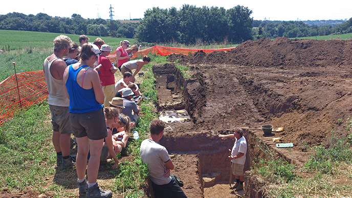
In archaeology, teaching in the field is of utmost importance for students to learn to read the soil. Cross-sections are instructive as they reveal soil layering (stratigraphy) from young to old. In this photo we see how the director of the Crustumerium excavations, Prof. Peter Attema, explains to the students what he observes in a trench, just dug by a hired digging machine, crosscutting a Roman road. At the deep level, where he stands are the traces of older roads that date to the period of Crustumerium, the Iron age settlement that the GIA-team investigates. It is now up to the students to help excavate and document these traces and to turn the area of the discovery into a neat archaeological area.
© University of Groningen, Groningen Institute of Archaeology.
Photo 50. 2018–2019 Working with Indigenous Peoples and excavating in the Arctic Foxe Basin region, Nunavut, Canada
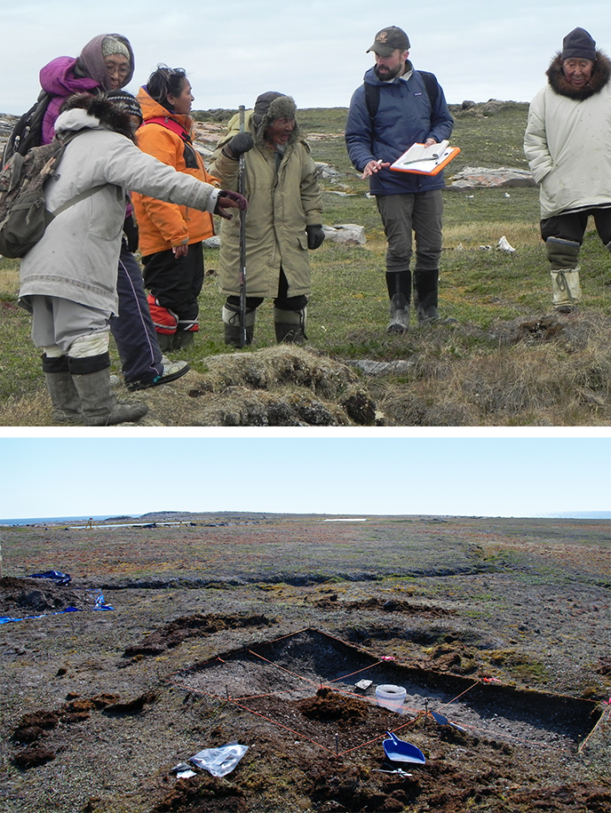
In Inuit Nunangat (the traditional Inuit territories of Arctic Canada), we are fortunate to benefit from the knowledge and lived examples of a vibrant population descended from those whose cultures we study. There is an increasing moral and ethical imperative to repair relationships between researchers and Inuit damaged by the colonial encounter; with each passing year, more archaeologists are working to build knowledge with Inuit in respectful, mutually-beneficial ways. In this image, Inuit elder Herve Paniaq (third from the right) describes to GIA/Arctic Centre researcher Sean Desjardins the layout of the sod house in which he grew up at Avvajja, nearby to Igloolik, Nunavut, Canada. This type of first-hand knowledge is incredibly useful to our understanding of the recent-historic and more distant past of Inuit in the region.
Planning, organizing and carrying out remote fieldwork in the Arctic is highly challenging logistically. Permafrost, wildlife and harsh weather are regular features of the work. Fortunately, the benefits far outweigh the difficulties: The Arctic contains some of the best-preserved cultural records on earth. This images shows the in-progress excavation of a Thule Inuit (ca. AD 1280 to 1900) pit feature on the island site Uglit, Foxe Basin, Nunavut, Canada.
© University of Groningen, Groningen Institute of Archaeology.
Photo 49. 1923–2020 Contextualizing old study-collections: a red-burnished vase in the collection of the GIA
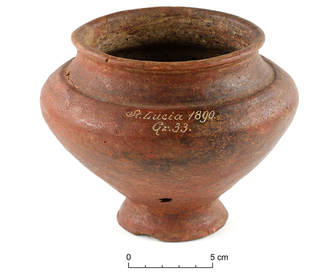
The above figure presents a vase in the collection of the Groningen Institute of Archaeology that originally contained the cremated remains of a women that lived around 650 BC. It was bought in 1923 by Prof. Albert Egges van Giffen (Groningen) from Prof. Rudolf Much (Vienna). This vase derives from Tomb 33 of the 1890 excavations at the site known then as St. Lucia (di Tolmino) in Slovenia. It was found at a depth of 105 centimetres and covered by a stone plate of 50 by 55 centimetres. The tomb contained the above urn, one large and two small spectacle fibulae (brooches).
Van Giffen bought in total the contents of six tombs from this cemetery. These tombs form part of one of the largest Hallstatt cemeteries known, consisting of thousands of tombs. Starting in Santa Lucija, going north, one can reach the Triglav, the highest mountain of the Julian Alps of 2864 meters, after a hike of 40 kilometres. The site itself is set in a valley, at a strategic location on the confluence of two rivers emerging in these Alps. It is presently known as Most na Soči, bridge over the river Soča, that waters into the Adriatic Sea, where the river is called in Italian, Isonzo. Most na Soči functioned during the Iron Age as a hinge between Italy, the Balkans and Austria. This frontier character is reflected in its entire history from onwards 8th century BC when it emerged as a settlement centre.
Figure: The red-burnished vase with elegant lettering in white ink stating St. Lucia 1890 Gr. 33 in the collection of the Groningen Institute of Archaeology
© University of Groningen, Groningen Institute of Archaeology.
Literature
- Nijboer A.J. 2020. Grave goods from Sveta Lucija (Slovenia) in Groningen (the Netherlands); contextualizing old study-collections. Since 1923, six tombs from the large, Iron Age burial ground at Sveta Lucija in the collection of the Groningen Institute of Archaeology. In: Palaeohistoria 61-62 (will be released early 2021).
Photo 48. 1984 Contacts with Wilhelmshaven
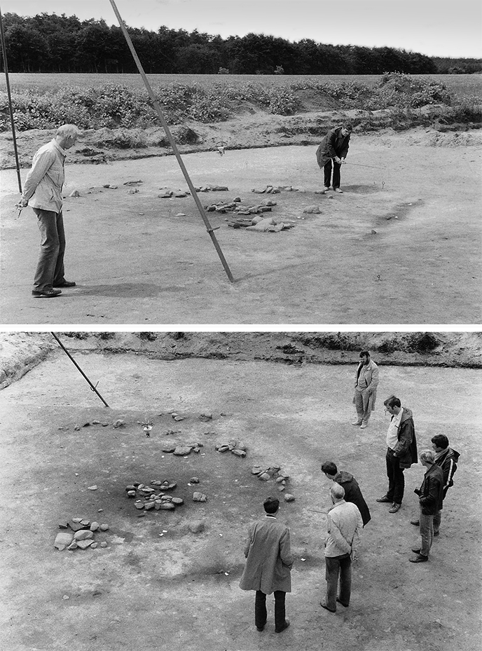
The BAI traditionally maintained contacts with "Wilhelmshaven", then called Niedersächsische Landesstelle für Marschen- und Wurtenforschung. The initial contact was laid by A.E. van Giffen, who had served as an example with the excavation methodology of Ezinge to director W. Haarnagel. Waterbolk continued the exchange of knowledge and excavation visits took place regularly, with considerable encouragement from the German archaeologist W.H. Zimmermann, who had studied at the BAI and later took charge in Wilhelmshaven. To this day, this advocate of mutual relations speaks and writes Dutch with his Groningen colleagues. The GIA and the Niedersächsisches Institut für Historisch Küstenforschung - both have changed names - still work closely together, knowing that our cultural landscapes fit together seamlessly.
The photos show a colleague's visit to one of the excavations in the Siedlungskammer Flögeln, 1984. Zimmermann had uncovered a Neolithic hut there, not an everyday find. Previously, house plans from the funnel beaker culture had been found. On one photo we see Tjalling Waterbolk and Haio Zimmermann and on the other from left to right Jan-Albert Bakker (Amsterdam), Tjalling Waterbolk, Haio Zimmermann, Sake Jager, Otto Harsema, Piet Kooi and Peter Dekkers, in discussion next to the features.
© H.A. Groenendijk.
Photo 47. 1982 Hunebed under monastery
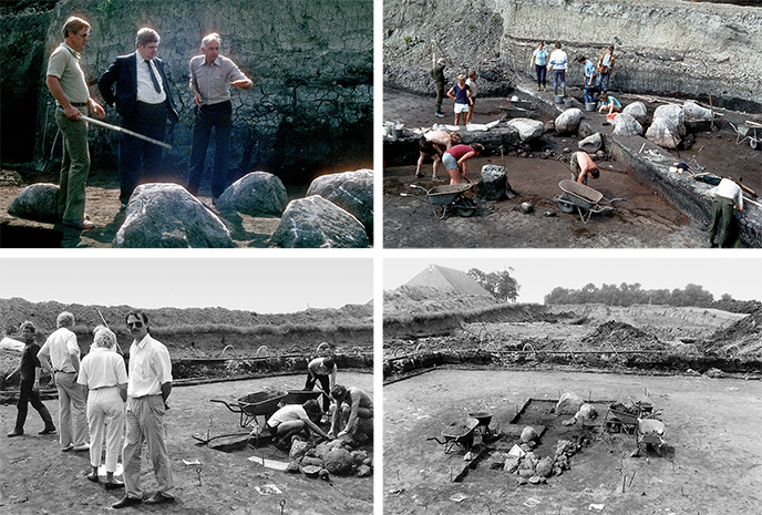
In 1982 the discovery of a hunebed under the wierde Heveskesklooster, municipality of Delfzijl, was nothing short of spectacular. The cause was the expansion of the Delfzijl industrial estate, prompted by the monument law that says that valuable sites cannot be excavated just like that. When peeling off the mound, excavation leader Jaap Boersma first exposed the remains of a Johannieter commandery (c. 1300-1600) and came across the bearing stones of a hunebed three meters below. Jan Lanting then took care of this fifth Groningen copy (G5). A hunebed so far from the Hondsrug can be explained because the landscape here during the construction period (shortly after 3400 BC) reached 1.5 meters below NAP while the sea level was still 4.5 meters below NAP. Around 2000 B.C. the hunebed disappeared under peat and it was only two thousand years later that the first salt marsh inhabitants settled here. Yet this hunebed, an elongated dolmen type and originally covered with a hill, was less intact than hoped for; later Neolithic societies had badly damaged it. A hundred meters to the east was another stone coffin, a burial monument dug in from the same cultural period (G6). There was great public interest and politics and civil service Groningen also came to the fore.
© University of Groningen, Groningen Institute of Archaeology.
Photo 46. 2011–2016 Administration under the Greek sun (38+ °C)
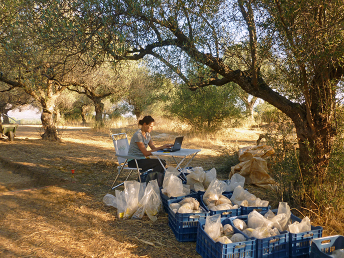
A piece of administration under the Greek sun (38+ °C). During the last days of a campaign - under the watchful eye of countless loud-buzzing cicadas - all the find bags and find tags from the excavation of the Northern burial site of Ayios Vaseilios are checked. It is important that the find numbers and find locations correspond exactly with the data in the excavation logs kept daily, so that there can be no confusion about the origin of the finds during their later study. After this last check, the finds are transported to the local “apothiki”, or the archaeological depot in Sparta.
Between 2011 and 2016, the GIA was involved in the excavation of the important Bronze Age excavation at Ayios Vasileios. A small group of Groningen and Greek students, physical anthropologists, and local workmen worked closely together under the direction of Prof. Sofia Voutsaki to locate and accurately document the tombs of the Northern Cemetery (dated 1700 - 1500 BC).
© University of Groningen, Groningen Institute of Archaeology.
Photo 45. 2007–2008 Archaeology at 78 degrees north latitude
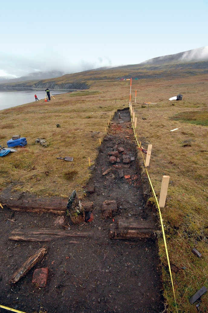
In the summers of 2007 and 2008 a team of archaeologists, students and employees of the GIA and the Arctic Centre went to Spitsbergen to excavate a Pomor settlement. Pomors were Russian hunters that went to Spitsbergen during the 18th and the first half of the 19th century to hunt walruses for their ivory tusks, blubber and skin. During the winter they were trapping polar foxes.
On the photograph the foundation logs of the log cabin and the remnants of the oven of Kokerineset are seen. Afar the campsite is seen where the research team stayed during the excavation. The water was taken from the riverstream nearby and when a tourist ship came by, the tourists were given a tour in return for the use of a shower on board. The campsite was surrounded by a trap wire to warn for nightly visits from polar bears.
Camping next to the excavation, like archaeologists from the Arctic Centre have been doing since the 1980s, is virtually a thing of the past due to climate change. Surveys and field research are ending more frequently abruptly because of polar bears nearby.
© Ben Bekooy.
Literature
- Dresscher, S. 2015: Timemanagement op Spitsbergen: Een historisch-archeologische benadering van Pomoren in de 18de eeuw. Paleo-aktueel 26, p. 125-133.
- Dresscher, S., 2016: Food Security in the High Arctic While Balancing the Demands of Commercial and Subsistence Hunting. Journal für Entwicklungspolitik. 32, 4, p. 44-66.
Photo 44. 1963–1964 Bog trackways in Drenthe
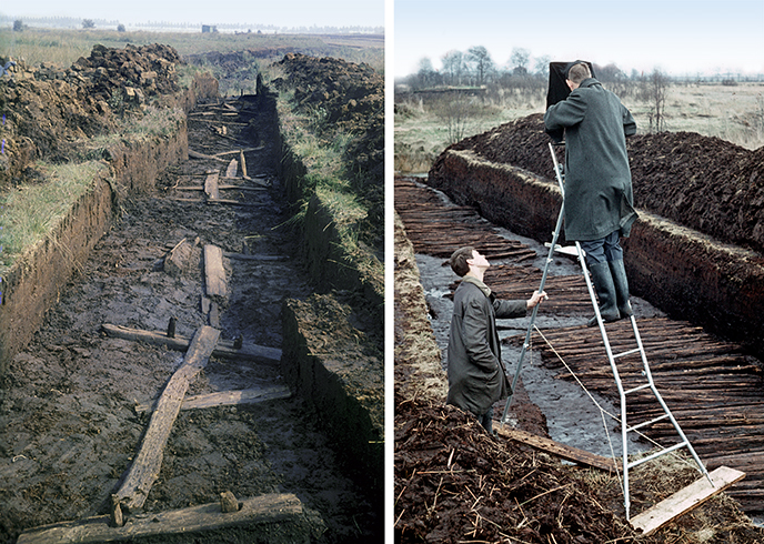
Due to the large-scale peat extraction of the past three centuries, it is difficult to imagine that the Netherlands was once half covered with peat. During the Neolithic to the Middle Ages, the inhabitants of Drenthe had to use specially constructed roads to travel the large parts of bogs and peatland. As early as the 17th century, writings sporadically mention the presence of wooden paths under the peat. The first serious excavation of such a "bog trackway" took place in 1819. Over the course of the twentieth century, more of these peat roads were excavated and are well-documented. More than forty peat roads are now known - some of stone, others of wood - and sometimes as long as twelve kilometers (!).
In the photo on the left is a wooden footpath found at an excavation in Bargeroosterveld in 1963. This footpath dates from the Iron Age and has an ingenious construction of cross beams and connections with deeply set wooden pegs, so that the path remained in place and couldn’t subside in the wet bog.
The photo on the right shows a road from the Neolithic era near Nieuw-Dordrecht. During the excavation in 1963, the unwieldy camera had to be placed on a rickety staircase for a good overview photo. An archaeologist in 2020 would probably have his drone take off, fly around and then process the photos into a 3D model.
© University of Groningen, Groningen Institute of Archaeology.
Literature
- Casparie, W.A., 1987: Bog trackways in the Netherlands. Palaeohistoria, 29. 35-65.
Photo 43. 2020 Archaeology Teaching at the UG in Covid-19 times
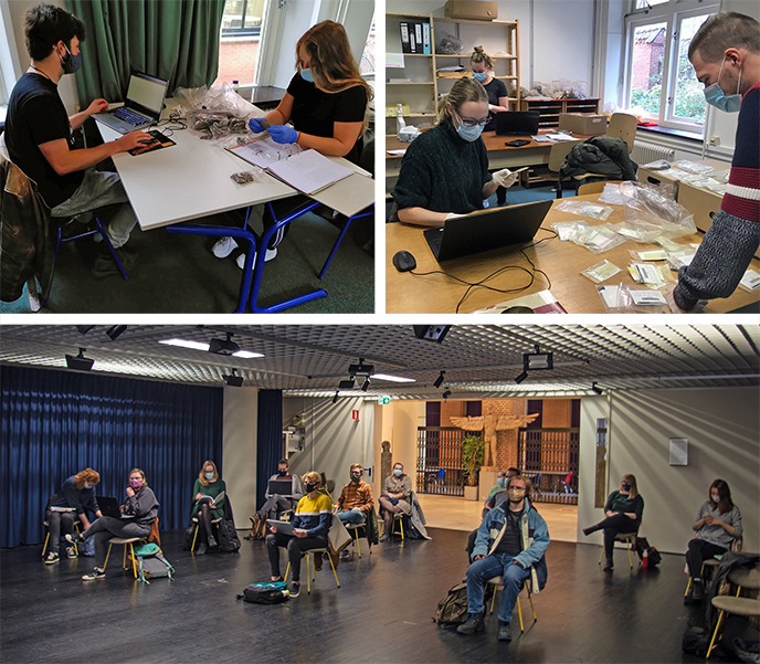
Mid-March 2020. The University of Groningen locks down as a result of the Covid 19 Pandemic. All courses are to be taught online and as a result the first year students will not carry out the traditional field school and cannot finish their curriculum. The practical course in Archaeobotany was also cancelled. Thanks to the great efforts from lecturers and students the remainder of the curriculum is continued without delay. As of September the curricula are taught in a hybrid fashion: online as much as possible. The new group of first year students are able to have on campus courses thanks to the availability of class rooms large enough to maintain distance. This allows them to connect to one another. The master students collaborate on the publication of an excavation, in our class room and a practical room in our Poststraat building. This entails practical work, with gloves and mouth masks.
© University of Groningen, Groningen Institute of Archaeology.
Photo 42. 1964 The Great Church of Emmen
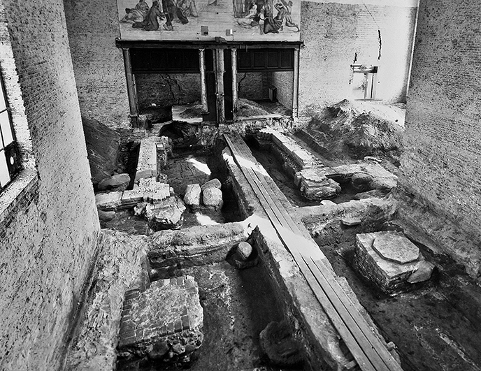
In the middle of the 20th century, restorations took place in a number of old churches in Drenthe. This provided the opportunity for archaeological research, which was gratefully used by the then BAI (now GIA). For example, a dozen churches were completely excavated between 1942 and 1978. This is a photo of the archaeological research in the Grote Kerk in Emmen in 1964. In our time there are no more complete excavations in churches. However, the Drenthe church archeology is getting a new impulse because church boards want to make the churches suitable for multifunctional use. Excavation work for the construction of underfloor heating, for example, must be guided archaeologically.
Some churches have already been founded around 800 AD. and due to the continuous use of the site, archeology is often very complex. The first church in Emmen was probably built around 850. Over centuries the church has been rebuilt at least five times. The church grounds were gradually raised a bit, resulting in an archaeological package of one and a half meters thick.
The first three churches in Emmen were wooden buildings. The photo shows the foundation of the first stone church built during the 13th century. The excavators have left two dams standing so that they could draw good profiles right through the church. Usually churches are full of graves. The photo shows the trail of a coffin and a tombstone "hangs" in the front right of the dam. With the exception of the tower, the church was demolished in 1856 and replaced by the current church.
© University of Groningen, Groningen Institute of Archaeology.
Literature
- Hengst, P. den, 2013: The archaeological excavation (1964) in the Grote Kerk in Emmen, Nieuwe Drentse Volksalmanak 130, 117-156.
Photo 41. 2019 Elaboration of data recorded on a profile drawing
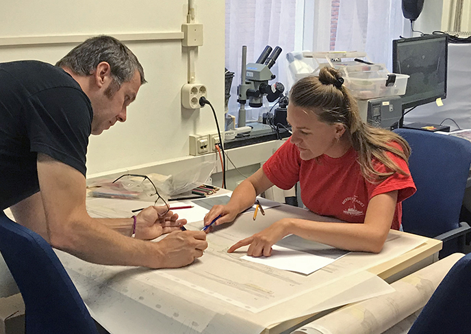
After the fieldwork in Yesse for that year has been completed, it is important, back at the institute, to interpret the data recorded in the field so that this information can be processed in a report or an article. In this picture the excavation leader and a senior student are seen examining a profile drawing of pit 12 in Yesse. On the basis of separately drawn profile parts, an attempt is made to understand the soil structure of the entire work pit. Although digital field photos, measurement data and 3D models of the work pit are available, it is still nice to work with colored pencils to color the hypotheses about the genesis of the layers in a temporary profile drawing. See also foto 32.
© University of Groningen, Groningen Institute of Archaeology.
Photo 40. 1927 Panorama of an urnfield at Wessinghuizen (Groningen)

Large parts of Westerwolde were still covered with extensive heaths at the beginning of the last century. In 1927, A.E. van Giffen excavated at Wessinghuizen an important complex of burial mounds and urnfields. Here he found remnants of various burial rituals from various periods, which testify to the continuity of habitation over centuries. Van Giffen was able to do his research because the owner wanted to have the land reclaimed.
Prior to the excavation four photos were taken of the location. At the time, they did not have the technical possibilities to take a panorama picture in one go. Advances in technology enabled photographer D. Fennema to link the four digitally made negatives into one panoramic image of a landscape that has disappeared.
© University of Groningen, Groningen Institute of Archaeology.
Literature
- Het onderzoek bij Wessinghuizen, gem. Onstwedde, pp. 7 – 27. In : Bouwstoffen voor de Groningsche Oergeschiedenis/ A.E. van Giffen – overdruk uit het verslag van het Museum van Oudheden te Groningen over 1928.
Photo 39. 2004 Terp research at Wierum (Groningen)
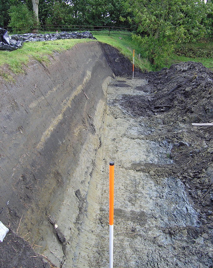
Many of the artificial terp mounds in the former salt marshes of the northern Netherlands have been seriously affected by quarrying of the fertile terp soil in the 19th and first half of the 20th century. Terps were entirely or partly dug away, leaving steep escarpments. Although this had an enormous effect on the preservation of the archaeological record, it also offers opportunities for modern terp research. While full terp excavations are highly demanding in time and costs, clearing the escarpments and removing the outer side with a mechanical excavator is relatively easy and makes in situ terp layers directly accessible. The large terp sections that are thus uncovered provide a lot of information on the structure and date of the terp, and thereby on the habitation history.
The photo shows a good example of such a terp section. It was taken in the terp of Wierum, north of the city of Groningen. Research at Wierum was executed in 2004. The immediate cause of the excavation were the plans of the provincial authorities of Groningen to restore the terp to its original size using dredgings from nearby rivers and canals. This would seal the escarpments and make them inaccessible for a long time.
The original escarpment, which is now sloping due to erosion, is in the photo still visible at the far end of the trench. Pottery finds show that the deepest layers in this section date from the 4th-3rd century BC, while the youngest undisturbed layers under the topsoil are from the 8th-10th century AD. The light grey clay at the bottom are natural salt marsh deposits, on which the terp was founded.
© University of Groningen, Groningen Institute of Archaeology.
Literature
- Nieuwhof, A. (ed.), W. Prummel & P.C. Vos, 2006. De wierde Wierum (provincie Groningen). Een archeologisch steilkantonderzoek (= Groningen Archaeological Studies 3). Barkhuis publishing & Groningen University Library, Groningen.
Photo 38. 1981 Use of a ladder truck BAI at Peelo (Assen)
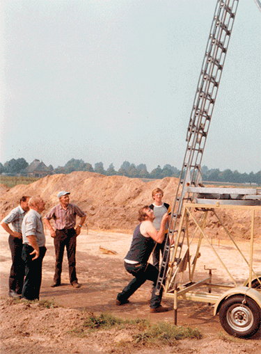
During an excavation in Angelslo (Emmen) in the sixties of the last century, employees of the GIA (then known as BAI) saw a ladder truck being used for the maintenance of lampposts. Mr. A. Meijer, digger, took the initiative to purchase such a truck by the BAI. The ladder truck was heavy and it was not easy to get the ladder up, but it did, in a period when drones did not exist and the hiring of an airplane couldn’t be financed from an excavation budget, provide the opportunity to create maps from a very high view. Unfortunately, the ladder truck was blownover during an excavation in Wijnaldum in the eighties - the ladder was bent and the construction could no longer be used.
In these photos, archaeologist Piet Kooi is at the top of the ladder to record a house plan found at Peelo (Drenthe).
© University of Groningen, Groningen Institute of Archaeology.
Photo 37. 1939 Lannion France: Cist
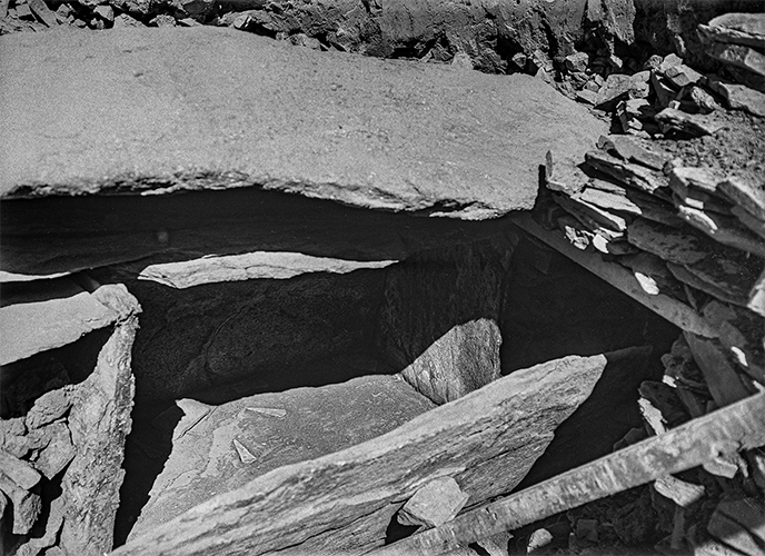
Just before the Corona outbreak, the GIA received a request for this photo from Germany, where an exhibition was prepared in the Landesmuseum für Vorgeschichte in Halle, which focuses on funerals from the early Bronze Age. The photo that they wanted to use was taken in 1939, during the excavation of A.E. van Giffen from a cist in Lannion. It took a while because the University was closed, as most of these pictures have not been digitized yet, but now the makers of the exhibition have the right file. On request, the GIA received the description below with the photo:
In 1939 parts of the large tumulus "La Motta" near Lannion in Brittany were excavated by A. E. van Giffen on behalf of the Biological Archaeological Institute of the University of Groningen. The tumulus yielded a stone chest with a remarkable burial from the early Bronze Age: a bronze sword, two bronze axes, six bronze daggers, seven flint arrowheads and a whetstone were found in the cist. This amount makes it likely that more than one person was ever buried in this grave. Unfortunately, no skeletons or human bones have survived, but it can be assumed that they were once deposited in the southeastern part of the cist, as only a bronze ax was found in this part of the cist.
The photo was taken from the west, with parts of the grave goods presented on site.
© University of Groningen, Groningen Institute of Archaeology.
Literature
- Butler, J.J., & H.T. Waterbolk, 1974: La Fouille de A.E. van Giffen à "La Motta". Un Tumulus de l'Age du Bronze Ancien à Lannion (Bretagne). Avec des remarques complémentaires de J. Briard et des appendices de J.J. Taylor et J.N. Lanting, Palaeohistoria 16, 107-169.
Photo 36. 2000+2019 Introduction camp first
years students
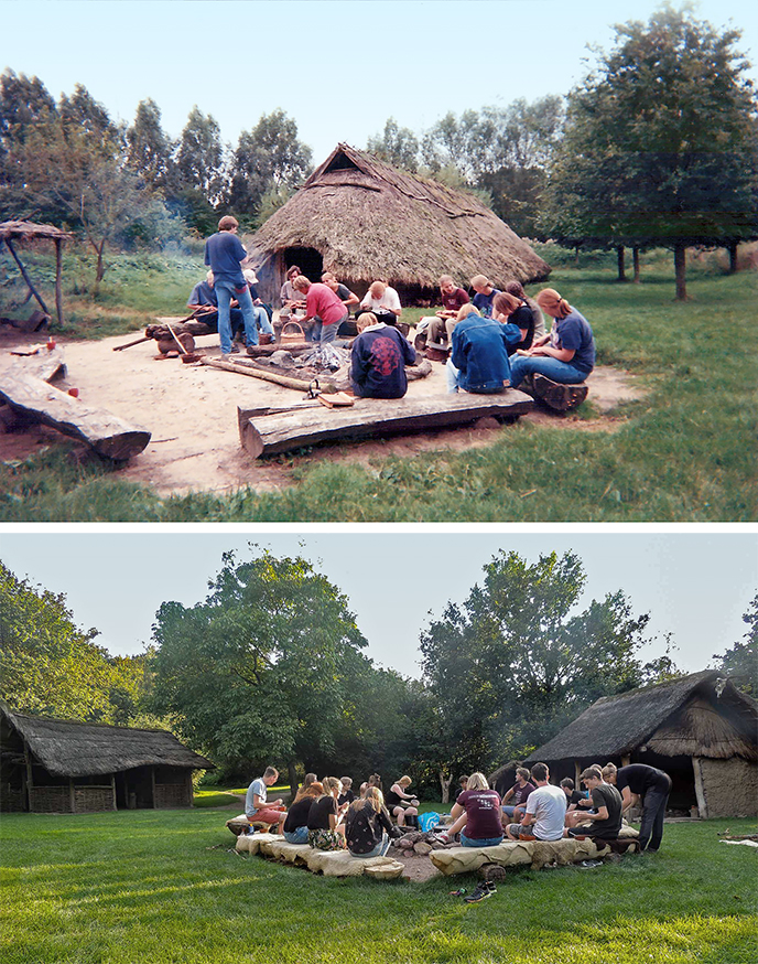
At the beginning of each academic year, the new first-year archaeology students go on an introduction camp, organized by the study association Bachur. The study association was founded in 1994 with the aim of connecting archaeology students from different years and tracks. To this day, the association still succeeds in that goal: with over a hundred members, almost weekly activities, national and international excursions and various committees, there is something to do for every archaeology student. Although the excursions and activities are different each year, the introduction camp has been a regular feature for nearly twenty-five years. The top photo shows an introduction camp from 2000 on the archaeological park in Haps (?), The bottom photo was taken in 2019 during the camp in the archaeological open-air museum Swifterkamp in Lelystad.
© University of Groningen, Groningen Institute of Archaeology.
Photo 35. 1978 Iron Age reconstruction in Orvelte (Dr.)
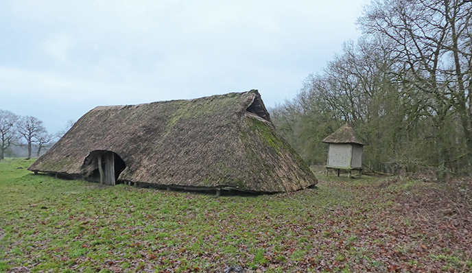
Situated just northwest of the village of Orvelte is an Iron Age farm, reconstructed by the GIA. BAI settlement excavations in the 1960s uncovered a large number of house plans. For the then researcher Otto Harsema, these settlement excavations were an important stimulus for an experimental archaeological project. Harsema's interest in translating Iron Age house plans into an actual Iron Age farm was reinforced by a visit to Lejre, Denmark, where some of the pioneers of experimental archaeology were working at the time.
For the reconstruction, a characteristic representative of the three-aisled house type was sought. In addition, the chosen house plan had to be unambiguous: disturbances and later-made adjustments that made the interpretation of post holes difficult and arbitrary would result in a less valid reconstruction. With this in mind, the researchers chose a house plan excavated in 1972-1973 in Hijken from the Late Iron Age (200 BC); a house map that occurs from Brabant to Ezinge.
With the reconstruction, the BAI researchers have been able to gain more insight into the basic principles of the construction of such a prehistoric farm, such as the amount of material required, different beam connections, the degree of difficulty of the various activities and the required construction time. In addition, the end result functions to this day as a space in which one can experience living in the Iron Age.
© Jacqueline Speelman, Hunebedcentrum.
Literature
- Harsema, O. 1980: De reconstructie van een ijzertijdhuis bij Orvelte, gemeente Westerbork, Nieuwe Drentse Volksalmanak 96, 149-175.
Photo 34. 2017 Students are building hut
reconstructions
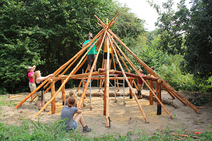
Since 2017, a group of students from GIA has been reconstructing Mesolithic huts. It started out as a fun week of building during the summer holiday, but now there is a real Working Group Experimental Archeology Groningen. The hut reconstructions and the working group are a platform for students to learn to set up and communicate their own research. In addition, the hut reconstructions have resulted in an active image enrichment of life in the Mesolithic. The new designs are being built together with the working group at archaeological parks such as Swifterkamp in Lelystad and at the Hunebedcentrum in Borger. The GIA supports these types of initiatives because it allows its students the freedom to further develop their own interests in archaeology and their first steps in scientific research.
Also in the past GIA researchers and students made several archaeological reconstructions. For example, there is an Iron Age farm in Orvelte, reconstructed in 1978 by Otto Harsema and Horrëus de Haas. Between 2013 and 2015, PhD candidate Daniël Postma built an Early Medieval turf house in Firdgum. Both reconstructions can still be admired today.
© University of Groningen, Groningen Institute of Archaeology.
Literature
- de Raaff, Y., 2018: House Stork. De Reconstructie Van Een Mesolithische Hut, Paleo-aktueel 29, 1-10. Available at: https://ugp.rug.nl/Paleo-aktueel/article/view/32534
- de Raaff, Y. 2020: (de)constructing the Mesolithic. a History of Hut Reconstructions in the Netherlands, EXARC Journal 2020/1. Available at: https://exarc.net/issue-2020-1/ea/mesolithic-hut-reconstructions-netherlands
Photo 33. 1934 An Iron Age Palisade in Zeijen,
Drenthe
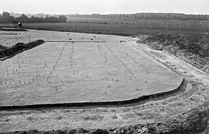
The GIA (then BAI) has excavated a couple of interesting sites in Drenthe that have become known as ‘Iron Age fortifications’, but could better be characterized as ‘with palisade enclosed settlements’. On the photo you can see the site Zeijen – I, seen from the south, with two house plans (centre and left). The palisade is indicated with the wooden stakes in the foreground and on the far right.
© University of Groningen, Groningen Institute of Archaeology.
Literature
- Waterbolk, H.T., 1977: Walled enclosures of the Iron Age in the North of the Netherlands, Palaeohistoria 19, 97-172.
- Waterbolk, H.T., 2009: Getimmerd verleden. Sporen van voor- en vroeghistorische houtbouw op de zand- en kleigronden tussen Eems en IJssel. Groningen, Barkhuis Publishing.
Photo 32. 2017 Fieldschool of the Monastery Yesse,
Groningen
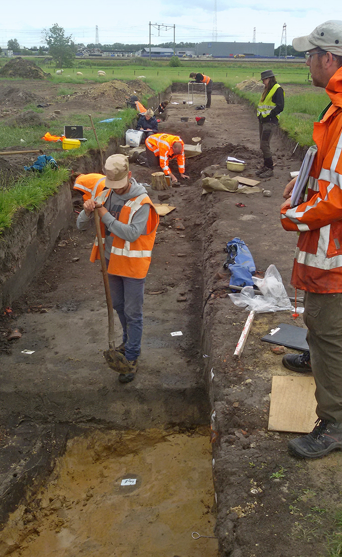
Carrying out independent archaeological fieldwork is an important skill to be learned within the Archaeology program. In Groningen, after a series of preparatory lectures and practicals (in which, among other things, surveying and archaeological drawing is practiced), a full month of fieldwork is carried out by the first-year students. This takes place on question-driven GIA research projects with a pre-conceived training component. As a result, there is less pressure with regard to the lead time and required space of a project (other than in commercial archaeology!). We can take the time to let students take a good look at, and think about, the field technical aspects. In that sense, both the student who is leaning on his shovel and the supervisor with her hands in her pocket are doing a terrific job: they reflect, discuss and keep a good overview. After all, archaeological data can only be documented once in its original context, so taking the time for a good explanation is always wise.
© University of Groningen, Groningen Institute of Archaeology.
Photo 31. 2009 A Mesolithic encampment in
Meerstad, Groningen
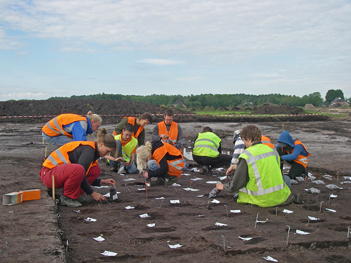
In 2009, as part of a field school, a flint concentration from the Mesolithic was excavated in Meerstad (an eastern extension of the city of Groningen). As usual on stone age sites, the archaeological layer was divided into sections of 50 by 50 cm in order to be able to sieve the soil. The pegs protruding from the ground indicate the vertices of these boxes. In this photo, the students take smaller soil samples that will be sieved on 1 mm mesh size. This allows the smallest flint fragments (so-called micro-debitage) to be traced. If such fragments are found, we can be sure that flint has been worked on the spot (and that not only ready-made tools were taken to the Meerstad camp by hunter-gatherers).
All data of this project are open access available: http://gia.ub.rug.nl/12
© University of Groningen, Groningen Institute of Archaeology.
Literature
- Arnoldussen, S., J.P. Mendlets, R.L. Fens & J.H.M. Peeters, 2012: Een mesolithisch kampement te Meerstad - vindplaats 2a. Grondsporen 12. Groningen, Groninger Instituut voor Archeologie.
Photo 30. 1957 A Bronze Age temple in
Bargeroosterveld, Drenthe
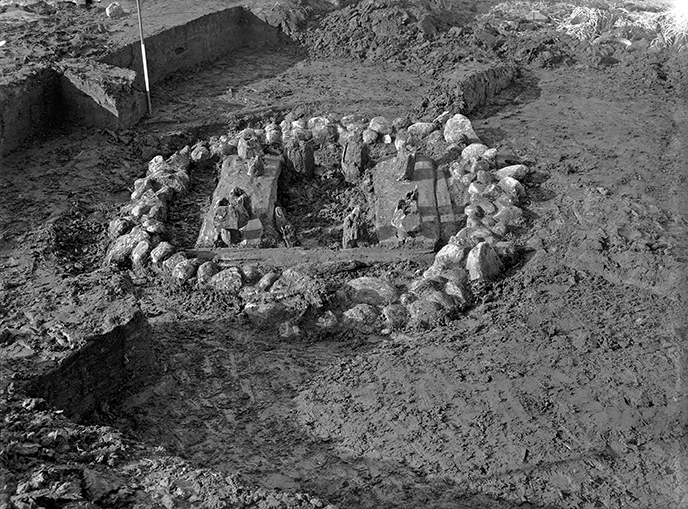
The 'temple of Bargeroosterveld' is a structure made up of 8 heavy oak posts that was found in March 1957 in the peat northeast of Bargeroosterveld. On the basis of new dendrochronological research, it is clear that this structure must have been built between 1478 and 1470 BC. Originally, the posts may have been connected with horizontal beams in the top ending in a shape reminiscent of bovine horns. Between these poles there might have been room for a sacrificial plateau, statue or coffin. The special construction method (surrounded by stones, placed in the peat) suggests that it may have had a ceremonial or ritual function. This remains a virtually unique example of a cult location from the (Dutch) Bronze Age.
© University of Groningen, Groningen Institute of Archaeology.
Literature
- Waterbolk, H.T. & W. Van Zeist, 1961: A Bronze Age sanctuary in the raised bog at Bargeroosterveld (Dr.), Helinium 1, 5-19.
- https://www.academia.edu/13949973/W.A.B._van_der_Sanden_Het_tempeltje_van_Barger-Oosterveld_Nieuwe_Drentse_Volksalmanak_117_2000_135-143
Photo 29. 2018 Ship excavation ‘Queen Anne’
in Rutten, Flevoland
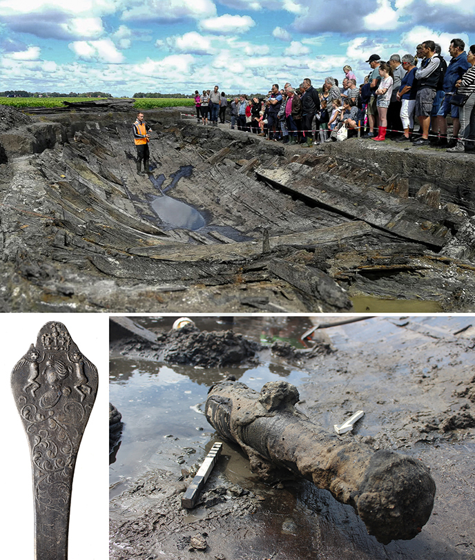
A three hundred year old shipwreck surrounded by onions, tulips and potatoes. It has become a familiar image to maritime archaeologists in the past 75 years: the soil of the province of Flevoland is in fact the former seabed of the Zuiderzee on which hundreds of shipwrecks have sunk. More than 450 wrecks have now been discovered and investigated, but many are still hidden under the polders’ crops. In the spring of 2016, farmer Dijkstra, who lives near Rutten, came across heavy wood fragments during the ploughing of his land: they turned out to be parts of a hitherto unknown shipwreck. An archaeological exploration in the fall of 2016 led to promising results, after which it was decided to fully excavate the wreck in the summer of 2018, in collaboration with the municipality of Noordoostpolder and the AWN Flevoland. The excavation was carried out by GIA under the supervision of PhD candidate and maritime archaeologist Yftinus van Popta. It offered dozens of students of the Archaeology program an opportunity to gain experience in excavating a shipwreck. There was also a large public interest, as the top photo shows: hundreds of enthusiasts stood by the trench on several occasions.
In three months, the shipwreck was completely excavated by hand (due to the shallow location of the wreckage parts, an excavator could not be used), digitally measured and drawn, 3D-modeled, cleared and reburied in the nearby Kuinderbos. More than a thousand objects were found in the shipwreck, which belong to the ship's inventory, cargo, rigging and personal property. Based on the ship's construction and the find material, the wreck is that of an armed English merchant ship built in 1705 and stranded between 1715 and 1725 on a sandbank along the northeast coast of the Zuiderzee. The ship may have departed from the south of Europe, based on the finds of olive jugs filled with olives, wine bottles with liquid contents, thousands of grapes (currants), peaches and a possible Spanish ham. Based on two royal pewter spoons bearing the portrait of the English queen Anne (1665-1714), the ship has been renamed the "Queen Anne". Several very busy public moments were organized during the excavation; work is currently underway on a monograph on the ship and an exhibition about the wreck can be seen in the RUG University Museum.
© University of Groningen, Groningen Institute of Archaeology.
Photo 28. 1968 Van Giffen and the Groninger
St. Walburgkerk
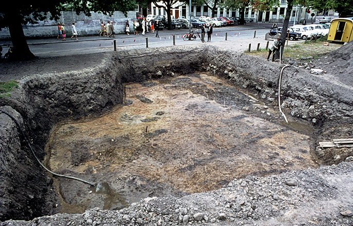
In the years 1950-1951, 1957 and 1968, in the city of Groningen, the remains of the St. Walburgchurh, located under the current Martinikerkhof, have been excavated. The excavation were led by A.E. van Giffen. In 1973 van Giffen and his draftsman H. Praamstra completed the research with a publication: De Groninger St. Walburg and its background.
Postholes were found under and next to the foundations in 1950, probably the predecessor of the chapel. In that year, a local paper, Nieuwsblad van het Noorden, reported that Van Giffen was unable (his own words) to "discover a certain regular configuration in those posthole." One of these contained a post stump with find number 130a, the last find number from 1950. In order to give context to the 'questionable timber construction' and the post stump, a substantial part of the church foundation was cleared and the excavation surface deepened during the 1968 post-examination. This color slide shows the deepest excavation surface in a westerly direction - with ditches, ditches and potholes of the sought-after predecessor. The sticks in the plane mark post pits.
In 1950 van Giffen must have been informed about the work of Prof. dr. Dr. Willard Frank Libby (Chigaco, USA) who, in 1946, posited that the radioactive carbon isotopes 14C for organic material captured during life carry an archaeological clock. He convinced the Groningen professor of physics, Hessel de Vries, of usefulness and necessity, which then drastically improved Libby's measuring method. This became apparent in 1952, when the age of post stump 130a was measured in Chicago and Groningen (the first measurement!): a difference of 1000 years. Measurements in some other laboratories confirmed De Vries' dating and his measuring method also. This made the predecessor of the St. Walburgkerk not Late Roman, but full Medieval and above that: the use of the 14C dating method in the Netherlands was now a fact. The post stump was measured again almost 40 years later. The cut date of the used oak is now between 855-885 or 895-1015 AD.
© University of Groningen, Groningen Institute of Archaeology.
Photo 27. 2015 Photogrammetry
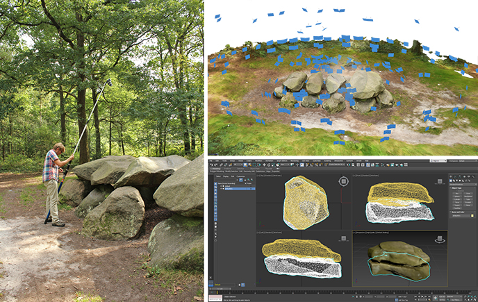
The GIA has owned 3D scanners for many years, which have been used regularly to record archaeological objects and contexts. In 2015, “photogrammetry” was introduced as a new method for obtaining 3D documentation and spatial data. For one it was applied to record all dolmens of the Netherlands in 3D and in a 2DGeographical Information System.
The method of 3D documentation that has been used with the dolmens with photogrammetry is based on digital photos that are converted into a 3D model by a software program. This principle has been used in cartography for more than a century (to extract relief from aerial photographs) and is also known as “Structure from Motion” (SfM). Because the "photographer" is always in a different place and captures different overlapping views (= motion), the 3D structure of the registered object can be reconstructed. In short, it is a method with which 3D models can be calculated based on a series of overlapping 2D images. By integrating the use of a GPS this method can also be applied to acquire accurate geographical information of a landscape or (part of) an excavation.
© University of Groningen, Groningen Institute of Archaeology.
Photo 26. 1991–1993 The matrix of a goldsmith in
Wijnaldum (Friesland)
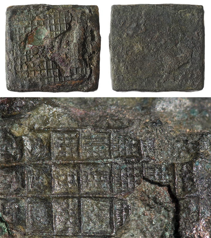
The terp with the name "Tjitsma", near Wijnaldum, is commonly known as "king’s terp". A famous find from this terp is an impressive, 18 cm long disc-on-bow brooch, of gold and completely inlaid with pieces of red garnet (almandine). Jewelry and weapons decorated in almandine are mainly known from rich, often royal graves in surrounding areas, so the brooch from Wijnaldum can also be associated with a member of the royal elite. This precious find is therefore tangible evidence for the presence of royal families in the Frisian-Groningen coastal area. During the 6th and 7th centuries, these families headed regional kingdoms, which were gradually incorporated by the Franks during the 8th century.
Additional evidence for the special status of terp Tjitsma is an at first sight unspectacular discovery that was made here during excavations in the years 1991-1993: a bronze stamp (matrix) of approximately 1.6 by 1.6 cm, with a fine waffle pattern on the front. The matrix was used for stamping thin gold foil, which was placed behind pieces of almandine to give it extra sparkle in reflecting sunlight. In combination with the disc-on-bow brooch this find shows that not only people of royal status lived on terp Tjitsma, but also that gold jewelry inlaid with almandine was produced at this specific site. This makes Tjitsma one of the few places in Europe where we can say with certainty that a goldsmith was active, who worked on behalf of the royal family who lived here.
The photo shows the front and back of the matrix from Wijnaldum. Despite the damage, a complex waffle pattern is visible on the front, which was stamped in gold foil of garnet-decorated jewerellery by a local goldsmith.
© University of Groningen, Groningen Institute of Archaeology.
Literature
- Bos, J.M. & A.J. Nijboer, 1997: Koninklijke patronage: de edelsmid van Wijnaldum (Fr.). Paleo-aktueel 8, 108-110.
- Nicolay, J.A.W., 2014: The splendour of power. Early medieval kingship and the use of gold and silver in the southern North Sea area (5th to 7th century AD) (= Groningen Archaeological Studies 28). Groningen, 259-260.
Photo 25. 1972 The first photo board
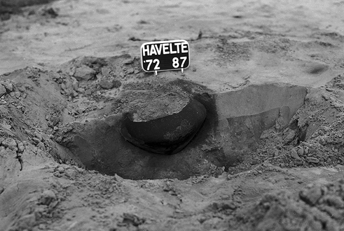
During the excavation of an urn field and burial mounds in 1972 at the Koningskamp in Havelte, a photo plate with white plastic letters was used for the first time. Purchased with the profits of a lecture and a self-made standard, it was used to avoid having to work with unidentifiable pictures of pots and urns. Previously, a find number was written down on a paper bag and placed near the object, then a photo was taken. The introduction of the photo sign in Havelte forced employees to immediately put (and write down) the correct number on the sign in the field. The sign and standard are now in the GIA archive. Nowadays, photo boards, both letter boards with individual letters and clipboards with interchangeable sheets, are an indispensable part of archeology.
© University of Groningen, Groningen Institute of Archaeology.
Photo 24. 2014 Geophysical research in Italy
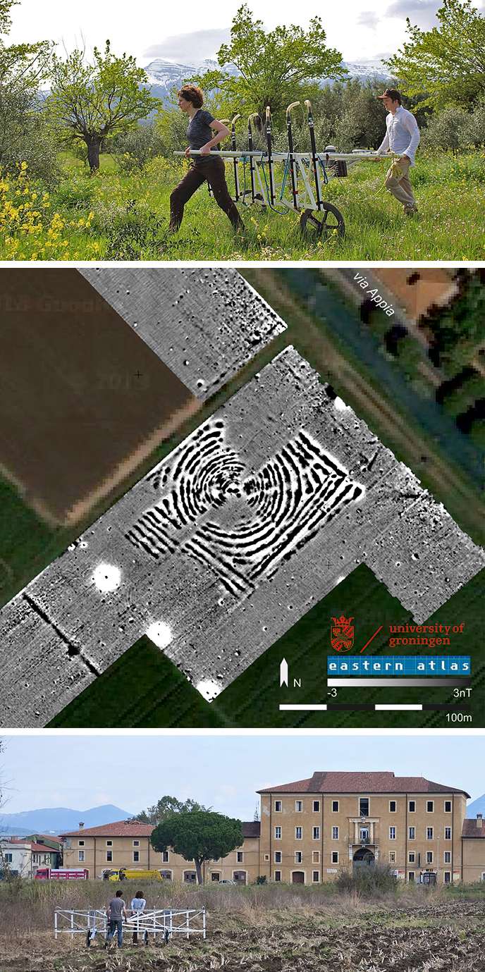
What if you want to study the human past, but do not want to disturb the buried archaeological record? Non-invasive, or non-destructive, research techniques have become common in archaeology in the past decades. Geophysical methods allow archaeologists to investigate ever larger areas without even putting a spade in the ground. GIA archaeologists have incorporated geophysics in their research of Bronze Age land use (Calabria), an Archaic city (Crustumerium), a Mycenaean palace (Ayios Vasilios), protohistoric salt production (Puntone Scarlino), and Roman land use (Pontine plain). One of our most mysterious discoveries so far is known as the ‘Unidentified Magnetic Object’ (UMO), a set of concentric circles of ca. 100x100 m alongside the Via Appia, south of Rome (figure: magnetic gradiometry +/-3nT results at Ad Medias; GIA Minor Centres Project / Eastern Atlas GmbH &CoKG, 2014). Anyone with ideas as to what this may be can contact Wieke de Neef!
© University of Groningen, Groningen Institute of Archaeology.
Literature
- De Neef, W., M. van Leusen & K. Armstrong, 2012: Multidisciplinair onderzoek naar late-bronstijd vindplaatsen op de contrada damale (calabrie, italie). Paleo-Aktueel 23, 15–22.
- Ullrich, B., G. Tol & T. de Haas, 2015: An UMO landed on the Via Appia. Results of the Minor Centres Project in the Pontine plain, Lazio (Italy). Archaeologia Polona 53, 389-392.
Photo 23. 2007 Crustumerium: 3D scanning of
tomb 222
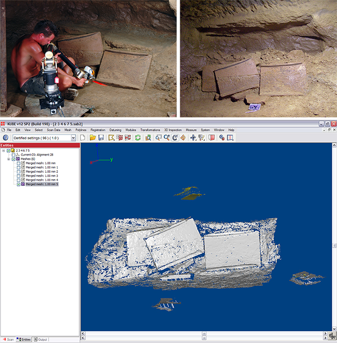
The purpose of 3D registration is to register the state of a moment and in doing so preserve it, as excavation is disastrous and there is a big chance that the tomb will collapse quite soon after the excavation. The 3D registration has preserved a representation of the tomb, also for use by future researchers.
In this photo, a GIA employee of the drawing room, is working with the scanning arm with laser. The red line of the laser can be seen - this indicates what is being scanned at that moment. The scanner records many thousands of points in 3D by means of laser light. It is the intention that the obtained points (cloud) can later be converted on the computer into a 3D reconstruction.
The skeleton had already been lifted when this photo was taken. It concerned a man who was buried around 550 BC. The grave was covered with a kind of roof tiles / covering tiles that have shifted and ended up on the ground. On the photo with photo plate you can see a set of the roof tile / covering tiles. The screenshot shows one of the many 3D scans that can be put together - using software – afterwards.
Due to the size of the files and the limited computing power of the standard RUG PC (for employees), the help of the CIT Reality Center (at the time the department High Performance Computing and Visualization of the CIT) was called in. There they have puzzled everything together and even made a movie of it:
In the location of the Reality Center (CIT RUG) there is a virtual reality space (the so-called "Cave") where you can view and examine the tomb with 3D glasses.
© University of Groningen, Groningen Institute of Archaeology.
Photo 22. 2008 Pontine regio project - survey
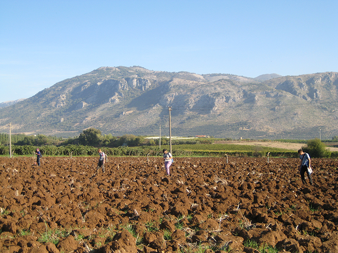
Within GIA’s endeavours in the Mediterranean, landscape archaeological research takes a prominent place. Especially the Pontine Region project, established in the 1980s by Peter Attema, has developed into a large collaborative effort that aims to study the long-term history of the Pontine Region in central Italy. This project is internationally at the forefront in the development of new field strategies, especially where it concerns the methodology of so-called field surveys.
This photo from 2008 shows staff and students of the GIA while carrying out such a field survey in the hinterland of the Roman colony of Norba. Ploughed fields are systematically traversed in search of artefacts and sites, in order to find out how, where and when the territory of this town was settled and cultivated. The research showed that the foundation of the colony in the 5th century BC hardly impacted the countryside, but that the area was intensively exploited during Norba’s heydays (3rd/2nd centuries BC).
© University of Groningen, Groningen Institute of Archaeology.
Literature
- Haas, T. de, 2011: Fields, farms & colonists: intensive field survey and early Roman Colonization in the Pontine region, central Italy; PHD thesis, University of Groningen.
Photo 21. 1972 Urnfield at Noord Barge (Hoge Loo)
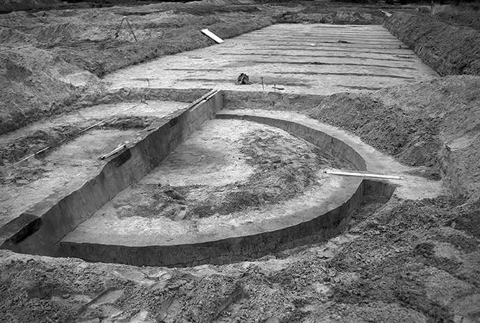
This photo shows a beaker-period grave with an enclosing circular ditch. Placed centrally, close to the main section, is the central grave. The ditch originally contained posts that delimited the burial mound. As the site was leveled prior to excavation, no mound body could be observed. In the background of the image, ditches dug to improve the medieval soil quality can be seen.
© University of Groningen, Groningen Institute of Archaeology.
Literature
- Kooi, P.B., 1979: Pre-Roman Urnfields in the North of the Netherlands, pp. 10-25: North Barge (Hoge Loo); PHD thesis, University of Groningen.
Photo 20. 2014 Stone Age - Lost craft: how flint
tools are made
When we talk about the Stone Age, it quickly turns to stone tools. For this, a lot of use was made of flint, a hard rock that can be easily worked with all kinds of percussion tools such as cobblers and hammers made of antler or wood. The resulting flakes had razor-sharp edges and were used to make all kinds of tools, such as knives, scrapers for working hides or wood, burins for working antler or bone, and drills for making holes. But also axes to cut down trees. Today, few societies continue to make and use stone tools. Archaeological books are full of images of prehistoric specimens, but for non-specialists in this field they are mainly static and abstract pictures. For students who are taught about prehistory during their education, demonstrations are given to give them a better idea of how flint tool manufacturing worked. Which techniques were used? How was the shape of semi-finished products and tools determined? How do you work from a mental concept toward a desired utensil? In this way, all those prehistoric finds acquire more meaning and more information can be extracted from them than a drawing or photo can show. Students who also try to work flint eventually learn to "read" prehistoric objects; "squeezing blood from stones", as an American archaeologist once wrote. But it is wise to have plasters on hand.
© University of Groningen, Groningen Institute of Archaeology.
Photo 19. 1932 Graveyard at Laudermarke,
Groningen
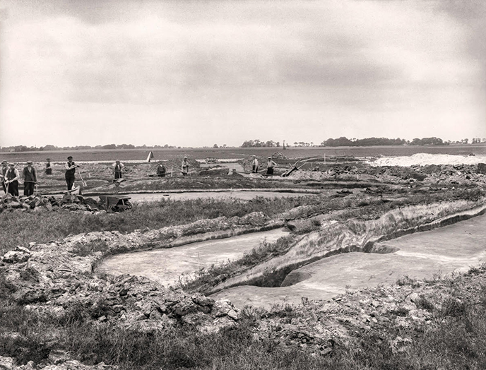
In 1932 in Laudermarke, under A.E. van Giffen, a part of a grave field that had been cut earlier in 1922 was uncovered. The photo shows the many workers who dug up there during times of unemployment as part of relief work. Van Giffen wrote about this “… many people, birds of the most diverse plumage. Even a piano tuner wielded the spade here as a sign of the times”. The photo shows how the two lighter trenches of a grave monument are cut. This grave monument (“.. sod mound (...) with funeral fire and a lot of charcoal in focus”) can be dated to the early Iron Age.
© University of Groningen, Groningen Institute of Archaeology.
Photo 18. 2019 Drones in GIA research
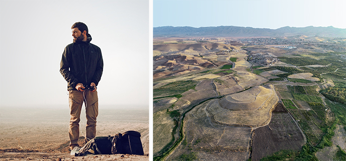
Archaeology is synonymous with digging, and hence going more or less deep and certainly below the surface. Through the centuries, excavations have helped to change our knowledge of past civilizations and ancient cultures greatly. And yet, sometimes an archaeologist has to put aside shovels and trowels and look at things from the distance. Occasionally, from very far away. Satellite archaeology, and more recently UAVs (Unmanned Aerial Vehicles), commonly known as drones, are contributing enormously to answer questions tied to large geographical scales, and the embedding of UAVs technology to explore grand themes of archaeology has proved to be particularly effective. Mapping ancient landscapes from the air, to say, is fundamental to understand the dynamics that took place in those very same territories, and how past communities interacted with their own physical space.
GIA students and staff members are increasingly integrating drones in their fieldwork activities, and with incredible results. For example, this aerial picture was taken by the GIA researcher on the left. It shows an artificial mound called Tell Balyuz which is located on the outskirts of Duhok, a city in Northern Iraqi Kurdistan. Drone mapping research carried out in this region is providing the archaeological community with high-resolution topographic maps and 3D models of a previously untouched landscape, also contributing to the monitoring of the archaeological and historical heritage of a critical region for the ancient world.
© University of Groningen, Groningen Institute of Archaeology.
Photo 17. 1982–1988 A terp profile in
Heveskesklooster
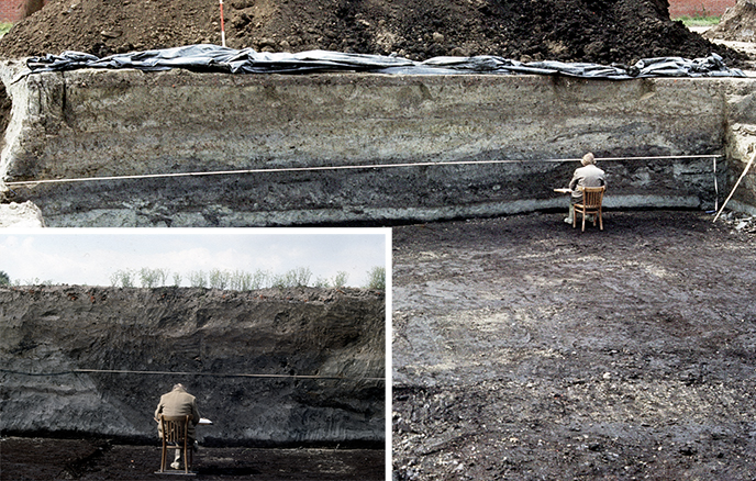
Industrial expansions southeast of Delfzijl, which were never realized, threatened a still intact mound called Heveskesklooster. In the years 1982-1988, the mound was fully excavated by the then Biological Archaeological Institute (BAI), led by J.W. Boersma. A yet unknown Neolithic hunebed and stone cist were covered by a layer of peat. On the clay situated on top of this peat they discovered a house platform that was erected here in the decades before the start of the common era. During the Roman period and the Middle Ages, this stage gradually grew into an extensive mound, on which there was a monastery (Commanderij Oosterwierum) between about 1300 and 1610 and then a farm until 1975.
In the photos, archaeological draftsman of the GIA looks at two profiles showing a section of the lower part of the mound. The bottom of both profiles consists of natural peat (dark brown), covered by a layer of sea clay (light gray). A complex play of colors is visible on the sea clay, reflecting layers of elevation (large photo) and the filling of a wide ditch (small photo). On the ribbon, which is stretched in front of the profile, the measurements can be taken while drawing the layers. The further interpretation of the drawing is a time-consuming and detailed work, even for an experienced draftsman. Seated in a wooden chair, he gazes at the layers that each tell a piece of history of Heveskes Monastery, century by century.
© University of Groningen, Groningen Institute of Archaeology.
Literature
- Boersma, J.W., 1988: A preliminary overview of the archaeological research of the Weed Heveskes Monastery (Gr.). In: M. Biersma, A.T. Clason, E. Kramer & G.J. de Langen (ed.), Terpen and Wierden in the Frisian-Groningen coastal area. Groningen, 61-87.
Photo 16. 1995–2006 The Southeast gate of Halos
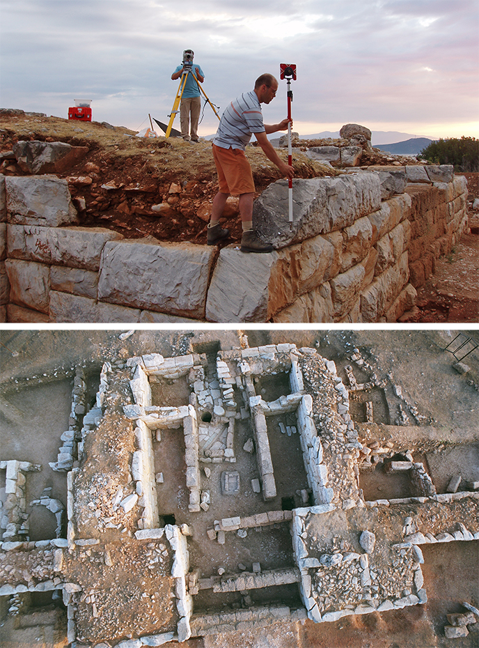
About ten excavation campaigns, between 1995 and 2006, archaeologists and GIA students spent excavating the Southeast Gate of the Hellenistic city of Halos. Like the houses and city walls, the gate was badly damaged by an earthquake around 265 BC. A large number of inhabitants will have left the city, but a few built new accommodation along the remains of the city wall. This also applies to the location of the Zuidoostpoort. In the passage of the gate, an enterprising resident set up a grain and olive processing and storage company.
Measuring walls, a water basin, fireplace, well, stairs, olive presses and storage vessels worked well. The top photo was taken in 2005, a GIA employee and a student record measurements via a total station (a total station is a surveying device that records all measurements in 3D). However, it turned out to be difficult to visualize the structures between the sometimes 4 m high walls, because at that time we were not yet able to use drones during an excavation. Photographer Thanos Efthimiopoulos provided the solution. Early in the morning he came with hot air balloons and a camera drawn over the excavation with long lines. The photos provided us with a glimpse into a Hellenistic company.
© University of Groningen, Groningen Institute of Archaeology.
Literature
- Reinders, H.R. et al., 2014: The City of New Halos and its Southeast Gate (= Groningen Archaeological Studies 27). Groningen.
Photo 15. 2016–2021 Survey and excavation in
Ayios Vasileios
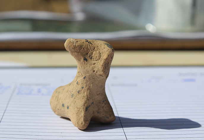
This is an animal figurine of clay from the Mycenaean period (Late Bronze Age, ca. 1300 BC). It is probably an ox or cow: you can recognize the head, the horns, the beginning of two front legs and even an eye. These kinds of figurines are found in houses, graves and shrines; they are modest offerings or votive gifts from ordinary people, who most likely wanted to obtain protection for their flocks. It was found in 2017 during the survey of Ayios Vasileios, a palace complex from the Mycenaean period.
Archaeologists have long fantasized about the possible existence of a Mycenaean palace in this region (Lakonia) in the southern mainland, but could not find it for a long time - until 2008, when a local farmer found a clay tablet bearing Linear B, an early Greek script, which was used almost exclusively for the palace administration. The subsequent excavations confirmed that there was a palace here. Between 2016 and 2020, this site was surveyed by a GIA team (field director dr. Corien Wiersma), while the cemetery of the site (the North Cemetery) was excavated between 2011 and 2016 by Prof. dr. Sofia Voutsaki and an international team. The projects are carried out under the auspices of the Archaeological Society at Athens, under the general direction of A. Vassilogamvrou.
© University of Groningen, Groningen Institute of Archaeology.
Photo 14. 1977 Reconstruction drawing Peelo,
300-400 AD.
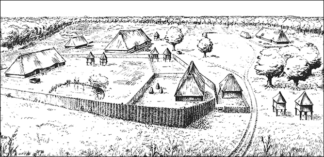
This drawing shows the settlement of Peelo in late Roman times, consisting of four yards with stable houses, sheds and grain storage in spiekers. In the foreground are bottle-shaped iron ovens next to the house. To the right of this is a building with a pyramid-shaped roof, a forge where iron is worked.
The reconstruction is based on the soil traces found during the field investigation in Peelo. These ground traces are recorded on the field drawings made during the excavation campaigns in - formerly - the hamlet of Peelo, between 1977-1994.
The drawing was made by H. Roelink, a draftsman of the GIA, on the instructions of the person in charge in the field in Peelo, P.B. Kooi.
© University of Groningen, Groningen Institute of Archaeology.
Photo 13. 1991 Mammoths in Drenthe
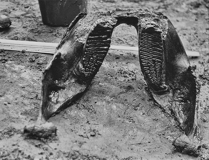
Drenthe is rich in archaeological remains, of which tens of Neolithic dolmens (hunebedden) visible in the present-day landscape have become the province’s icon. Less known are remains from times long gone, when Neanderthals were hunting in the plains of Ice Age northern Europe. Stone tools, such as handaxes, have been found at various locations in Drenthe, but remains of the animals they hunted are scarce in these parts of the Netherlands. However, during construction works for a gas pipeline in 1991, remains of at least three woolly mammoths – adult and juvenile – and a woolly rhinoceros were discovered near Orvelte. A number of radiocarbon dates has indicated that the bones, among which a complete mandible, were about 45,000 years old. Investigations by a multidisciplinary team from Groningen and Utrecht demonstrated that these animals died in a swampy, treeless valley dominated by dwarf birch and grasses. The animals remains got “trapped” in stagnating open water, and were quickly covered with muddy sediment (gyttja). Were these the remains of Neanderthal hunting parties? The researchers found no evidence for this, but it cannot be excluded either. Bones from so-called “kill sites” do not always show traces of the kill itself or subsequent butchery.
© University of Groningen, Groningen Institute of Archaeology.
Photo 12. 1977 Excavation Swifterbant-S3
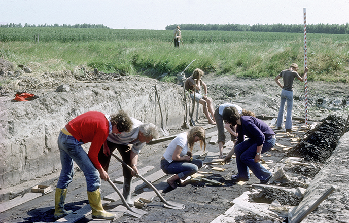
During the construction of the polder Eastern Flevoland, kilometers of new ditches were dug. Already In 1962 prehistoric finds were made. We now use the term Swifterbant culture, named after the polder village where these finds come from. Around 4300-4000 BC, hunter-gatherer-farmers lived here on the banks along a small river. The archaeological field research is a Groningen stronghold: during the summers of 1972-1979, a team led by J.D. van der Waals excavated and in the summers of 2004-2020 it was a team led by D.C.M. Raemaekers.
The photo gives an overview of the fieldschool at location S3. In the background the height of a point in the trench is measured using a level; in the middle student administer finds in paper bags and in the foreground students use a shovel to slice off thin layers of the find layer, in search of new finds.
© University of Groningen, Groningen Institute of Archaeology.
Photo 11. 2007 A blocklift from Crustumerium
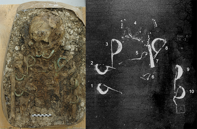
An initial phase of the expansion of the city-state of Rome in the 6th century BC meant the demise or subjugation of neighbouring towns along the Tiber. For example, Crustumerium (inhabited from the 9th century BC) was defeated by Rome in 499 BC.
Little has been found of the settlement, but the various cemeteries still contain a lot of information, based on which a reconstruction of society and its contacts with neighbouring ethnic groups such as the Latins, the Etruscans and the Sabines is possible.
Archaeological research at the necropolis of Monte del Bufalo regularly reveals complex burials. The extreme working conditions (sun and drought) sometimes lead to turning a part of a grave into a so-called blocklift (photo). This block truck is further investigated under laboratory conditions. For example, X-rays are taken prior to the mini excavation.
The blocklift in the photo is the top half of a burial of a woman of about 45 years old who was buried around 650 BC. Her age can be deduced, among other things, from wear on the teeth. She received a lot of personal jewellery and also tools associated with weaving. The colour of her teeth is caused by corrosion: metallic copper dissolves from the jewellery and deposits in the enamel of the teeth. The X-rays shows very clearly the metallic grave gifts such as the fibulae (numbers 1,2,3,5,6,7,8 and 9) and also the beads (around number 4). Under the beads around the mouth area of the person you can still faintly recognize the teeth - can you distinguish them?
© University of Groningen, Groningen Institute of Archaeology.
Photo 10. 1984 Unveiling Bronze find in the GIA canteen

At the end of November 1984, a plot in the Drouwenerveld (Drouwen, Drenthe province) was plowed deeper than before. An amateur archaeologist searched this field because earlier pottery sherds had been found there; he found a number of bronze fragments. He reported this to the provincial archaeologist and after an agreement had been made about the finder's wages, the location was visited, together with GIA staff members. After a first search with a metal detector, the top edge of a pot, with bronze objects in it, was visible from a 2x2 meter test pit. Because it would soon be dark and they did not want to leave the find unattended, the pot + contents were lifted in their entirety and transported to the GIA in a finds chest.
A few days later pot and objects were, in the presence of staff, students and press, carefully unveilded in the canteen of GIA. Also the precise location of the pieces was sketched. The pot turned out to be filled with mainly broken bronze objects (70 pieces), sometimes incomplete. It was probably an amount of bronze that was intended to be melted down for casting new objects.
© University of Groningen, Groningen Institute of Archaeology.
Literature
- Kooi, P.B., 1986: Kroniek van opgravingen en vondsten in Drenthe in 1984. NDV 1986, 38 (146)
- Butler, J.J., 1987: Drouwen: het eind van de Noordse regenboog? NDV 1987, 3 (103) - 50 (150)
Photo 9. 1957–1958 Excavation at Anlo
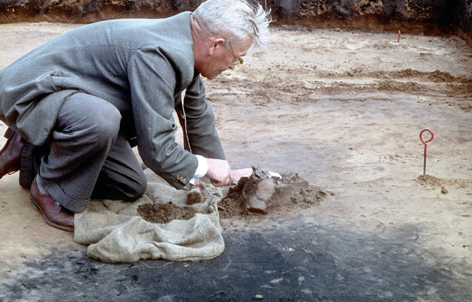
This photo shows Jan Lanting sr., Trained in archeology by A.E. van Giffen. He carefully prepares a vase from a beaker grave during the excavation of a stockyard / bronze age settlement in Anlo in 1957-1958. He probably wants to take a photo, using a matchbox as a measuring stick.
© University of Groningen, Groningen Institute of Archaeology.
Photo 8. 2008 Reconstruction drawing of Midlaren
around 200 AD.
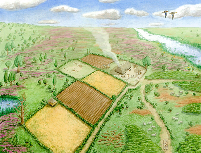
This is a reconstruction of the settlement on De Bloemert during the late Iron Age (approx. 200 BC), with the Hondsrug on the left and the Hunzedal on the right. Seen from the south.
The process of the reconstruction drawing is extensive and diverse: photographs were taken and the drawer visited the excavation site to get an impression of the surroundings. Subsequently obtained advice from GIA-experts was necessary: interpretation of ground tracks for late Iron Age buildings, ground tracks for agricultural activities, pollen found for impression of agricultural activities and vegetation, spread of building land over the surface, animal bone material for type of fauna. A lot of feedback to experts took place every time after making sketches. Unfortunately an error still occurred: the presence of chickens in the yard is incorrect, because chickens were only introduced by the Romans. This information is processed in a reconstruction - watercolour on paper.
© University of Groningen, Groningen Institute of Archaeology –
draw. S.E. Boersma.
Photo 7. 2020 Zooarchaeology at GIA
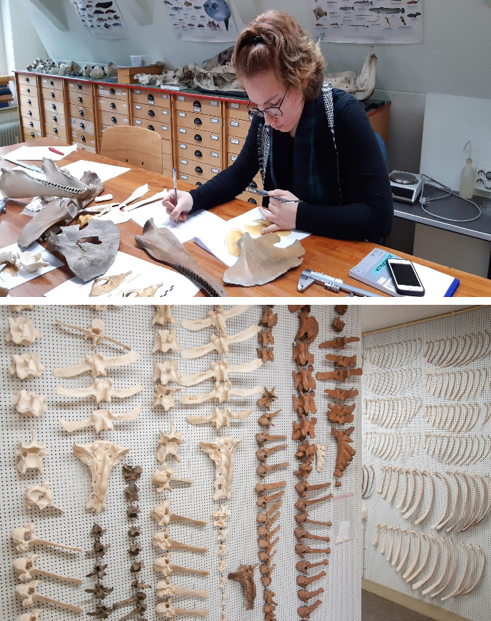
Zooarchaeology has played an important role since the foundation of the GIA. The thesis of A.E. van Giffen - the founder of the GIA, originally the BAI - was entitled “Die Fauna der Wurten” and shows that research in this discipline goes back more than 100 years in Groningen. In the past 100 years, a zooarchaeological reference collection has been compiled: more than 5000 mammal, bird, fish, reptile, amphibian and shellfish remnants are part of it. Part of this collection is physically attached to a wall - this is part of the collection of vertebrae and ribs.
As part of the Bachelor course "Practical Zooarchaeology", students learn to deal with animal remains from archaeological contexts. In the photo, a Bachelor student is identifying and analyzing some dolphin bones. Identification to species is very important in zooarchaeology because it provides a lot of information about the interaction between humans and animals in the past.
© University of Groningen, Groningen Institute of Archaeology.
Photo 6. 1933 Excursion to Ezinge
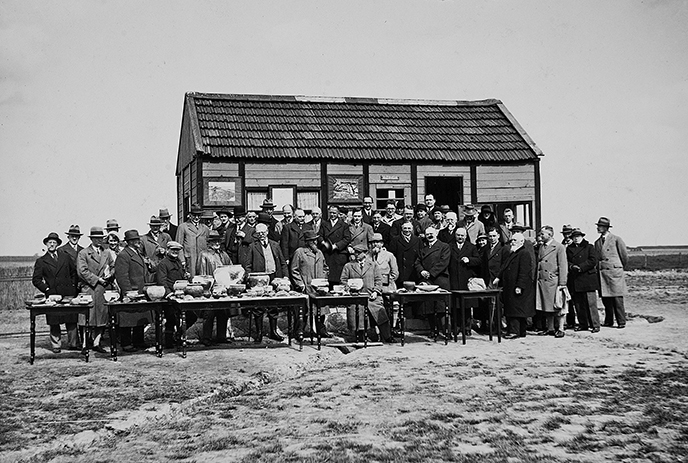
In april 1933 van Giffen organized a congres for a group of German archaeologists. During a tour through the province of Groningen the excavations in Ezinge were visited. As usual during these gatherings a groupsphoto was made. The group posed for the managers office (a wooden barrack), named Azinga. Tables lend from a local pub were used to display finds from the excavation.
The excavations in Ezinge took place between 1923 and 1934 and because of this length a barrack was placed on the site, for use of van Giffen and his direct staff members. Standard they used a white officer tent which can be seen on the first picture in this series, made during the excavation at the Wierhuizen.
One year later, after the last campaign was completed, the barrack was disassembled and transported to Diever, where it was rebuild on the Heezeberg. It functioned up to 1979 als a holiday home for the van Giffen family.
© Rijksuniversiteit Groningen, Groninger Instituut voor Archeologie.
Literature
- Kooi, P.B. & K. van der Ploeg, 2006: Ezinge, IJkpunt van de archeologie (978-90-367-7403-1).
- Nieuwhof, A. (ed), 2014: En dan in hun geheel, de vondsten uit de opgravingen in de wierde Ezinge (= Jaarverslagen van de vereniging voor Terpenonderzoek 96); (ISSN 0920-2587, ISBN 978-90-811714-6-5).
Photo 5. 2012–2013 Celtic Fields in Someren - De Hoenderboom, Brabant
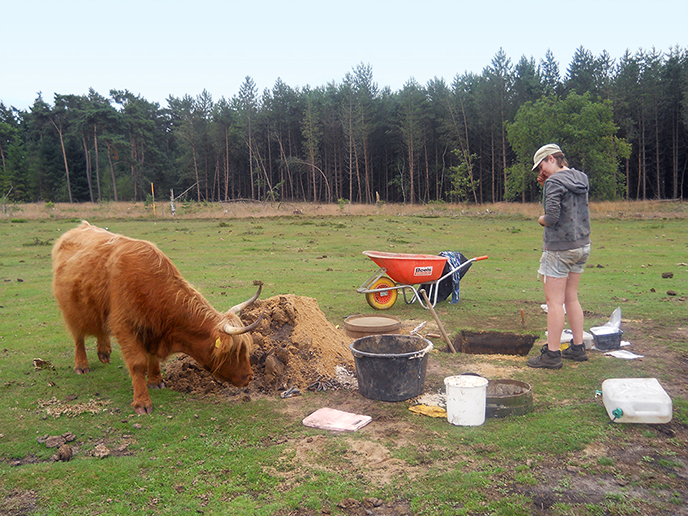
In 2012 and 2013, the GIA carried out a targeted excavation of a prehistoric agricultural plot or Celtic field in Someren - De Hoenderboom. These are walled fields from the final phase of the Bronze Age. This project was carried out together with the Rijksdienst voor het Cultureel Erfgoed (RCE) as it concerned a protected monument, and with the cooperation of Staatsbosbeheer and the municipality of Someren. In these trenches it was established for the first time that plough traces of an ard plough were preserved in the fields as well as in their banks. This was important evidence for the presumed slow growth of the Celtic field banks. The large grazers that keep the Hoenderboom open today are taking a look at the working pit.
© Pir Hoebe.
Photo 4. Archaeobotany at GIA
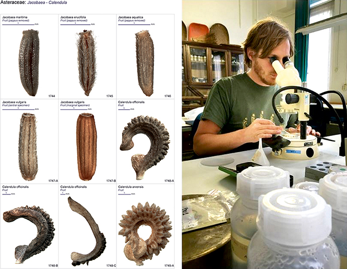
The GIA archaeobotany department is located in the Broerstraat 9 building. Archaeobotany is a supportive discipline in which plant remains, found during excavations or coring, are studied. The botanical reference collection built up by GIA staff over the past 100 years, has been used to conduct targeted archaeobotanical research. Part of this collection can be seen in the background of photo 3b. This collection is used to answer questions about what used to be eaten, which plant species are native and exotic, and what kind of climate can be expected based on the plant species found at a site.
Photo 3a shows a page from the Digital Seed Atlas of the Netherlands, which has been compiled from the reference collection. The photo shows fruits from the Asteraceae (Composites) family. Within this family fall ragwort and marigold flowers. These have been found in botanical samples taken in the field. In the second photo, a researcher conducts microscopic research to identify and count plant species. Bottles with water can be seen in the foreground. By adding water to a sample it can be seen whether certain residues float. Also the wet-preserved seeds and fruits remain unchanged in shape.
© University of Groningen, Groningen Institute of Archaeology.
Literature
- Cappers, R.T.J., R.M. Bekker & J.E.A. Jans (2012; 2nd ed.): Digitale zadenatlas van Nederland/Digital seed atlas of the Netherlands. Groningen: Barkhuis & Groningen University Library.
Photo 3. 1927 Excursion to Buinen
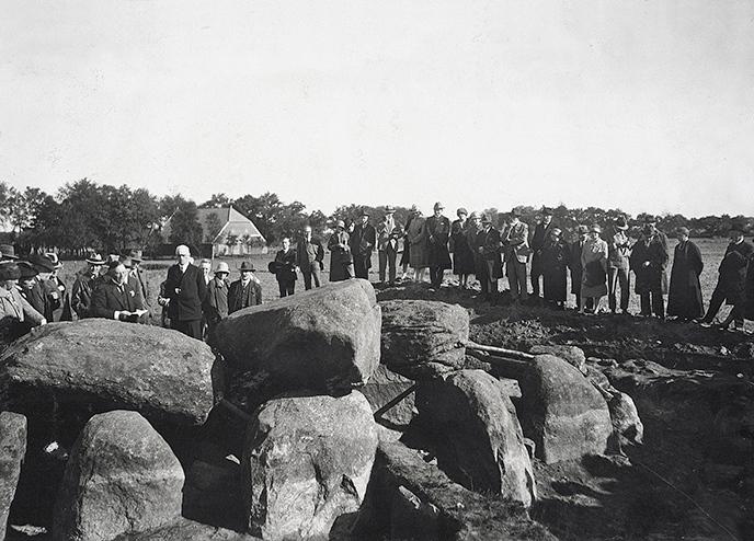
In A.E. van Giffen’s career the research of the megalithic tombs in Drenthe are recurrent subjects. Until many years after his retirement in 1955, he carried out excavations and restaurations. In 1927 he excavated megalithic tomb D28 near Buinen. This photo shows an excursion. At the left you can see van Giffen, holding a piece of paper in his hand. The excavation yielded exceptional finds like two beads made out of copper thread. These still are the oldest metal objects in the Netherlands. The beads are part of the collection of the Drents Museum. The excavation photo’s pictures are part of the GIA collection. This is a fine example of the cooperation between provincial museums and a predecessor of GIA, the BAI (Biological Archaeological Institute).
© University of Groningen, Groningen Institute of Archaeology.
Photo 2. 2014 Levelling in Crustumerium, Italy
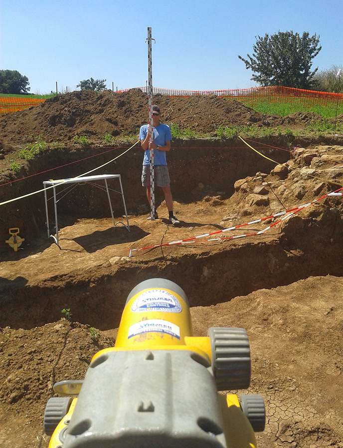
An important aspect for every excavation is the precise measurement of the height of a location, track or object. On the photo a measurement is made of a point at the burial mound 'Quilici O' on the pre-Roman excavation Crustumerium in Italy, where the GIA has been excavating since 2006. The vertical measuring rod in the hands of the employee is called a level staff. With the levelling instrument (bottom of photo) you can read the relative height of the point (or object) on which the level staff stands. This measurement is related to a national measuring point.
© Tim Kauling.
Photo 1. 1917 Appingedam, de Wierhuizen
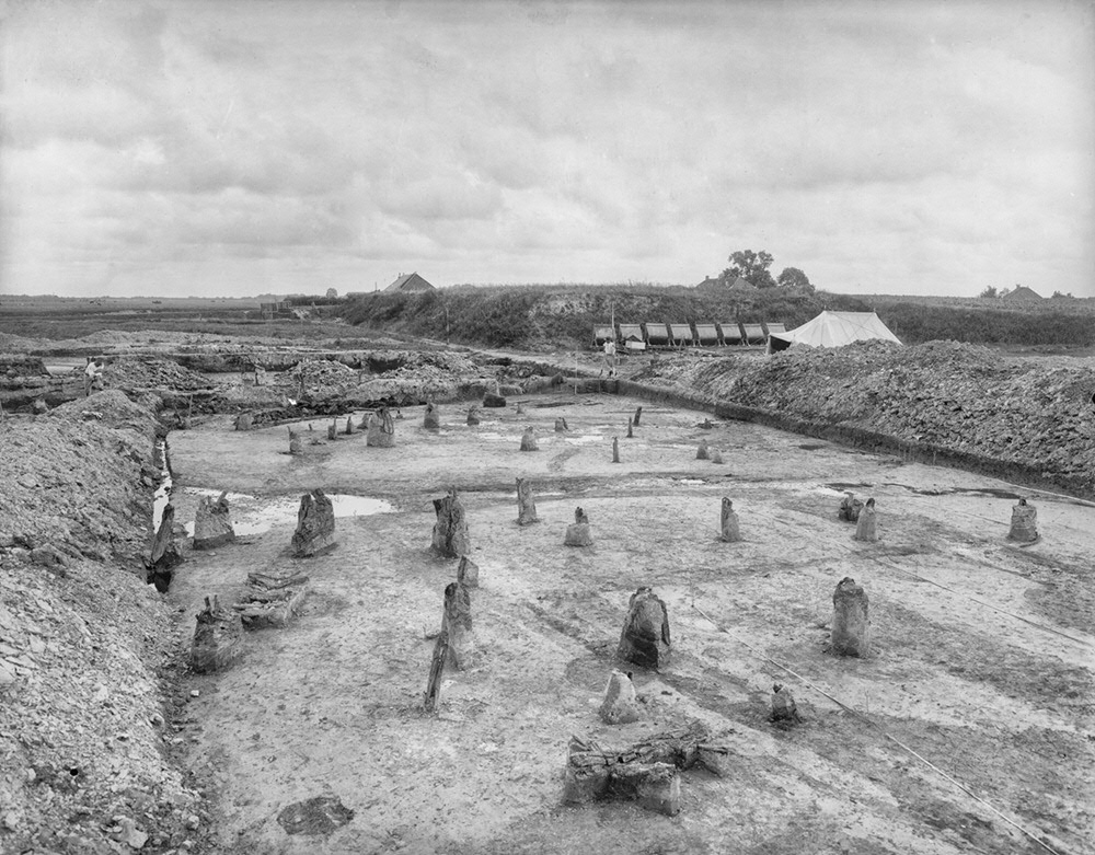
In 1916 Jan Evert Scholten bought the remainder of the dwelling mound (wierde or terp) Wierhuizen in Appingedam. Jan Evert was one of the co-founders of the Vere(e)niging voor Terpenonderzoek (1916 - Association for Terp Research), an association that is still active and closely linked to the GIA. The excavation was carried out by a young Albert Egges van Giffen. In 1917 he was assisted in the excavation by 20 interned Belgians. During the First World War, soldiers from countries at war were interned in a neutral country (following the Second Peace Conference of The Hague - 1907). In the terp, remains of houses, farms and graves were found. The rows of posts in the photo were interpreted as “wall houses.” Although later they were re-interpreted as the remains of three-aisled buildings, van Giffen's publications laid the foundations for modern terp research.
© University of Groningen, Groningen Institute of Archaeology.