‘To boldly Geo where no one has gone before’
A striking, rounded building on Zernike Campus, right next to the large pond, houses the Center for Information Technology (CIT) of the University of Groningen. The ground floor is home to the UG spatial expertise centre: the Geodienst. The department has been operational for over two years as a geotechnology startup in research support and innovation. Geodienst support takes various forms: providing geodata, Geographical Information Systems (GIS) software, courses, analyses and maps, and solutions to all manner of data problems. Geodienst also stands for innovative projects with partners from both within and outside the university. Readers will probably be most familiar with the beautiful maps that the Geodienst produces. We meet with Govert Schoof, the enthusiastic, accessible Project Manager at the Geodienst. Technically, he is on leave, but that doesn’t stand in the way of an interview.
Text: Jorien Bakker / Communication office UG
Schoof: ‘UG staff and students can turn to us with any Geo or GIS-related questions. Our team has expertise in GIS analysis, data, software, application development, visualizations and, as we like to tell ourselves, good coffee. We support researchers and students and carry out innovative projects. We are also happy to help researchers write grant applications, analyse data and provide tailor-made courses. We use ArcGIS Online to share GIS-data within the UG. Students, researchers and staff members can easily log in with their s or p-numbers.’
Nerdy
Govert Schoof signs all his e-mails with ‘to boldly Geo where no one has gone before’, a truly nerdy tag. Does he see himself that way? ‘Yes. Nerd is my nom de guerre in a sense. I already was a bit of a nerd in the past, before it was cool to be one, so to speak. I read science fiction novels, played Dungeons and Dragons and Warhammer and followed Star Trek devoutly. I still have a weak spot for geeks and underdogs, and that is noticeable in our team: it is a safe environment where you can be yourself and where we have a lot of laughs together. It goes without saying that all team members also do a superb job every day.
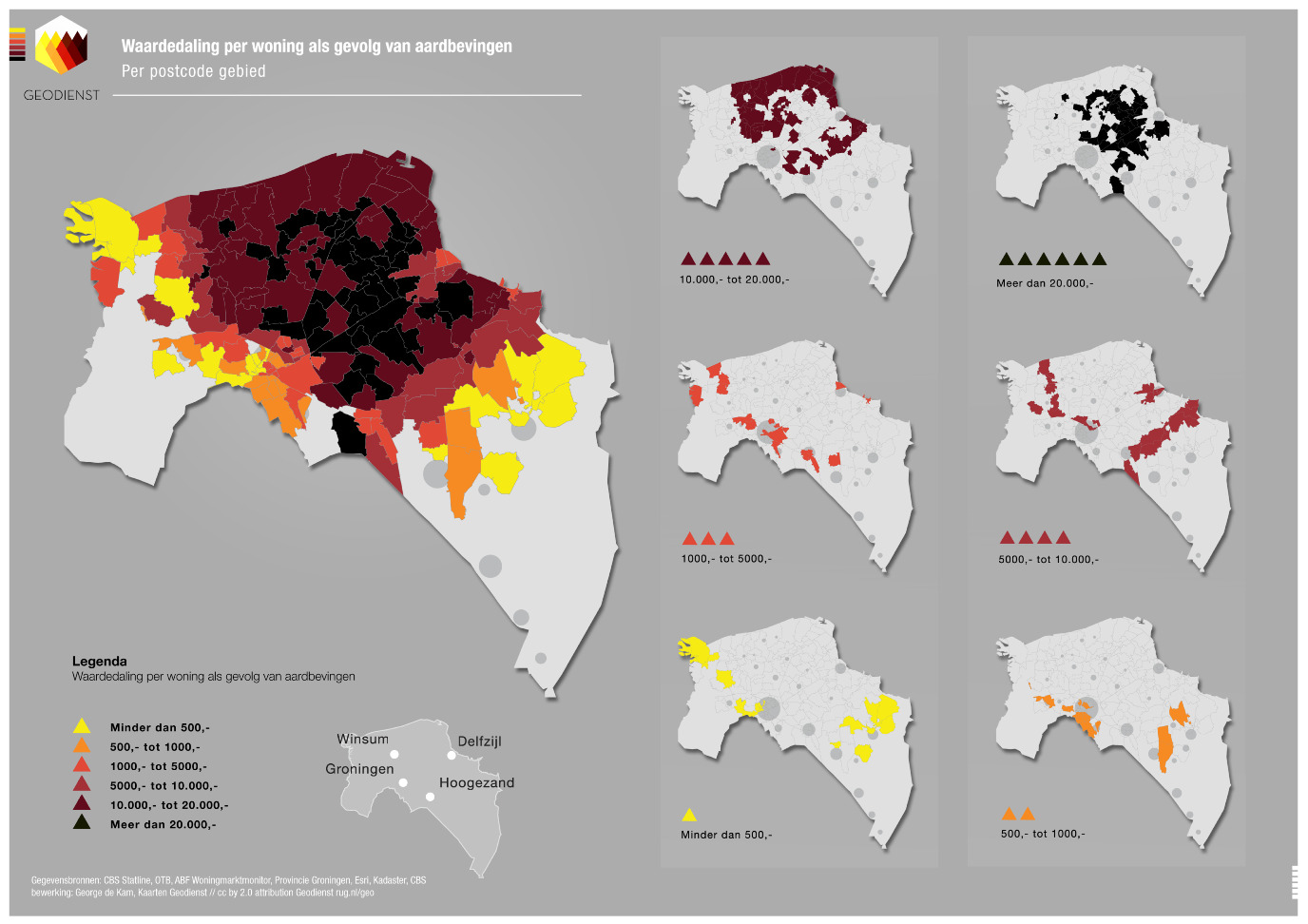
The Geodienst has recently started an Open Data Portal for sharing publicly available data, both from within the university and from external parties. In addition, the Geodienst not only works on behalf of UG faculties but also for many other parties. How does this work? Schoof: ‘Around six staff members process between 100 and 200 calls per month from the different faculties and also from Hanze University of Applied Sciences. Our analyses and user-friendly maps
have provided support for dozens of academic publications in the past two years. We work mainly in the fields of Healthy Ageing, energy, sustainability, ecology, history, archaeology and Disaster Risk Management, but there are many more.
Our contacts with industry and government are also intensifying. We introduce the Geodienst to new companies and provide knowledge-intensive custom-designed services to municipalities and water authorities. We also collaborate with the media and businesses from the Geo sector on a regular basis. This makes us a serious partner in this market, and we have noticed that firms are really on the lookout for academic knowledge. Our market activities do not detract from the support we provide to academic research, but result in a highly motivated team and a high level of expertise that stands us in good stead in serving all university faculties and their wide range of domains.’
News
At times it seems like the Geodienst is constantly making the news, with one newsflash after another for the University of Groningen. How have you have become so successful? Schoof: ‘It is cool to see that our data makes for nice news flashes. Consider the availability of public transport bikes (OV-fietsen), the distribution of churches in the Netherlands, and maps showing flood-risk levels. I enjoy the challenge of making our group successful. There have been attempts in the past to create a Geo team. Apparently, we have found the right formula this time and have had a bit of luck in the process. Our central position within the CIT and the expertise available there are definitely a help. The Geodienst has earned a good reputation in academia, but there is still room for more inter-university cooperation. Other Geo teams are often research groups with very specific expertise, whereas we take a very broad approach to the field. We are currently involved in a NWO-wide project with the VU University Amsterdam and a Leverhulme project with the University of Oxford. ‘Not bad’ for a group that has only been around for a few years. But we want more, so consider this an open invitation to fellow universities to join in!’
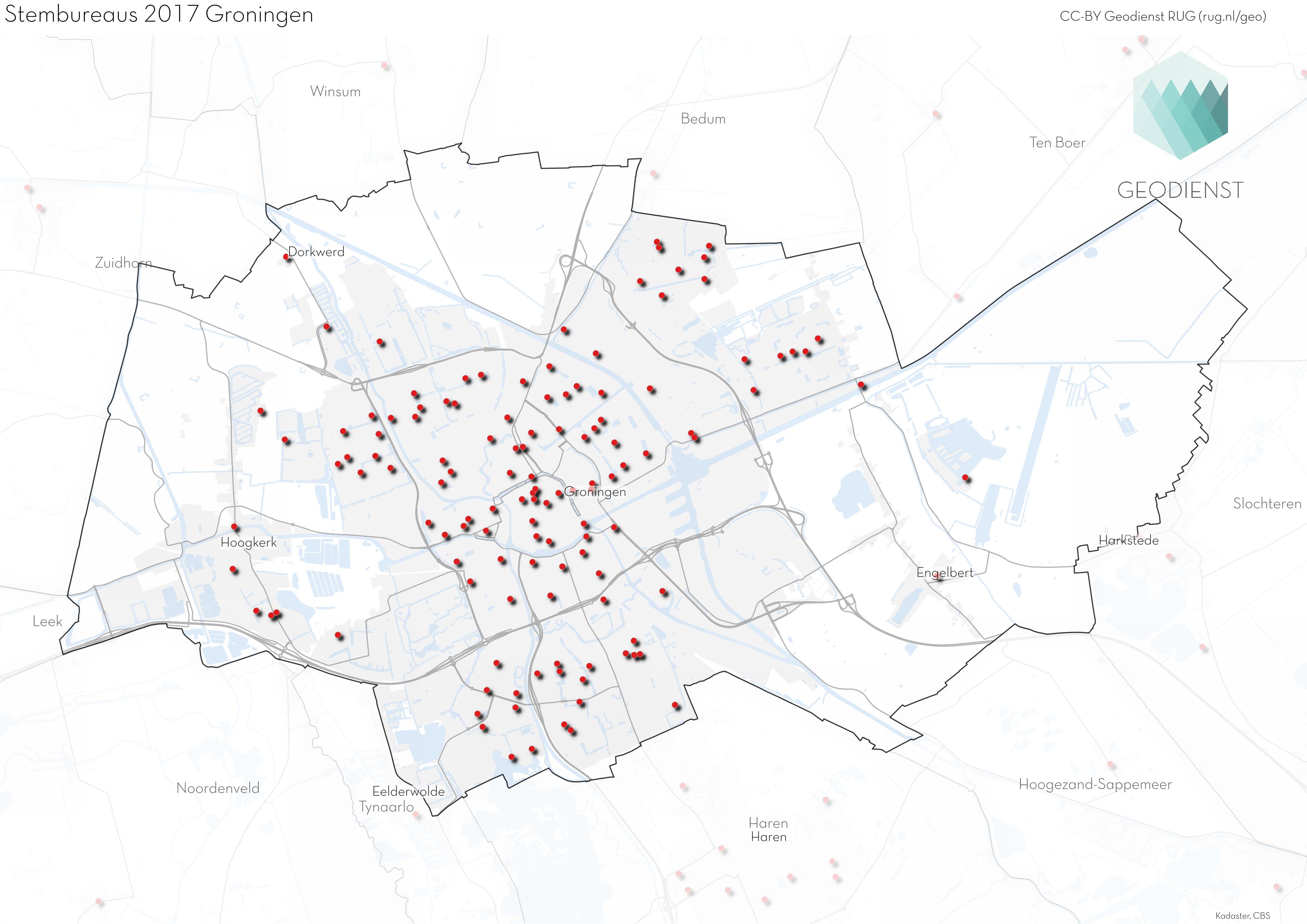
Stemwegwijzer
After a successful pilot during the parliamentary elections in March 2017 and the subsequent municipal reorganization elections , the Geodienst is currently updating its voter guidance tool Stemwegwijzer for the 2018 municipal elections and referendum. On the website stemwegwijzer.nl , this tool shows voters the way to the nearest polling station based on their own location or a location of choice. Govert and his colleagues are also updating a high-quality open dataset of all polling stations in The Netherlands.
Schoof: ‘We are adding coordinates to the locations mentioned on municipal websites and are checking them via the Addresses and Buildings key register. In this way all locations will be correct and voting will become even easier.’
The first 150 municipalities have already been updated. The others will be updated as soon as more information becomes available, while some municipalities are not participating yet. The City of Groningen, for example, only has its municipal elections in November 2018, due to the planned incorporation of the municipalities of Ten Boer and Haren. ‘Our progress can be monitored at geodienst.xyz/verkiezingen . We expect stemwegwijzer.nl
to be completed one week before the 21 March municipal elections and referendum.’
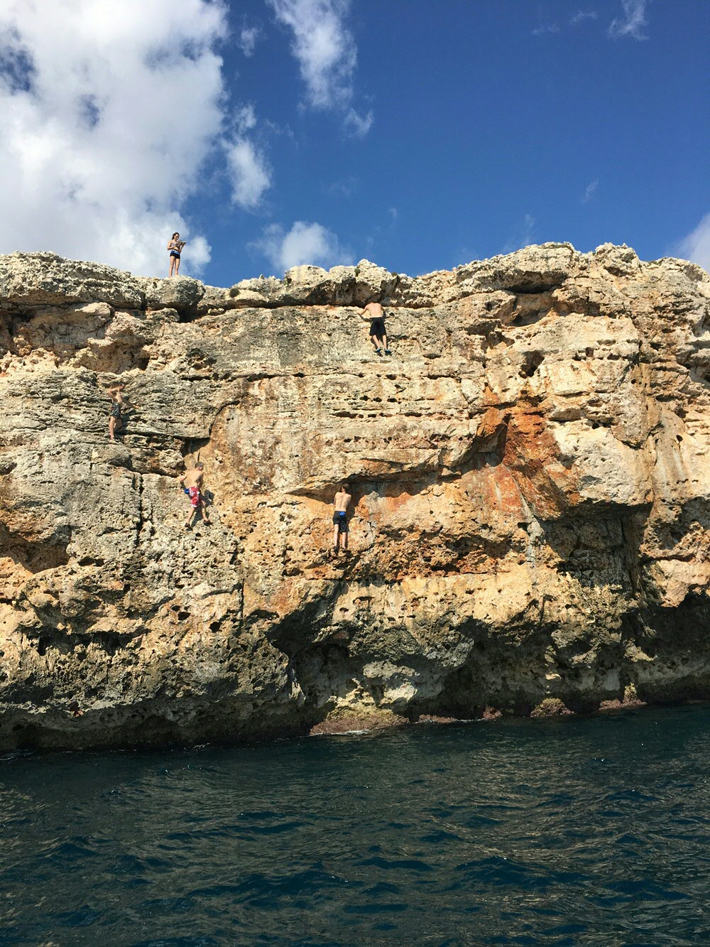
Conquering abysses
In addition to scaling the abyss of Geo information, Govert Schoof enjoys conquering some abysses of his own, being into bouldering. ‘I started a non-profit climbing hall with three friends a few years ago. Unfortunately it had to make way for new buildings. My two friends then started a commercial version (the Gropo), entirely developed according to the typical Groningen entrepreneurial spirit, so it turned out very nice. You can find me there often, though I enjoy bouldering abroad even more. There is always a mobile phone in my back pocket, though!’
More information
More news
-
-
15 September 2025
Successful visit to the UG by Rector of Institut Teknologi Bandung
-