Anthropocene: an Introduction to Landscape Analysis and Spatial Statistics
The interactions between humans and their environments are complex and multifaceted. How do we approach such intricate relationships, underlying mechanisms at play, and subtle drivers of change that can help us gain important insights into the dynamic interplay between the human and natural elements that currently make up our environments?
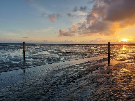
This spring school provides an introduction to a geographer’s spatial perspective on the analysis and study of landscapes and various human and natural phenomena. This will be achieved through a combination of outdoor and indoor activities on the beautiful island of Schiermonnikoog, where we will take a better look at the island’s seemingly natural surroundings and explore the potential of spatial statistics to quantify and identify spatial patterning and correlations.

The week will comprise of bicycle excursions across the island to interpret different landscapes by analysing their visible elements, lectures on spatial statistics covering spatial relationships, clustering and correlation techniques, and computer practicals during which participants can practice with the exploration, analysis and mapping of different sources of information.
By the end of the week, you will (a) have a better understanding of the composition of landscapes andthe identification of anthropogenic influences in a seemingly natural environment, and (b) have gained a general understanding of spatial statistics and how they can be applied to answer a range of research questions across different domains.
This unusual set-up will allow us to address Anthropocene issues in both conceptual and practical ways by becoming familiar with the background knowledge, and range of powerful tools, that can be used to understand complex phenomena and environments.
Practical information
|
Dates
|
2 – 6 March 2026
|
|
Location
|
The island of Schiermonnikoog, the Netherlands
|
|
Level
|
Students of any level of higher education, and practitioners, that have basic training in statistics. |
|
Fees
|
€ 650 – standard fee for non-UG participants, including full program, ferry return trip, bike rental, accommodation and breakfast on the island of Schiermonnikoog from Monday through Friday € 525 - fee for students, PhD candidates and staff of the RUG
|
|
Academic coordinators
|
Daniella Vos, FSS |
|
Contact |
Daniella Vos |
Requirements
This course is intended for students, academics and practitioners from any background who are interested in developing spatial and landscape analysis skills. The participants should have followed at least a basic training in statistics (for example university introductory course on statistics) and be able to cycle short distances. A background in GIS (geographic information systems) is helpful, but not mandatory to follow this summer school. The course coordinator can provide a list of free online training modules to develop basic GIS skills before the start of the course upon request.
It is expected that the participants have a sufficient command of the English language to actively participate in the discussions and to present their own work in English.
Course schedule
Monday 2 March:
Travel by ferry to Schiermonnikoog, introduction to the Anthropocene and the history of the island, bicycle tour of the island.
Tuesday 3 March:
Introduction to spatial statistics, lectures and tutorials on data exploration and clustering analysis, excursion to the salt marshes and second world war heritage sites.
Wednesday 4 March:
Lectures and tutorials on spatial regression and correlation analyses, excursion to village and Westerplas lake.
Thursday 5 March:
Excursion to beaches and forests of Schiermonnikoog, free afternoon, evening film night.
Friday 6 March:
Lecture on cartography and data visualization, discussion and rounding up the week, return to Groningen.
Learning outcomes
After this course you will have developed:
1. Insights into the complex interplay between humans and their environments
2. A basic understanding of, and skills for, the analysis of landscape composition
3. An understanding of the basics of spatial statistics and how they can be applied to analyse and map complex phenomena
Workload
-
Preparation: between 2 and 10 hours depending on individual needs
-
Lectures: 10 hours
-
Field activities: 20 hours
-
Computer practicals: 10 hours
Upon successful completion of the programme, the Summer School offers a Certificate of Attendance that mentions the workload of 42 hours (28 hours corresponds to 1 ECTS). Students can apply for recognition of these credits to the relevant authorities in their home institutions, therefore the final decision on awarding credits is at the discretion of their home institutions. We will be happy to provide any necessary information that might be requested in addition to the certificate of attendance.
Application procedure
To apply, kindly fill out the online application form. Please note that you will be asked to upload the following documents:
- Curriculum Vitae (max. 2 pages)
- Motivation letter, clearly stating why you want to join this summer school, what you will bring to the school and what you hope to learn (max. 1 page)
The deadline for application for participants who require a visa for the Netherlands is 1 January 2026. The deadline for those that do not require a visa is 2 February 2026.
Applications will be evaluated on a rolling basis. Participants will hear from the organizing team on the outcome of their application within 2 weeks (excluding holidays) from the date of application.