
Collection of maps and atlases
The maps room is part of the Special Collections department. It consists of a cartographic reference library and of old and new atlases and maps. The reference library can be consulted here, just as the old maps and atlases that are stored in the strong room and in the depot. For consulting the large format maps and atlases, a separate large table is available. A list of the newest acquisitions is available at the maps room upon request.
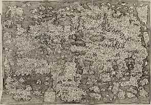
Digitally available
Our collection of individual maps — manuscript maps as well as printed maps — is stored in the strong room. In order to make this collection readily accessible, all maps that have been designed manually or published before 1901 are available in our Digital Collections. Many of these maps stem from the collection of Mello Backer and they have the City and Province of Groningen and its surroundings (Drenthe and East-Frisia) as their subject. The rest of the Netherlands and Europe are also covered extensively. In total, the collection consists of about 800 maps, of which some 200 stem from the ‘Groningana’ collection of Mello Backer. Their classification is geographical, from a small to a larger area (province, country, continent, globe).
The collection
The University Library possesses a general cartographic collecion, with an emphasis on national, topographic, geographic and thematic atlases. By means of many facsimile reprints of old atlases and map books, the user can get a broad view of the history of cartography. Furthermore, the collection can be used to get a cross section of the products of the golden age of the Dutch cartography of the 16th-18th centuries. Special attention is paid to the Northern Netherlands (Groningen, Drenthe and East-Frisia).
Did you know…?
That Cornelius Aurelius's Cronycke van Hollandt Zeelandt en Vrieslant published in 1517 by Jan Seversz at Leiden — this book is kept in the Special Collections strong room — contains the oldest map printed in the Netherlands? This map is a woodcut made by Cornelis Henricz Lettersnyder — his printer's mark C.H. appears below on the right in the small square — that had already been printed in 1514 by Jan Seversz. It was added to Aurelius's so-called Divisiekroniek in 1517. The year 1514 is mentioned on the lower left part of the square with the printersmark of Seversz, which contains the coat of arms of the city of Leiden as well.
Provenance and acquisitions
The University Library collects atlases and maps by making acquisitions and receiving donations. The ‘Groningana’ collection of Mello Backer that was donated to the University Library in 1899 contains not only books, but also a collection of atlases and individual maps of the city and the province of Groningen, including many manuscript maps. Other donations of maps to the University Library were made by i.a. Acker Stratingh (father) and Pelinck Stratingh (son) in 1925 and the Provincial Library of Groningen in 1989.
Extent
-
reference library: 1,300 titles
-
atlases dated before 1940: 200 titles
-
atlases dated before 1800: 30 titles
-
individual maps: 1,300
-
old maps, mostly city plans: 550 (signature: uklu D)
-
wall maps rolled on a stick: 30 (signature: uklu Rol)
-
topographical series of maps: 1:25.000 and 1:50.000 from 1970-present
-
thematic series of maps (partly Northern-Netherlands): soil map / geological map / geomorphological map / land draining map
Conditions governing access
All books from the reference library, all maps and all atlases can be found in our online catalogue. There is also a catalogue of filing cards, divided into regions, map makers and map titles (discontinued after 1990).
In the Special Collections Reading Room you can consult:
- an overview of cartographic essays in journals and yearbooks with a connection to Groningen, Drenthe and East-Frisia
- an overview of the topographical maps (scale 1:25.000 and 1:50.000)
- an overview of the map supplements of The National Geographic
- a list of acquisitions of new books in the reference library
- a list of acquisitions of new maps and atlases.
Similar collections in Groningen
Groninger Archieven : historical information center for the city and province of Groningen. Very extensive collection of maps of the city and province.
Literature about our Cartography Collection
- 'De kaartencollectie van de bibliotheek der Rijksuniversiteit te Groningen' / Wil Groothuis, in: Caert-thresoor (1990), no. 3, p. 37-41
- [8 descriptions of old maps from the collection of the UL Groningen] / Wil Groothuis en Cathrienus Schaafsma, in: De wereld aan boeken. – Groningen : UBG, 1987. – p. 109-118
- Lijst van kaarten van gedeelten der provincie Groningen en der geheele provincie Groningen / verzameld door M. Backer. - Groningen : Gebr. Hoitsema, [1874]. - 42 p. ; 23 cm. - (Bijdragen tot de kennis der provincie Groningen ; 18e st.)
- Beredeneerde lijst van plattegronden der stad Groningen / verzameld door … M. Backer. – [S.l. : s.n., 19e eeuw]. – 10 bl. (uklu HANDS BACKER 61)
Literature about Atlases and Maps
Northern Netherlands
- Hoogtepunten van de Friese cartografie : kaarten van provincie, goën, grietenijen, plattegronden van steden en dorpen, verveningen, slatten, dijken / P.J. de Rijke. - Leeuwarden : Friese Pers Boekerij, cop. 2001. - 114 p. : krt. ; 40 cm
- De Hottinger-atlas van Noord- en Oost-Nederland 1773-1794 / H.J. Versfelt. - Groningen : Heveskes, 2003. - 71 p., [188] p. pl. : krt. ; 34 cm.
- De Franse kaarten van Drenthe en de noordelijke kust, 1811-1813 / H.J. Versfelt, M. Schroor. - Groningen : Heveskes, 2001. - 85 p., 39 p. krt. : ill., krt.
- Kaarten van Drenthe : 1500-1900 / H.J. Versfelt. - Groningen : Heveskes, 2004.
- De atlas van Huguenin : militair-topografische kaarten van Noord-Nederland : 1819-1829 / H.J. Versfelt en M. Schroor. - Groningen [etc.] : Heveskes, 2005. - 135 p., 85 p. krt. : ill. ; 34 cm
- Biografie van de Bosatlas : 1877-heden / Ferjan Ormeling ; met medew. van Rob van der Vaart. - Groningen : Wolters-Noordhoff Atlasproducties, 2005. - 136 p. : ill., krt. ; 36 cm
- Grote Atlas van Nederland 1930-1950 = Comprehensive Atlas of the Netherlands 1930-1950 / [tekst:] B.C. de Pater, B. Schoenmaker ; [samenstelling en onderzoek:] R.C.M. Braam ... [et al.] ; begeleidingscommissie Koninklijk Nederlands Aardrijkskundig Genootschap//Royal Dutch Geographical Society Advisory Committee: P. van den Brink ... [et al.] ; [eindred.: J.R. van Diessen]. - Zierikzee : Asia Maior/Atlas Maior ; Utrecht : KNAG ; 's-Gravenhage : Nederlands Instituut voor Militaire Historie, 2005. - 584 p. : ill., krt. ; 49 cm
- Frisia dominium : kaarten van de provincie Friesland tot 1850 : geschiedenis en cartobibliografie / P.J. de Rijke. - 't Goy-Houten : Hes & De Graaf Publishers, cop. 2006. - 452 p. : ill., krt. ; 33 cm. -(Utrechtse historisch-cartografische studies, ISSN 1568-2072 ; 4)
- De historische atlas van Assen / Jan Battjes, Egbert Brink. - Assen : Koninklijke Van Gorcum, cop. 2009. - 96 p. : ill. ; 31x30 cm
Province of Groningen
- De atlas van Kooper : oude kaarten van de provincie Groningen / Meindert Schroor ; met medew. van: Auke Hummel, Hilda Raap ; [red.: Hilda Raap ; register Klazien Schroor-Dijkstra]. - Bedum : Profiel, 2003. - 160 p. : ill., krt. ; 35 cm
- De atlas der stadslanden van Groningen (1724-1729) / Meindert Schroor ; [fotogr. kaarten: John Stoel]. - Groningen : REGIO-PRojekt Uitgevers ; Groningen : Gemeentearchief Groningen, 1997. - 53 p., [140] p. krt. : ill., krt., plgr. ; 34 cm
- De atlas der provincielanden van Groningen (1722-1736) / Meindert Schroor ; [bureaured. M.I.W. Jager ; fotogr. krt. P. Schuurmans]. - Groningen : REGIO-PRojekt Uitgevers, 1996. - 50 p., 126 p. pl. : ill., krt. ; 34 cm
- Dollardzijlvest, gepeild en aangekaart : een kartografische kijk op de geschiedenis van land en water in het Oosten van Groningen en Drenthe / red.: J.N.H. Elerie ... [et al.] ; in samenw. met J.D.R. van Dijk en W.R. Foorthuis. - Groningen : Van Dijk & Foorthuis Regio PRojekt, 1992. - 108 p. : ill., krt. ; 24×28 cm
- De kaarten van Groningerland : de ontwikkeling van het kaartbeeld van de tegenwoordige provincie Groningen : met een lijst van gedrukte kaarten vervaardigd tussen 1545 en 1864 / door J.J. Vredenberg-Alink. - Uithuizen : Bakker, 1974. - 151 p. : ill., krt. ; 31 cm
- Geschiedenis van Stad en Ommelanden in kaart : gids voor de lustrumtentoonstelling, 21 juni t/m 29 juni 1969 / gastred.: H. Vrielink. - [Groningen : Groniek], 1969. - 96 bl. ; 30 cm. - (Groniek. onafhankelijk Gronings historisch studentenblad ; [no. 2] spec. uitg)
- Groninga dominium : geschiedenis van de cartografie van de provincie Groningen en omliggende gebieden van 1545-1900 / Piet H. Wijk ; [red.: Ekkers & Paauw ; fotogr. Jan Buwalda ... et al.]. - Groningen : Elchers ; Assen : Van Gorcum, 2006. - 372 p. : ill. ; 33 cm
City of Groningen
- De plattegrond van de stad Groningen door Jacob van Deventer uit omstreeks 1565 : vorming en vernietiging van een kaartbeeld / door G. Overdiep. - Alphen aan den Rijn : Canaletto, 1984. - 146 p. : plgr., foto's, ill. ; 20x27 cm + losse kaart en plattegrond
- Egbert Haubois : bijdrage tot de kennis van leven en bedrijf van een zeventiende-eeuwse ingenieur en kaartmaker in Groningerland / door W.K. van der Veen. - Alphen aan den Rijn : Canaletto, 1983. - 98 p. : ill. ; 19x27 cm + Kaart
- Historische atlas van de stad Groningen : van esdorp tot moderne kennisstad / Meindert Schroor ; [eindred. Lucy Klaassen ... et al.]. - Amsterdam : SUN, cop. 2009. - 80 p. : ill., krt. ; 34 cm. -(SUN-historische atlassen). - Uitg. in samenw. met het Regionaal Historisch Centrum Groninger Archieven
- De kaart van Egbert Haubois : spiegel van wens en werkelijkheid / [red. Lies Boiten ... et al. ; bijdragen van W.K. van der Veen ... et al.]. - Alphen aan den Rijn : Canaletto ; Groningen : Groninger Museum, 1983. - 144 p. : foto's, tek., krt. ; 19x27 cm + kaart
| Last modified: | 07 February 2024 12.04 p.m. |