Maps
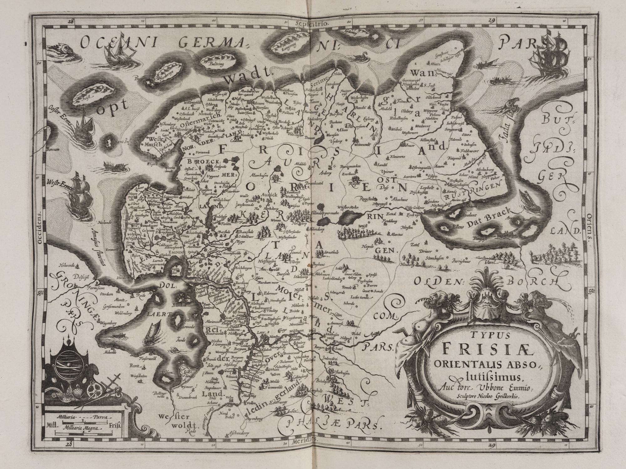
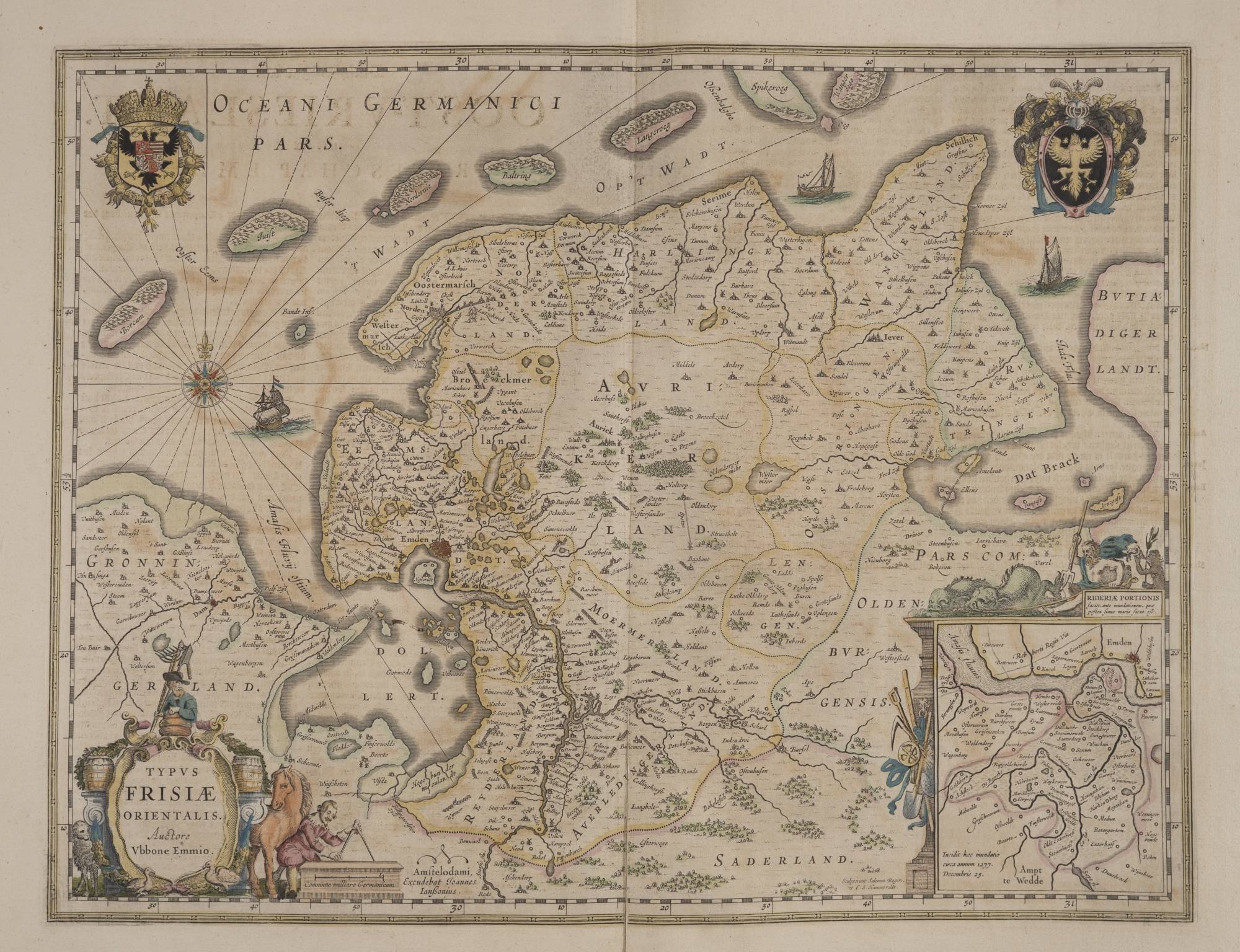
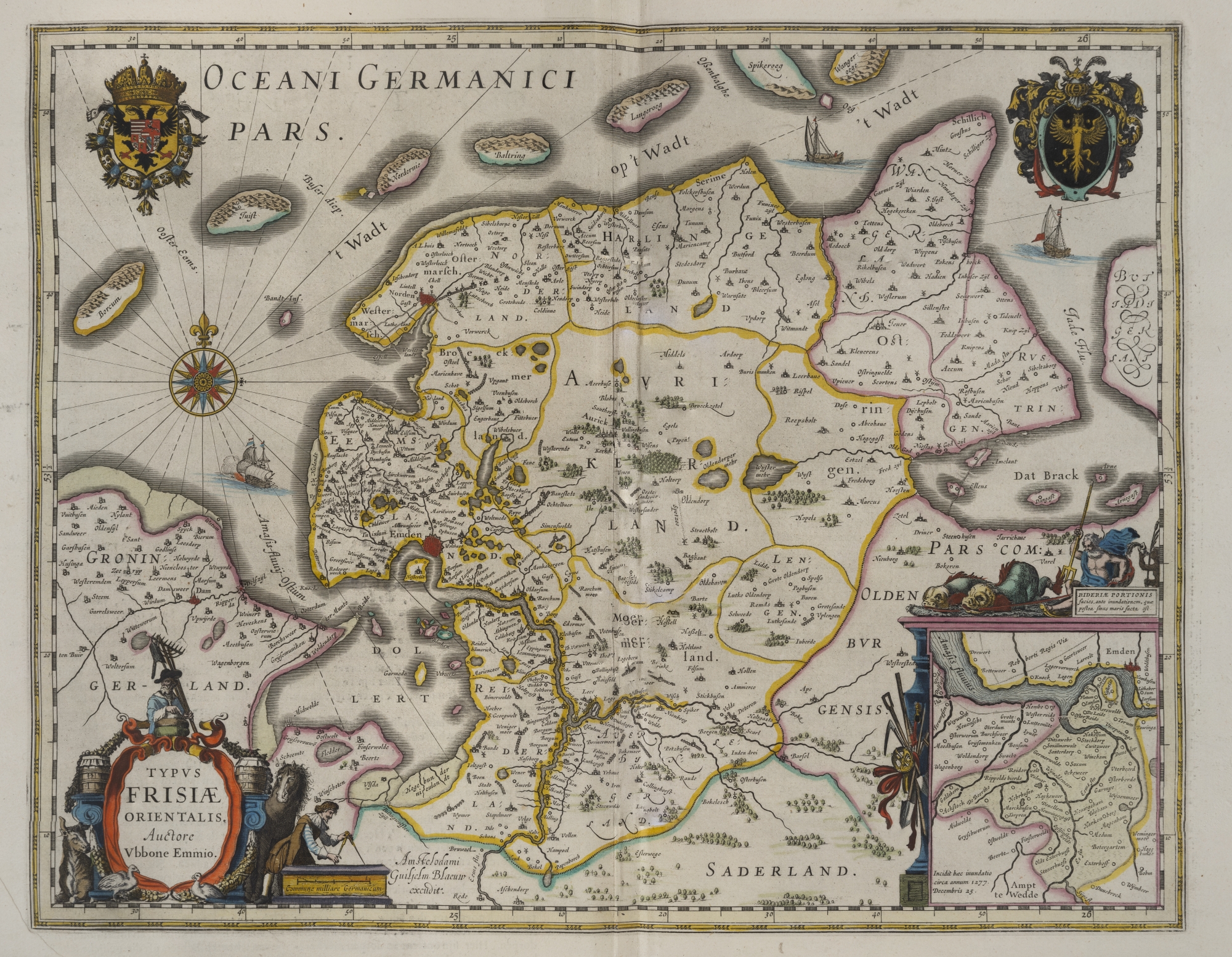
Ubbo Emmius’ Rerum Frisicarum historia (Leiden 1616) also contains a map of his homeland of East Friesland that he composed himself. He created this map in accordance with the same principle he applied to his writings: historical accuracy. This also led to controversy.
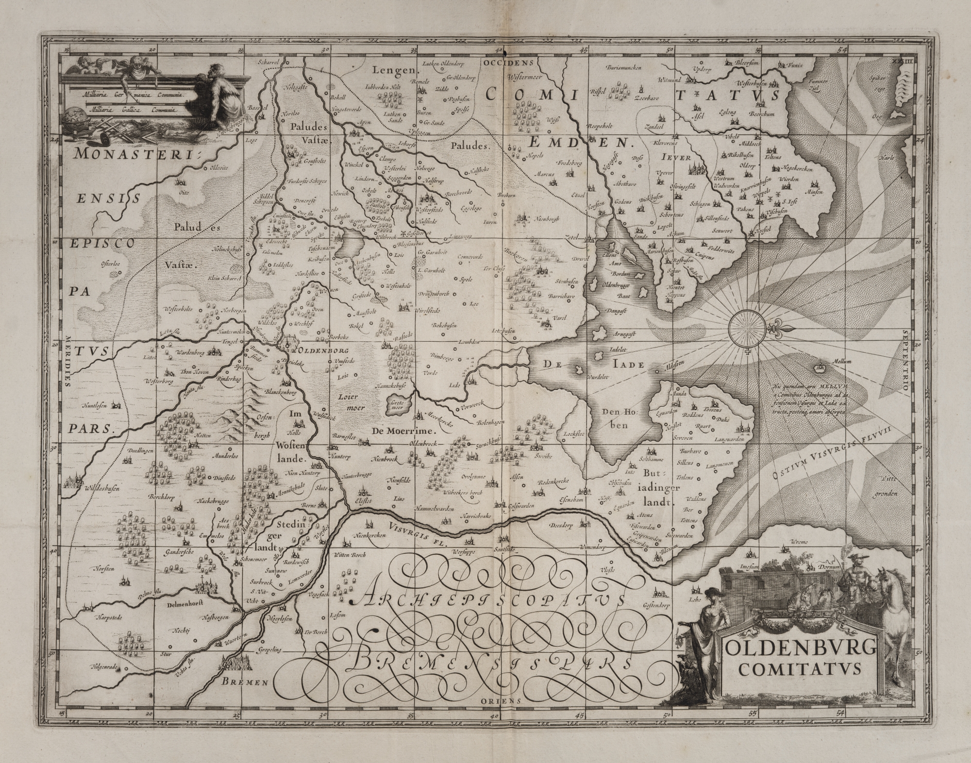
Maps were usually printed separately, so not as part of a quire. The buyer of a book would purchase the quires and would then have them bound in a binding he selected himself. At that point, the map would be bound with the quires. Maps were coloured after the purchase, too, by hand. This means that usually each copy has different colourings.
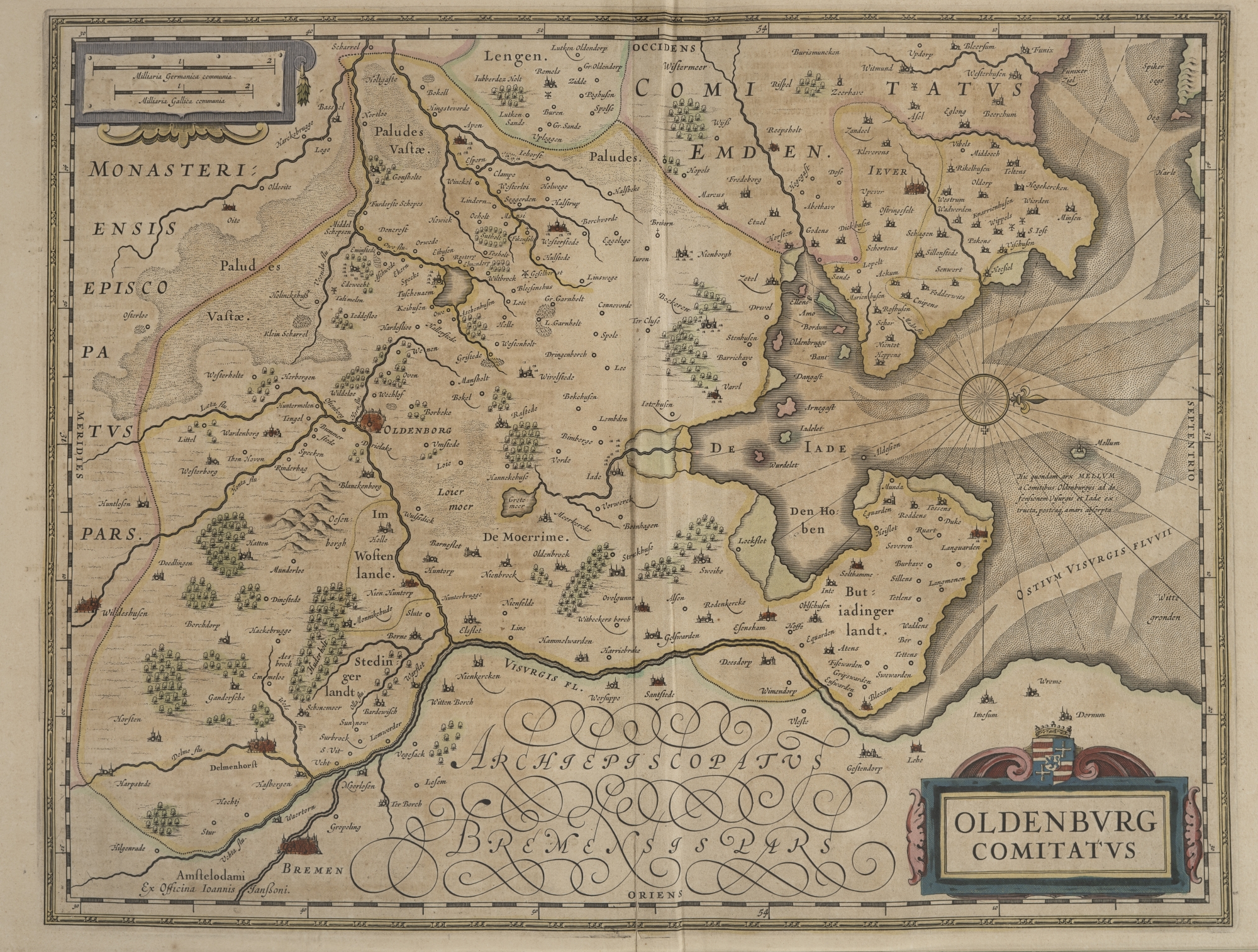
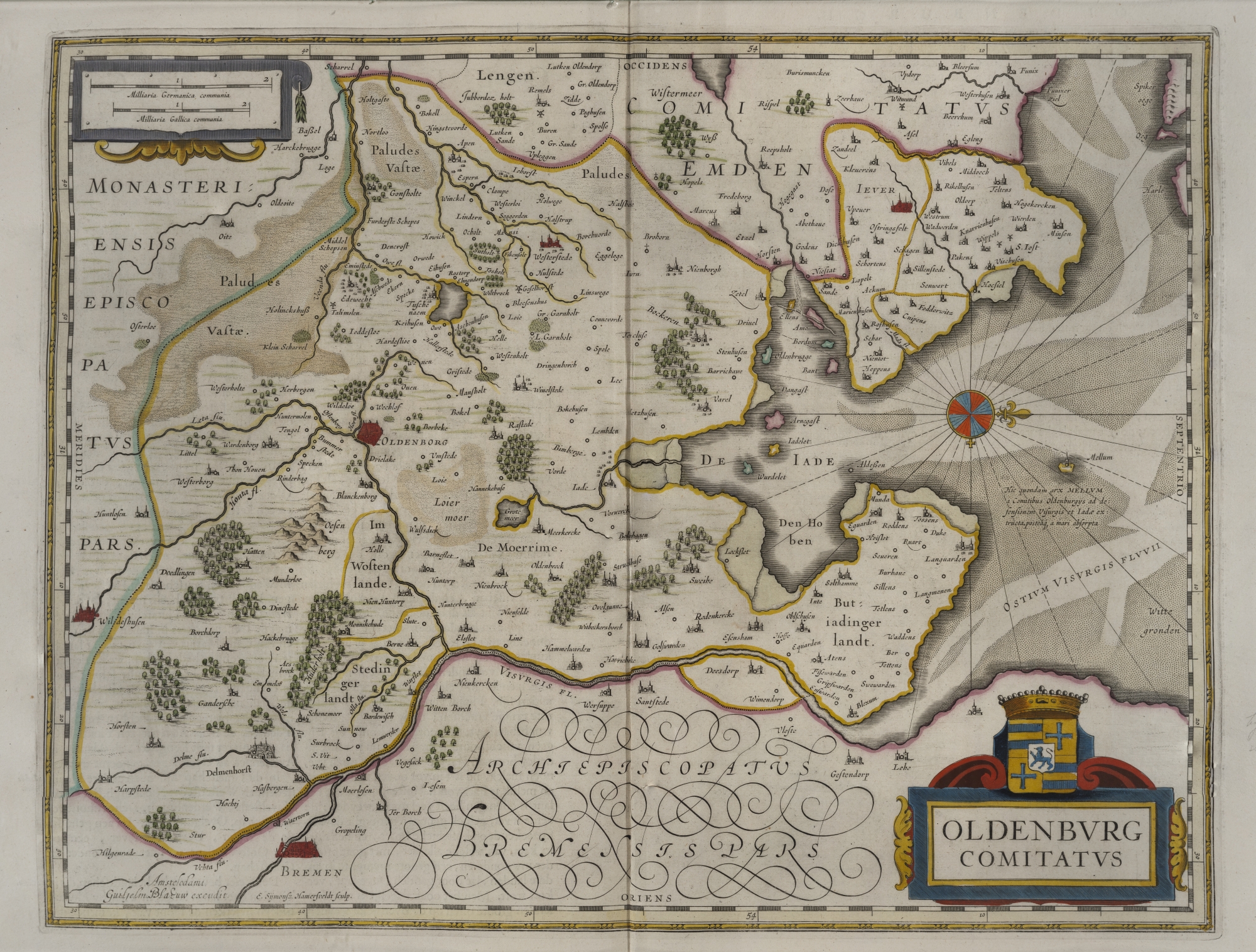
Here we see three different examples of Ubbo’s map of East Friesland, and three of the county of Oldenburg. They also show that the quality of the colourings could vary. This difference in the quality is also a topic of discussion in one of Ubbo's letters:
“I have received the copies of the geographic map you sent me, for which I sincerely thank you. I do not know anyone here who is good at colouring these kinds of maps. The coloured copies sent by you are done reasonably well, with the exception of the towns and villages, that seem like they have dirt on them rather than colours. And the borders of regions are done a little clumsily and are unclear in various places. If I really had time to spare, I would colour one or two copies myself so they would be what I wanted.” (Letter to Otto Friedrich von Wicht dated Groningen, 2 January 1600).