
Maps of Meaning
Itinerary of a Cartographer: Ubbo Emmius
Imagine a scenario in which Person A discovers that the established order has partly based its information on fables, thereby exposing the fact that the past was less glorious than it is generally perceived to be. Person B (representing the established order) responds to these claims by discrediting Person A, asserting that Person A is refusing to acknowledge the venerable sources that prove the truth of the perceptions that Person B is seeking to perpetuate. Person C even wishes to drag Person A to court, on charges of slander. Person A continues to defend himself and writes a new version of the past that is based on more trustworthy sources.
This scenario may sound familiar. To some degree, it resembles the Trump administration’s fake news-ization of media criticism, but it is also reminiscent of the struggle between those who create hoaxes and label honest critique as fake news, and those who use fact-checking to distinguish fact from fiction and to help ensure a more accurate portrayal of reality in the news and stories that rule public perceptions. Companies like Facebook and Google are struggling to deal with fake news. This appears to be a very modern problem that developed along with the internet revolution. In this exhibition, we will demonstrate that the creation and spread of misinformation also existed in medieval and pre-modern times, and we will explore academia’s involvement in this process.
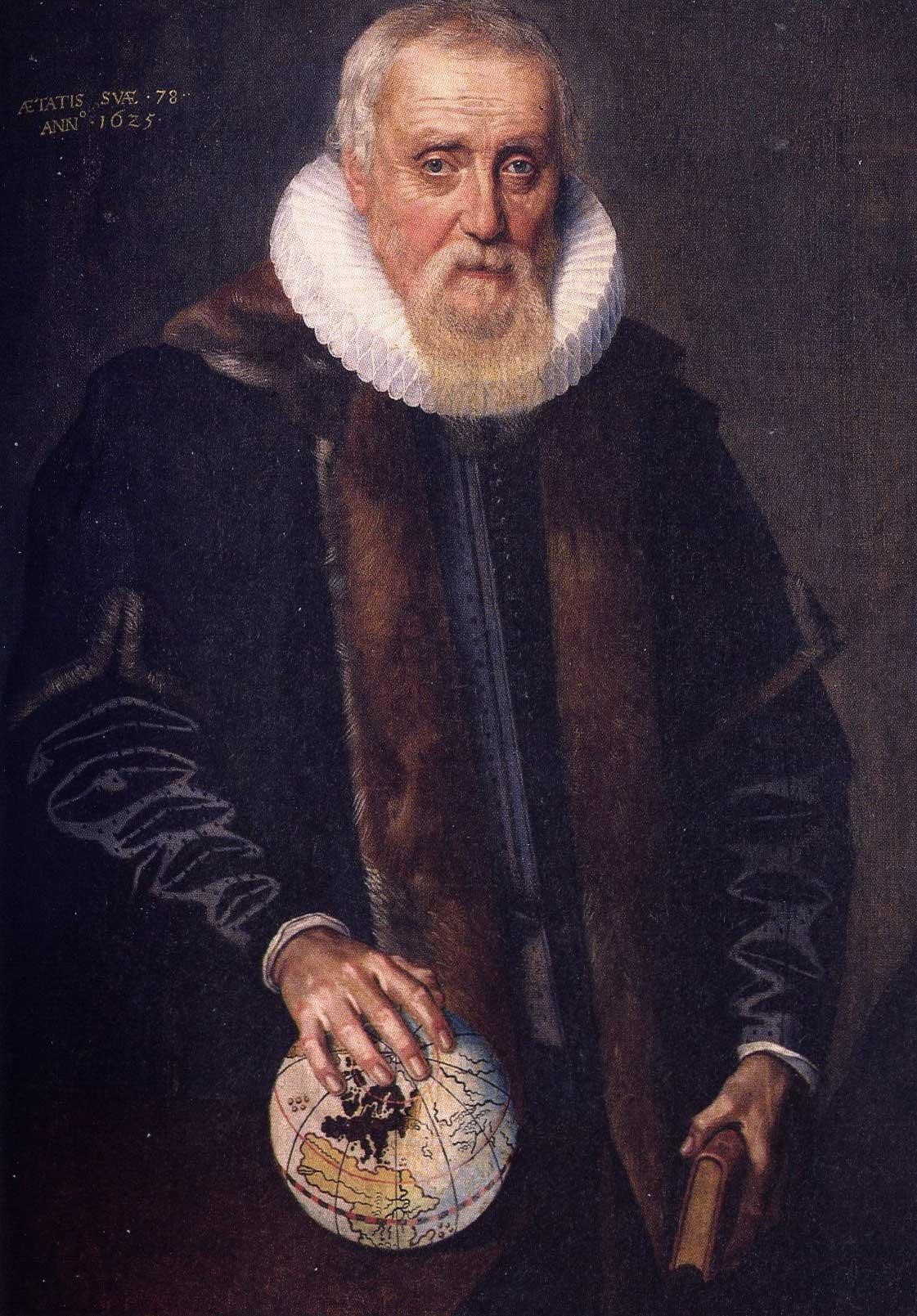
You may have heard of Ubbo Emmius, or have gone to a high school bearing his name. Or perhaps you recognize his name from the Ubbo Emmiussingel, or the Ubbo Emmiusstraat in Groningen. The name is probably familiar to students and university staff from the monument in front of the Academy Building (the six specific elements surrounding a beech tree with Emmius’ name in golden letters), or from his portrait in the Senate Room (slide 1).
Some might know that Ubbo Emmius was the first rector magnificus of the University, which was called the Academy when it was founded in 1614. But he is also Person A in the above scenario.
It all started in Greetsiel, where Emmius was born on 5 December 1547. At the tender age of nine, he was sent to a school in Emden, the idea being that he would follow in his father’s footsteps and become a pastor. In 1565, Emmius went to a famous school in Bremen, where Johannes Molanus was rector. This was only for a very short period as his parents then arranged for him to attend the newly founded Latin school in Norden. When Emmius completed his education at the age of 22, his father considered him ready to go to university. Emmius began his university education at the Lutheran university in Rostock in 1570. He took courses in a wide range of disciplines: history, theology and natural sciences. In his third year, Emmius hoped to study at a different university, but the death of his father obliged him to return home to stay with his mother in Greetsiel. His sister Teelke then drowned while making the sea crossing from Norden to Greetsiel, and Emmius remained in Greetsiel for three years. Finally, in the summer of 1576, he travelled to Geneva. He did so on foot, which we know because he kept a small diary describing his journey. [2]
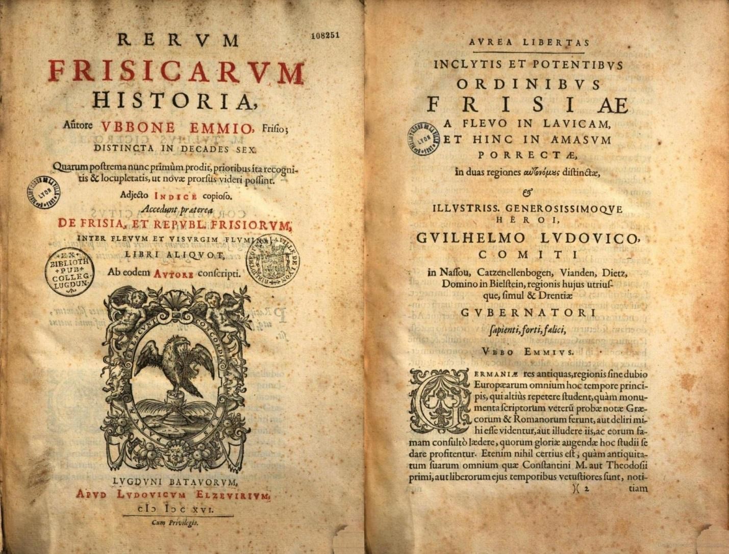
Emmius completed his education in 1578 and started his first job in 1579. He was appointed rector of the Latin school in Norden, the same school he had attended as a pupil from 1565 to 1570. He remained there for nine years, but had to leave because the presence of a Calvinist rector in a Lutheran school was a source of friction. In 1588 he was offered the position of rector at the Latin school in Leer, a job he held for five years. During both these rectorships, he continued working in academia. In 1592, he finished the first ten books of his life’s work, the Rerum Frisicarum Historia (History of Frisia; see slide 2).
Emmius met exiles from the city of Groningen and the so-called Ommelanden (its surroundings), which were temporarily under Spanish (catholic) rule during the Eighty Years’ War (1568-1648). His academic connections enabled him to move to Groningen in 1594, when Groningen was once again held by the (protestant) stadholders. The city council offered him the position of rector of the Latin school that had once been headed by the eminent Regnerus Praedinius (1510-1555). [2]
Emmius lived in the city of Groningen for the rest of his life. When the Academy was founded in 1614, Emmius was Frisia’s most renowned scholar. As the oldest and most respected among five colleagues, he became the first rector magnificus of the University of Groningen. Meanwhile, he continued working on his Rerum Frisicarum Historia, which he eventually completed in 1616. Emmius did not stop writing then. He had already decided in 1606 that he wanted to write a book on chronology, which was eventually published in 1619. Shortly afterwards, he started working on a biography of stadholder Willem Lodewijk, who died in 1620. That work was printed in 1621. His final work was a geography and history of the ancient Greeks. Emmius never saw it in print because Elzevier, his publisher, was slow to publish it. He died on 9 December 1625. [2]
During his years in Groningen, Emmius asserted himself as a historian with a strong awareness of historical truth, a position that set him apart from the academic establishment of that time. Famous contemporary historians such as Suffridus Petrus (1527-1597), Bernardus Furmerius (1542-1616) and Andreas Cornelius (15??-1589) all wrote histories and chronicles based on fables and legends originating in the late-medieval period and their own 16th century. In 1588, Andreas Cornelius claimed that he had found a new source passed down orally from generation to generation. Though technically nothing but hearsay, Suffridus Petrus gratefully received these ‘new’ facts and used Cornelius’ source to fill in the gaps in his Frisian history. [2]
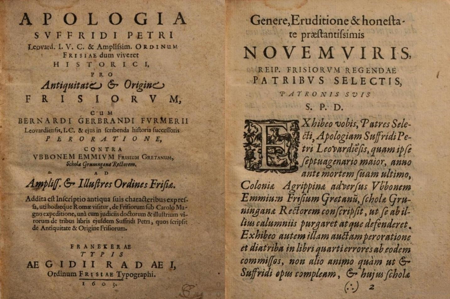
Emmius, on the other hand, based the second and third series of ten books of his Rerum Frisicarum Historia (first published in 1598 and 1599 respectively) solely on primary sources. He was very critical of fables and legends and only mentioned them to explain that anyone who actually believed them to be the historical truth was probably not of sound mind. Naturally, this criticism was not well received by Petrus and Furmerius, who did not want to let this attack by an unknown writer pass with impunity. They accused Emmius of treating the sources with disdain. They regarded him as being irresponsible in his downplaying of the glorious history of the Frisians: he was a ‘frisophobe’. Slide 3 shows the title page and beginning of Petrus’ historical work, which explicitly targeted Emmius. [2]
In 1603, Emmius once again attacked his fellow historians, repeating his argument about source critique and historical truth. Begun in Italy by Machiavelli and Guicciardini, this fight was being fought all over Europe. Emmius, who had criticized Hermann Hamelmann, Oldenburg’s court historian, in 1599, was already experienced in this battle. Emmius accused Hamelmann of having been careless in his handling of historical truth. This accusation angered the Count of Oldenburg, who summoned Emmius to appear on counts of slander. In this conflict, the stadholder Willem Lodewijk backed Emmius, claiming that Emmius only wished to uphold an historian’s dutiful principles. [2]
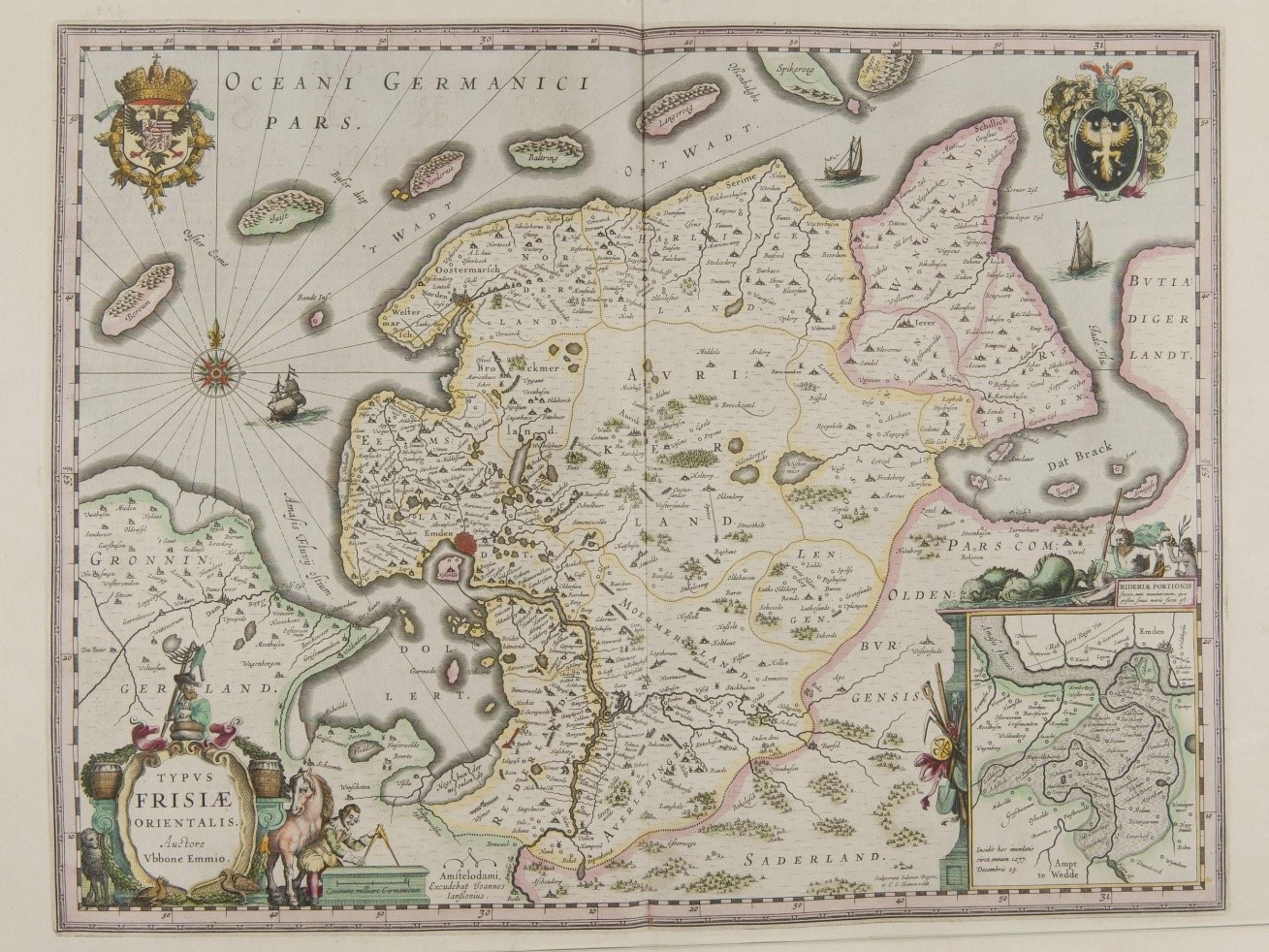
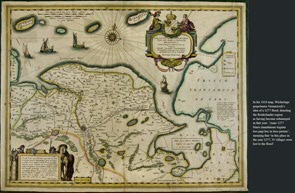
Emmius’ aim to present history as truthfully as possible is also evident in the maps he created. During his time in Norden and Leer, he travelled through Ostfriesland (East Frisia) to establish the geographical locations of all towns and villages. His broad education had furnished him with the skills to draw an accurate map. His history of Frisia and the accompanying map were to become very popular (see map on the fourth slide).
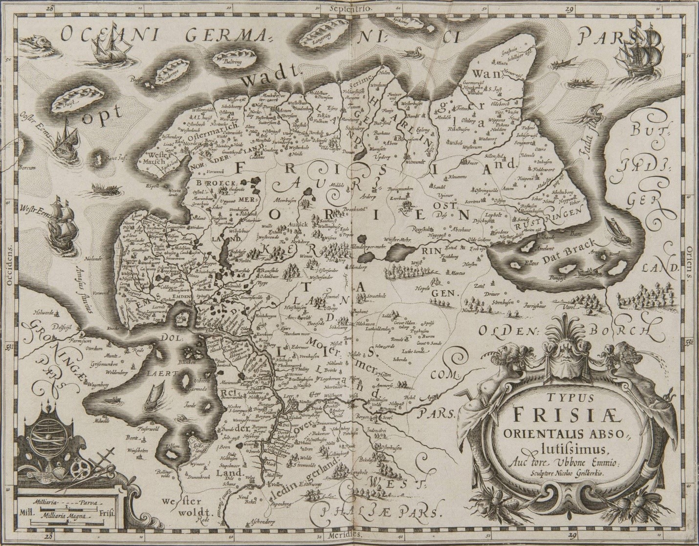
The map appears in an inventory of maps and manuscripts from 1870 in the state archives in Mons, France. As shown above, some of his maps were reprinted or published after his death—in 1633, 1664 and 1730 respectively (see slides 5, 6 and 7).
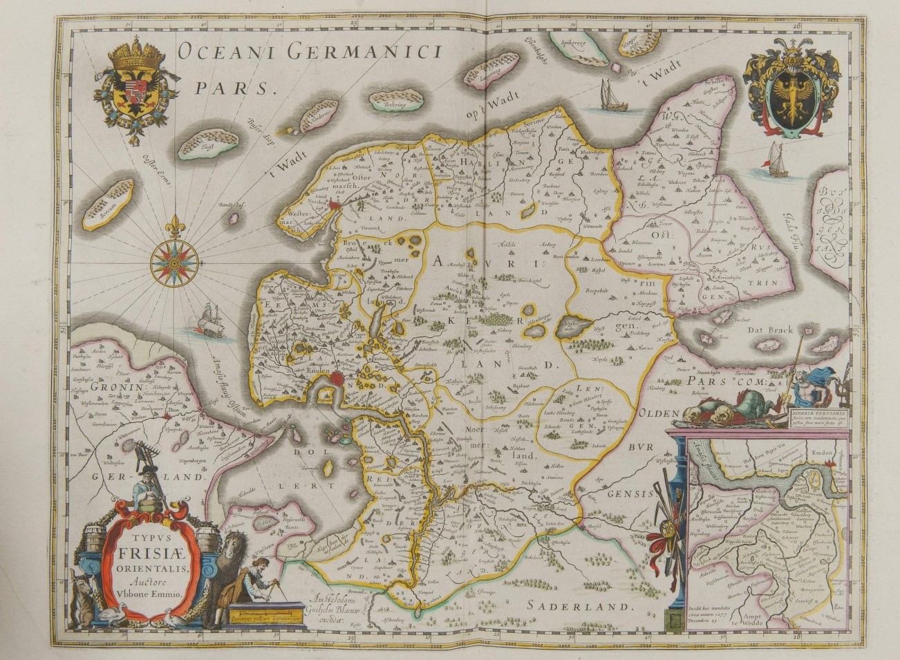
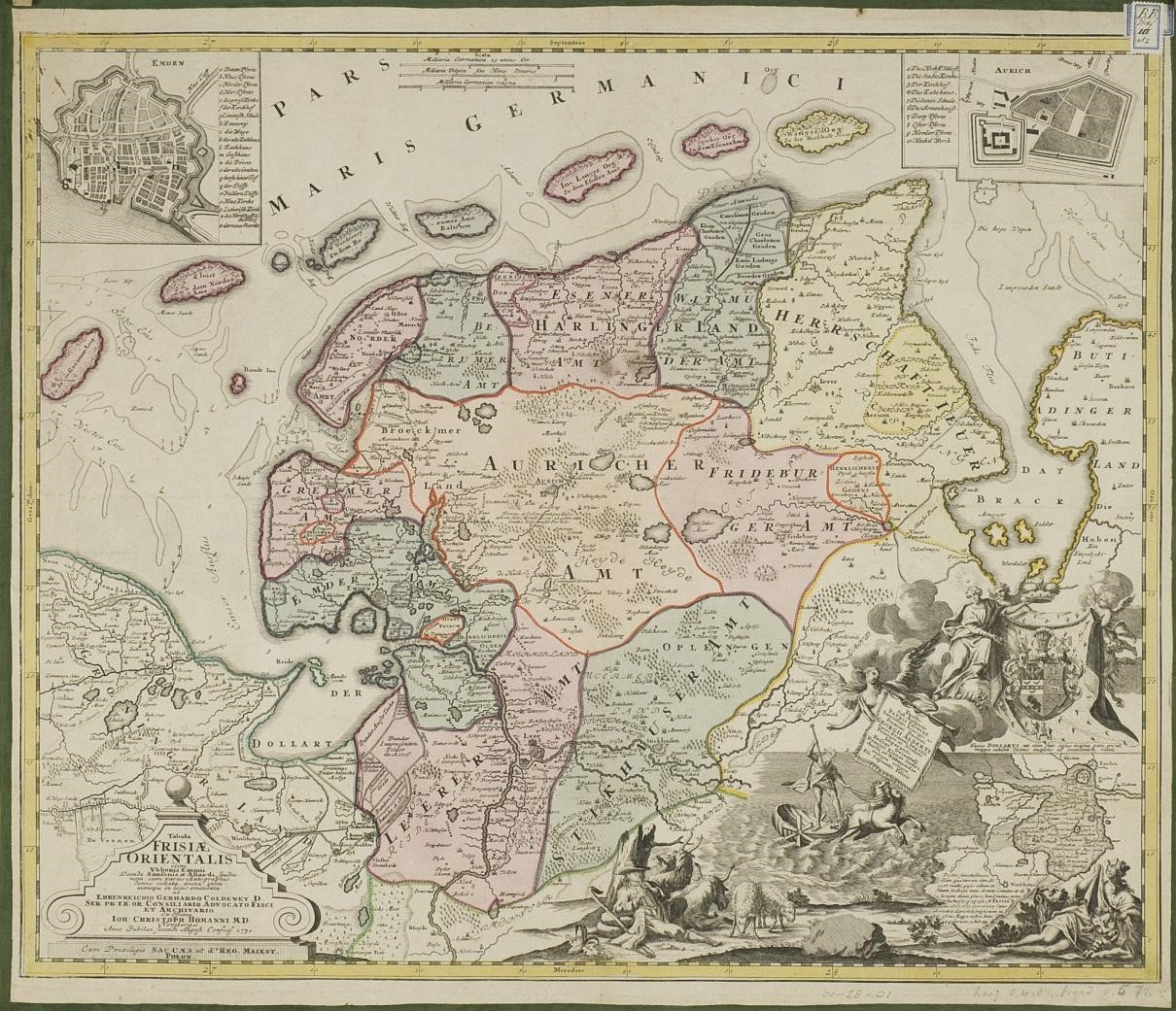
There is, however, one peculiar observation to be made about Emmius’ maps. As we know from his life, Emmius championed source critique and historical truth. Yet, in his later maps we can still find references to an anachronism based on legend—that of the purported flooding of the Reiderland in 1277 (bottom right corner of his 1633/38, 1664 and 1730 maps).
Atlantis of the Clay
From around the mid-16th century onwards, great strides had been made in the field of cartography, enhancing the accuracy with which maps could reflect the shape, size and history of the lands they depicted. [1] One major innovation within cartography was the use of plane trigonometry. Jacob van Deventer was among the first to apply it to the science of map-making when he created the ‘Frieslandt’ map of 1559. Despite these advances, the line between myth and reality continued to be blurred at times. Indeed, this was Ubbo Emmius’ criticism of established cartographers. [2] He regarded their map-making methodology as a dilution of topographical and geographical reality, and he criticized them for affording local folklore a credibility that it did not merit.
This failure to separate fact from fiction often resulted in maps depicting non-existent rivers or islands. This included the creation and adoption of the myth of the Reiderland—the Atlantis of the Clay. Emmius’ original 1616 map of the northern territories justifiably omits what other maps do not. The first map to incorporate the story of the drowned villages of Reiderlandt was made by Vermeersch in 1574 (slide 8).
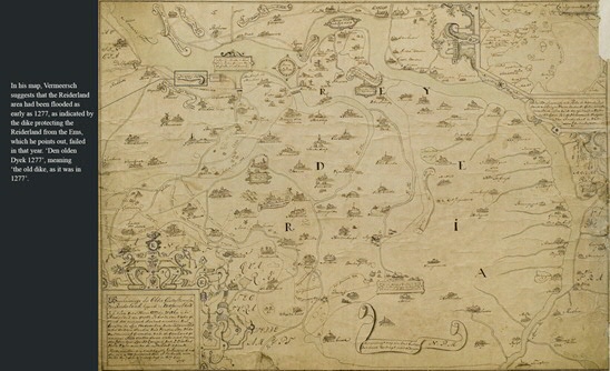
He depicted the land from Frisia to Ostfriesland, claiming that the river inlet that was then known as the Dollard was the former Reiderland and alleging that it had been submerged for almost half a millennium. Although he was right to point out that the seas had swallowed the Reiderland, his dating of this event was out by some 500 years. And yet, cartographer after cartographer followed his lead, perpetuating the myth of the 33 drowned villages of the Reiderland despite the fact that the Reiderland had been lost to the stormy waters of the Ems much more recently, in 1509. [3]
Within a mere fifty years, the true date of the Reiderland flooding and the creation of the Dollard had somehow become obscured to cartographers such as Wicheringe (for a comparison with Emmius’ maps, see for example Wicheringe’s 1616 map, slide 9),
Van Deventer and, as mentioned, even Emmius in his posthumously published maps, all of which presented the former region of the Reiderland as an Atlantis of the Clay: long lost to the seas (‘incidit haec inundatio circa annum 1277’). Here, reality became entangled with fiction, creating a history that was indeed submerged in water, but also in myth. In his 2009 article Myth and Reality, Otto Knottnerus points out the multiplicitous meaning of maps. Just as they can convey geographical data, so too can they communicate political messages—in this case, one very reminiscent of a biblical narrative. Knottnerus’ explanation for the 16th-century maps’ incorporation of the mythical flood of 1277 is that this may have served as a warning against neglect and tribalism. Like the biblical flood, Reiderland’s submersion was presented as a washing away of sins brought about by the vices of the people of Reiderland. [4] Emmius tells us: ‘Neighbours quarrelling, one nobleman envying the other, farmers possessed by jealousy, hatred between local officials and their successors—all of them were more concerned with private matters, putting their whims and wishes over the public cause, no longer paying any respect to the laws of the land.’ [5] As the humanist scholar Willem de Volder wrote in 1553, the myth of the creation of the Dollard in 1277 caused the new name of the former Reiderland to be associated with a ‘deadliness we should all be fearful of’. [6]
And so we know that cartographical history is not always what it seems. But Knottnerus begs the question, did cartographers of the time add mythical layers of meaning to their maps for their own amusement or did they intend for their maps to convey a deeper meaning? Were these maps designed to make people aware of divine retribution should they ever behave in a fashion similar to that of the people of the Reiderland, the Atlanteans of the clay? What we do know is that different maps can have different meanings and that through maps cartographers can convey a meaning beyond plain geography—either on purpose, or by accident, if they are careless in assessing the validity of sources. Whatever the meaning of the mythical flood of 1277, it reminds us of today’s ‘fake news’—stories based on misinformation—thereby stressing the importance of scrupulous research, from the science of map-making to the composing of a simple tweet.
Notes
[1] Vredenberg-Alink, J.J. De kaarten van Groningerland: De ontwikkeling van het kaartbeeld van de tegenwoordige provincie Groningen met een lijst van gedrukte kaarten, vervaardigd tussen 1545 en 1864 (Uithuizen: Bakker’s Drukkerij, 1974)
[2] Boer, J. J. Ubbo Emmius en Oost-Friesland (Groningen: Wolters, 1936), pp. 43-64
[3] Knottnerus, Otto S. Dollardgeschiedenis(sen) —Mythe en realiteit . In Karel Essink (ed.), “Stormvloed 1509”—Geschiedenis van de Dollard (Groningen: Stichting Verdronken Geschiedenis, 2013), pp. 95-116
[4] Fromm, Hans. “Riesen und Recken.” In Deutsche Vierteljahrsschrift für Literaturwissenschaft und Geistesgeschichte, 60 (1986), pp. 42-59. Haubrichs, W. “Ein Held für viele Zwecke. Dietrich von Bern und sein Widerpart in den Heldensagen des frühen Mittelalters.” In idem et al. (eds.), Theodisca: Beiträge zur althochdeutschen und altniederdeutschen Sprache und Literatur in der Kultur des frühen Mittelalters (Berlin & New York, 2000), pp. 330-363, here 337. Luther, M. Werke: kritische Gesamtausgabe (Weimar, 1883-2009, 109 vols.), here vol. 24, p. 164
[5] Emmius, Ubbo. Ostfriesland (Führung durch Ostfriesland, d.h. genaue historische Beschreibung Ostfrieslands), translated by E. von Reeken (Frankfurt/Main, 1982), p. 19
[6] ‘Dollarthi rabies priscis ignota furenter quod fluat, ex ipsa re mihi nomen habet. Nomen habet ferale nimis, nobisque timendum.’ Guilelmus Gnapheus, Aembdanae ciuitatis enkomion. In Æmbdanæ ciuitatis atque adeo totius Vltramasanæ Frisiæ laudem carmen panegyricum, ex tempore lusum, Emden 1557. In 1550, Gnapheus (alias Willem De Volder) was involved in negotiations about ahttps://www.verdronkengeschiedenis.nl/nl/stormvloed/docs/9-%20Knottnerus%20-%20Dollardgeschiedenissen-opmaak-3def.pdf https://www.verdronkengeschiedenis.nl/nl/stormvloed/docs/9-%20Knottnerus%20-%20Dollardgeschiedenissen-opmaak-3def.pdf border conflict with Groningen as a ‘meister die de junge heren leerde’ (master teaching the young gentlemen). Beninga, Cronicon, vol. 2, pp. 745-6. Incorrect identification by Van den Broek, Groningen, een stad apart, p. 457.
Direct links to the digitised maps
- Figure 4: [ UB Groningen, Special Collections, uklu VP-- 5 ]
- Figure 5: [ UB Groningen, Special Collections, uklu RG--- 3 A (2) ]
- Figure 6: [ UB Groningen, Special Collections, uklu RG---- 2 (2) ]
- Figure 7: [ UB Groningen, Special Collections, uklu 01-28-01 ]
- Figure 8: [ UB Groningen, Special Collections, uklu 01-17-12 ]
- Figure 9: [ UB Groningen, Special Collectios, uklu 01-13-22 ]