Geo Services puts open data on the agenda

Geo Services (part of the Center for Information Technology) took a major step forward last autumn by launching an Open Data Portal. The portal provides access to datasets with a geographic component and an attractive presentation of the data. But the portal has more features. The Portal has since attracted considerable international interest. Govert Schoof, senior project manager Geographic Information Systems at Geo Services, gives a run-down.
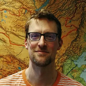
Govert Schoof is senior project manager Geographic Information Systems at Geo Services. Geo Services is part of the Center for Information Technology (CIT) and offers exciting new combinations of geo-information, geo-data and IT. Innovation is a priority at Geo Services.
The launch of the Open Data Portal in autumn 2015 took innovation at Geo Services to a new level. ‘Open’ should be seen in the broader sense of the word: visualization, download and re-use. The Open Data Portal has a visualization tool that can be used to adapt data sets. This is often the first step in analysing a set, and makes the data set more visible and attractive.
The portal also includes a direct connection to the ArcGIS platform. ArcGIS is GIS (Geographic Information Software) that is used to adapt geo-data. Advanced products are created using the data sets from the portal and ArcGIS. The process of downloading and reusing a dataset has been built in as it were, so that users do not need to follow separate instructions.
‘All data is Geo-data’
The main functions of the portal are to offer access to datasets with a geographic component and to present the data attractively. This latter aspect is particularly important to researchers working in the field as it means that their academic work is given more extensive (and better) exposure. Although more and more datasets are being made available, Geo Services would like to see even more. There is no lack of potential because, as Govert puts it: ‘All data is Geo-data’. Most datasets have geographic features. Take the physical place where they were measured; the place itself can usually be expressed as a geographical coordinate.
The Open Data Portal has several functions. It forms a hub for providing Geo-advice and services for researchers, for example. Geo Services tries to take some of the pressure off researchers. One concrete service that it offers is the geo-referencing of a dataset. This involves linking the data to a map (geo-reference), enabling new visualizations and analyses to be made.
Geo-referencing is a complex, specialist task, which is not really part of a researcher’s remit. In some cases, it is made complex by the dataset sent to the portal itself, which has not been properly defined. Geo Services could itself benefit from the expertise of specialists in cases like these, e.g. expertise from the Research Data Office of the University of Groningen.

Expanding the expert network
Privacy is always an important point when working with data and Geo Services is particularly alert to this aspect. A good example would be a dataset measured at the level of a Dutch address. It would be easy to use this data to track a person or persons. One solution would be to aggregate the dataset at a higher level, at district level rather than address level, for example. However, this would involve intervening in the dataset before making it available on the Open Data Portal, which is a specialist job needing the advice and control of experts.
The Open Data Portal was set up pragmatically, on the basis of the available resources. The limited staffing level at Geo Services means that dataset descriptions and metadating are based on feasibility. According to Govert, extra support is vital from young, creative student-assistants to cope with all the work. Although the increasing workload ensures continuity, the long-term picture is still uncertain, says Govert. He would like this to change by installing a solid team of permanent staff supported by flexible extra manpower when needed. Geo Services would welcome the services of a cartographer, for example, and ambitious, creative student-assistants. Govert is particularly pleased to have the expert network of the University of Groningen at his disposal, although this does little to establish the required continuity.
The dream of sharing geo-data
There is no shortage of activities or plans for the future at Geo Services. Govert is keen to address the current disjointed nature of access to datasets. This could be organized better by archiving the datasets in different physical locations (as usual), but using a national interface for access, whereby visualization, export and adaptation obviously remain possible. Govert sometimes dreams of sharing geo-data with other Dutch universities.
The work of the Geo Services portal has not gone unnoticed in other countries. In addition to various companies, two academic parties with considerably higher Shanghai rankings have also expressed interest. Govert notes that Geo Services is definitely making a name for itself, and was even recently allocated a Netherlands Organisation for Scientific Research (NWO) grant. A Dutch insurance company and the Dutch railways are also showing interest in the progress being made by Geo Services. Govert is not really surprised: the specialist services that Geo Services provides to the University of Groningen are unique in the international academic world.

